MyTopo
Fort Spokane Washington US Topo Map
Couldn't load pickup availability
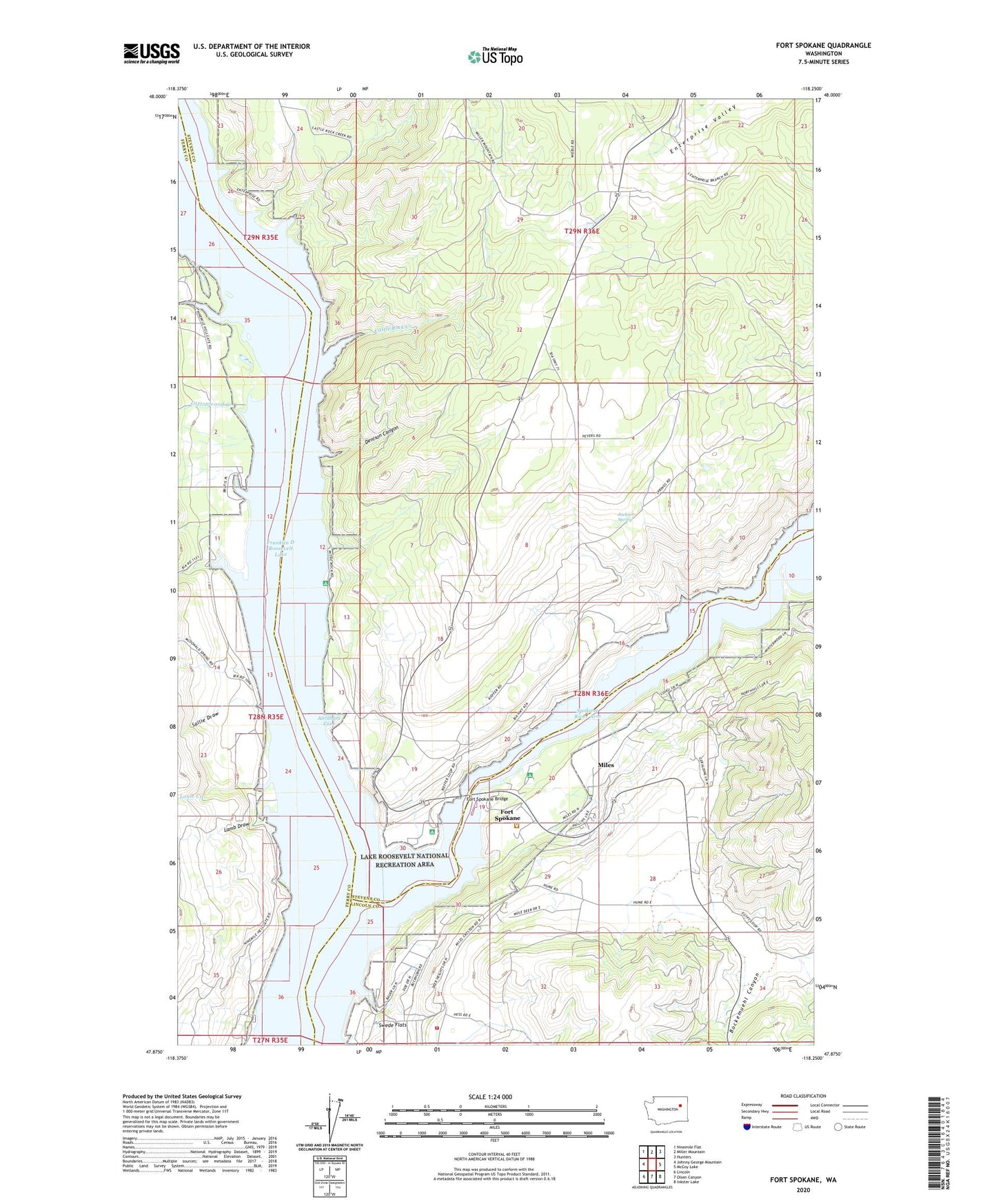
2020 topographic map quadrangle Fort Spokane in the state of Washington. Scale: 1:24000. Based on the newly updated USGS 7.5' US Topo map series, this map is in the following counties: Stevens, Lincoln, Ferry. The map contains contour data, water features, and other items you are used to seeing on USGS maps, but also has updated roads and other features. This is the next generation of topographic maps. Printed on high-quality waterproof paper with UV fade-resistant inks.
Quads adjacent to this one:
West: Johnny George Mountain
Northwest: Ninemile Flat
North: Miller Mountain
Northeast: Hunters
East: McCoy Lake
Southeast: Inkster Lake
South: Olsen Canyon
Southwest: Lincoln
Contains the following named places: Abraham Cove, Bockemuehl Canyon, Castle Rock Creek, Cottonwood Creek, Crystal City, Denison Canyon, Enterprise School, Fort Spokane, Fort Spokane Bridge, Jackson Spring, Lamb Draw, Lincoln County Fire District 5 - Deer Meadows, Louie Creek, Miles, Mitre Rock, Rothlisburg School, Sallie Draw, Sixmile Creek, Spokane River, Swede Church, Swede Flats, Threemile Creek