MyTopo
Keller Ferry Washington US Topo Map
Couldn't load pickup availability
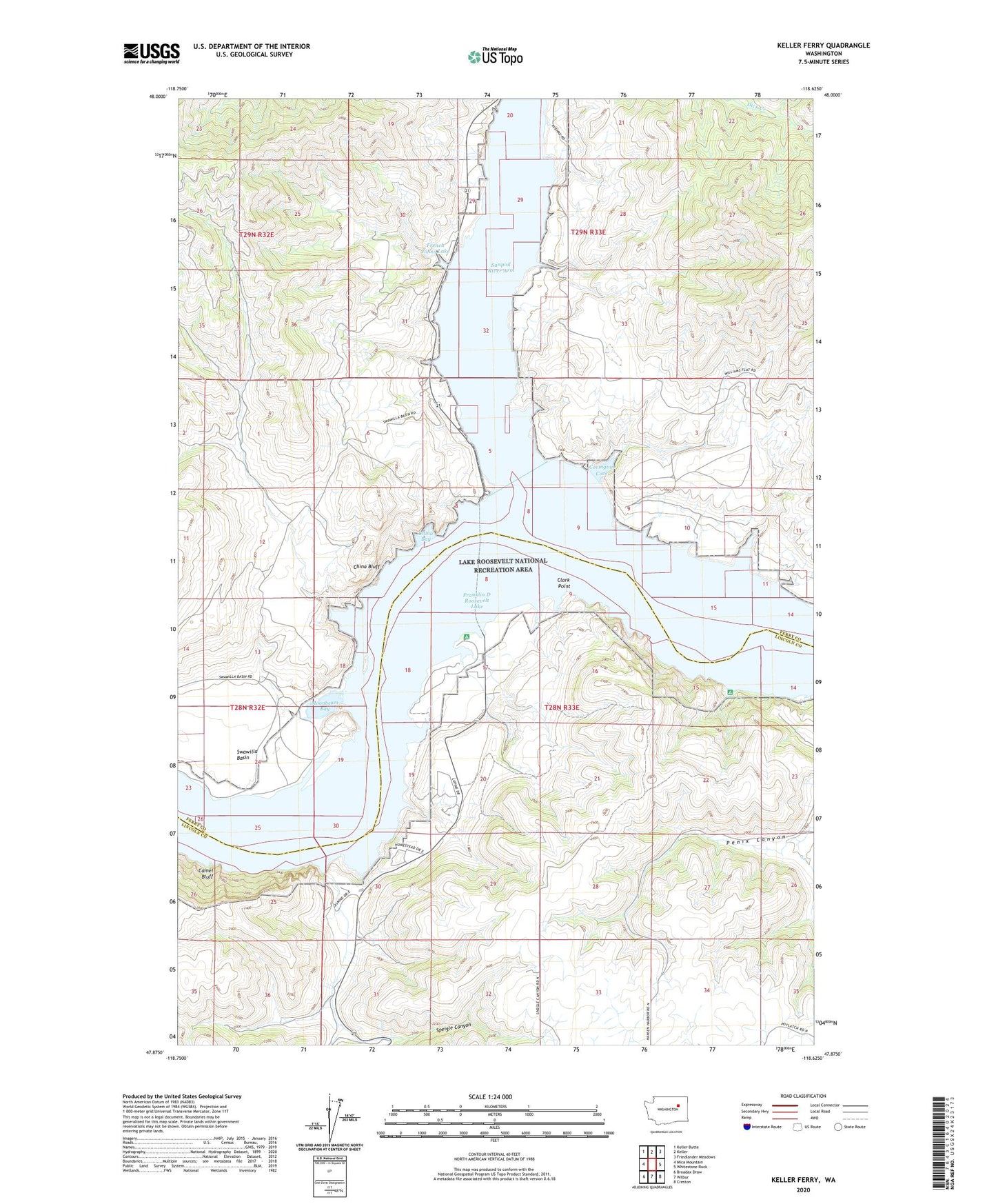
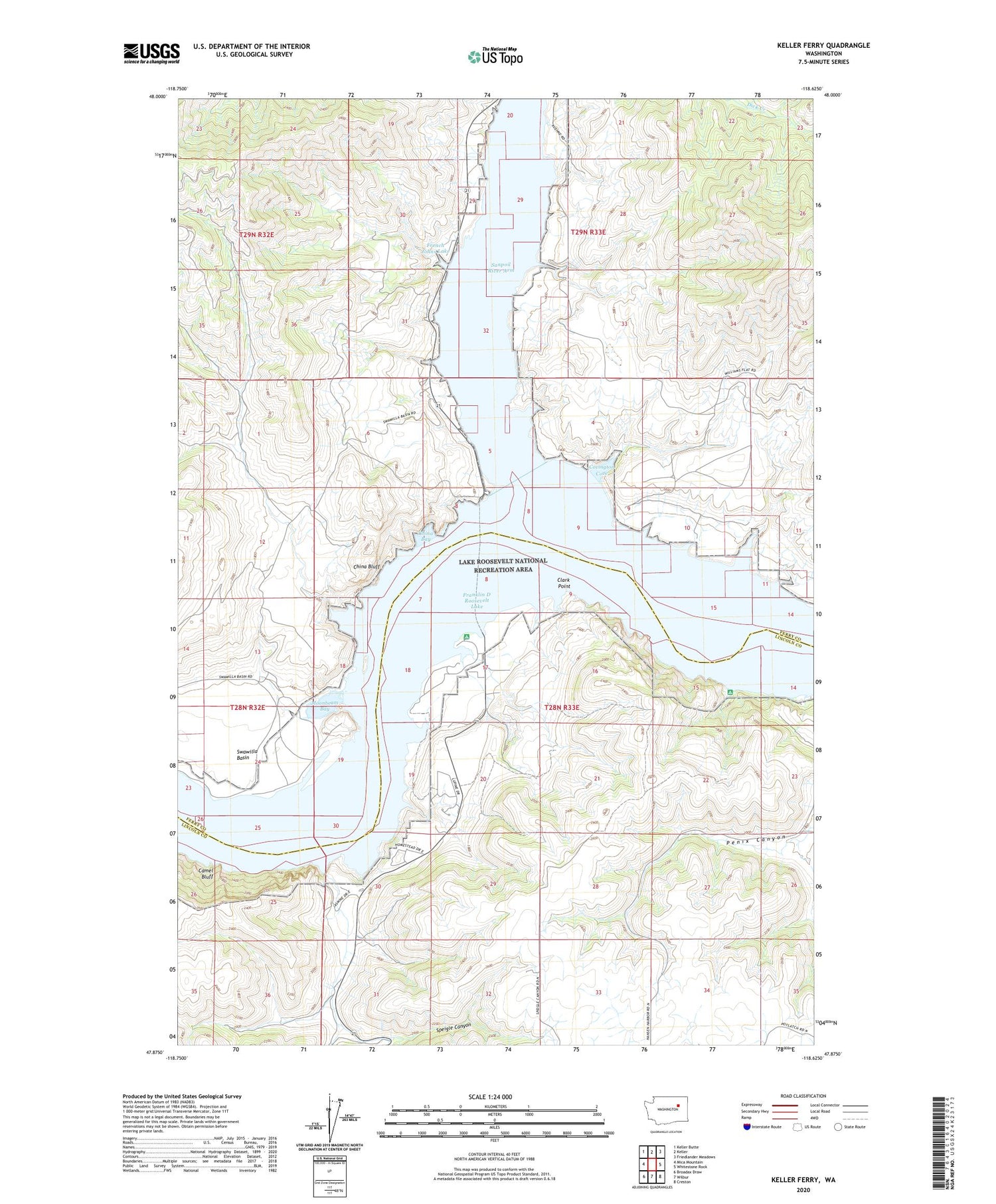
2020 topographic map quadrangle Keller Ferry in the state of Washington. Scale: 1:24000. Based on the newly updated USGS 7.5' US Topo map series, this map is in the following counties: Ferry, Lincoln. The map contains contour data, water features, and other items you are used to seeing on USGS maps, but also has updated roads and other features. This is the next generation of topographic maps. Printed on high-quality waterproof paper with UV fade-resistant inks.
Quads adjacent to this one:
West: Mica Mountain
Northwest: Keller Butte
North: Keller
Northeast: Friedlander Meadows
East: Whitestone Rock
Southeast: Creston
South: Wilbur
Southwest: Broadax Draw
Contains the following named places: Camel Bluff, China Bay, China Bluff, Clark, Clark Point, Covington Cove, Franklin D Roosevelt Lake, Lake Roosevelt National Recreation Area, Moonbeam Bay, Sanpoil River, Sanpoil River Arm, Speigle Canyon