MyTopo
Knappton Washington US Topo Map
Couldn't load pickup availability
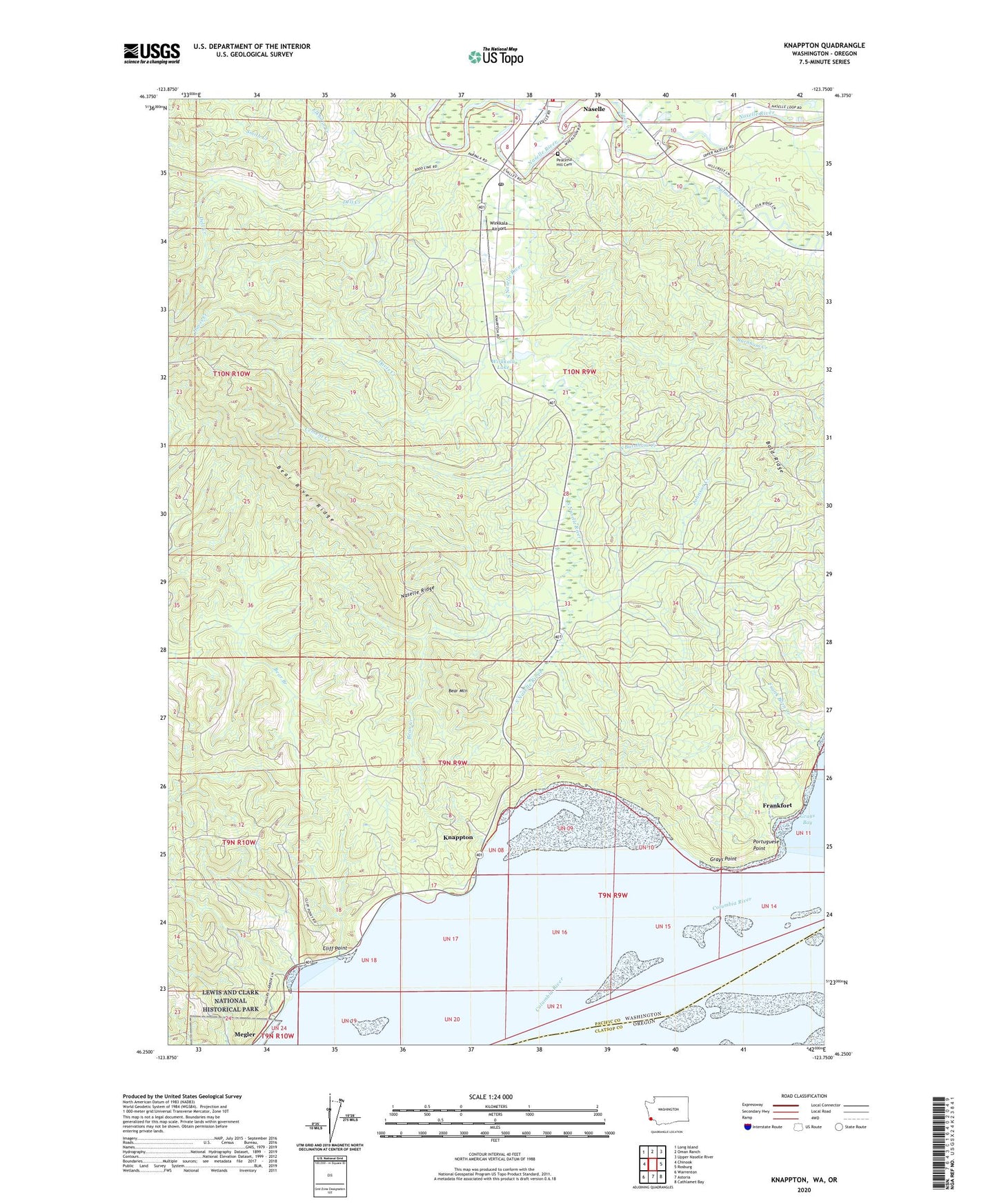
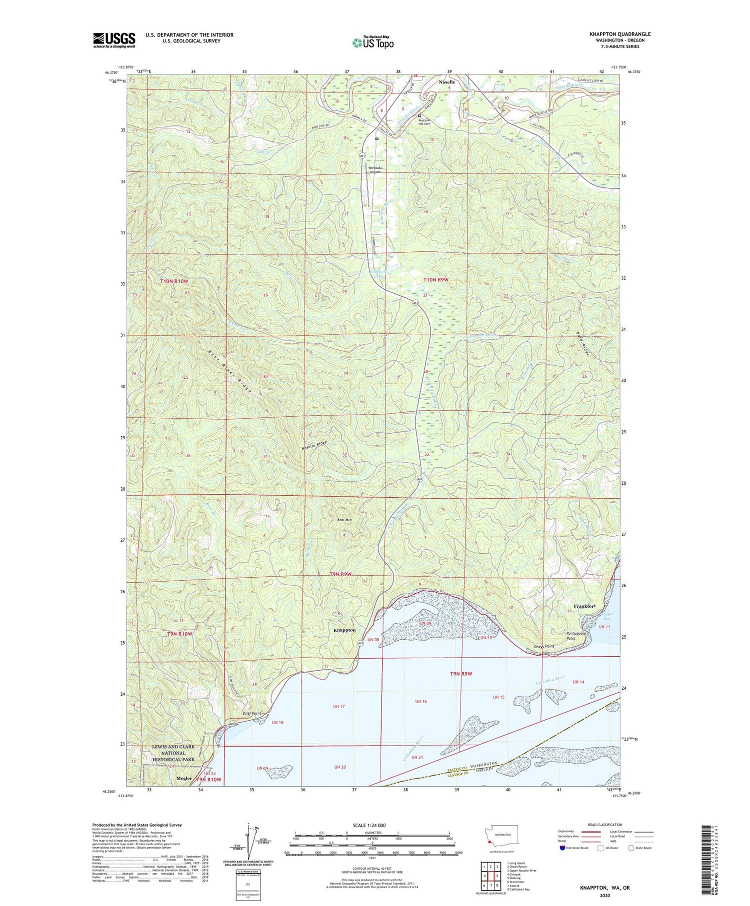
2020 topographic map quadrangle Knappton in the state of Washington. Scale: 1:24000. Based on the newly updated USGS 7.5' US Topo map series, this map is in the following counties: Pacific, Clatsop. The map contains contour data, water features, and other items you are used to seeing on USGS maps, but also has updated roads and other features. This is the next generation of topographic maps. Printed on high-quality waterproof paper with UV fade-resistant inks.
Quads adjacent to this one:
West: Chinook
Northwest: Long Island
North: Oman Ranch
Northeast: Upper Naselle River
East: Rosburg
Southeast: Cathlamet Bay
South: Astoria
Southwest: Warrenton
Contains the following named places: Assembly of God Church, Bald Ridge, Bean Creek, Bear Mountain, Burnham Creek, Cement Creek, Cliff Point, Congregational United Church of Christ, Davis Creek, Dell Creek, Frankfort, Grays Point, Grays Point Light, Hungry Harbor, Johnson Creek, Johnson Ranch, Knappton, Lane Creek, Megler, Naselle, Naselle Census Designated Place, Naselle Post Office, Naselle Ridge, Naselle Timberland Library, Naselle Volunteer Fire Department, Naselle-Grays River High School, Naselle-Grays River School, O'Conner Creek, Peaceful Hill Cemetery, Portuguese Point, Salmon Creek, South Burnham Creek, South Naselle River, Wirkkala Airport, Wirkkala Dam Number Three, Wirkkala Lake