MyTopo
Lake Kapowsin Washington US Topo Map
Couldn't load pickup availability
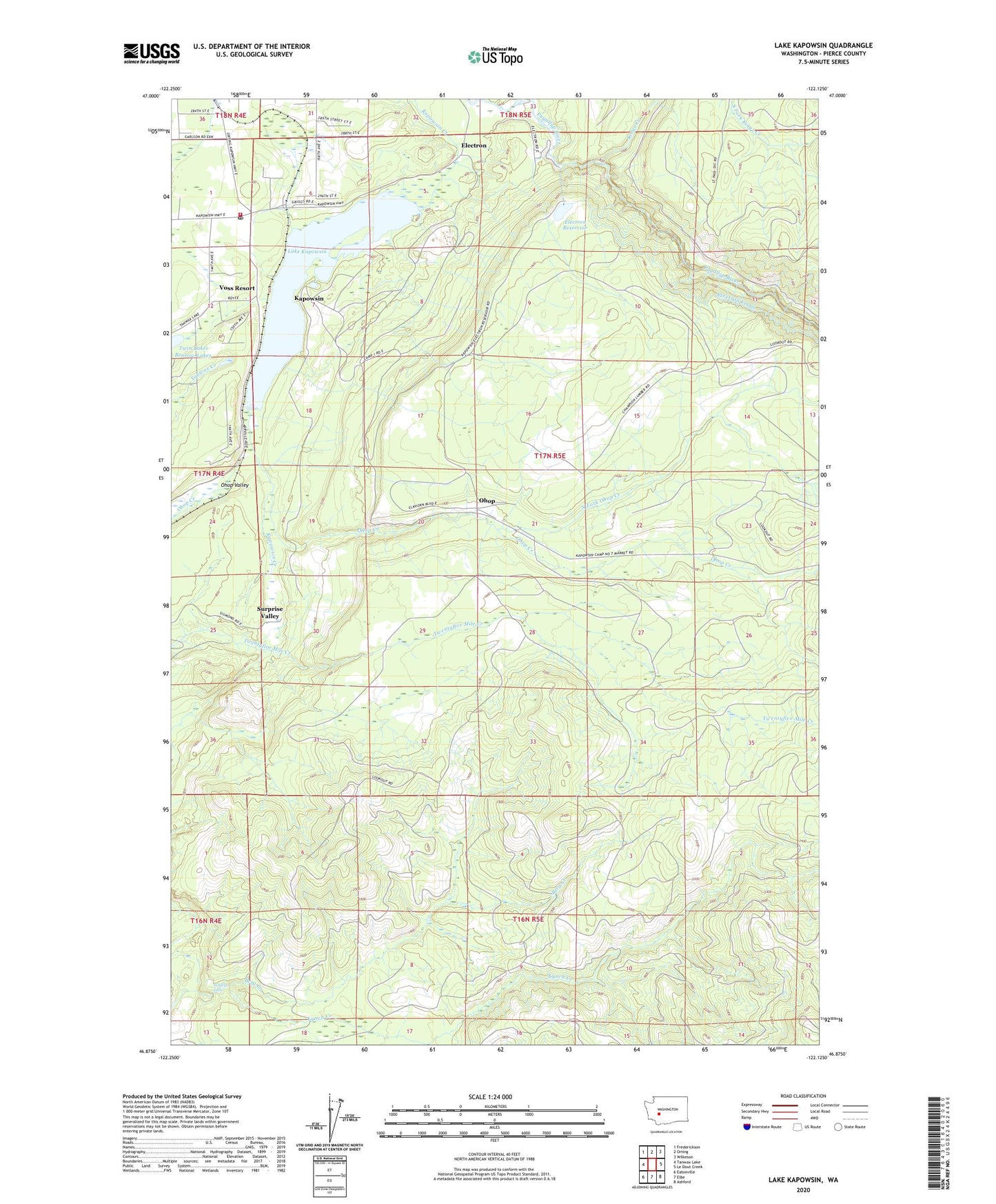
2020 topographic map quadrangle Lake Kapowsin in the state of Washington. Scale: 1:24000. Based on the newly updated USGS 7.5' US Topo map series, this map is in the following counties: Pierce. The map contains contour data, water features, and other items you are used to seeing on USGS maps, but also has updated roads and other features. This is the next generation of topographic maps. Printed on high-quality waterproof paper with UV fade-resistant inks.
Quads adjacent to this one:
West: Tanwax Lake
Northwest: Frederickson
North: Orting
Northeast: Wilkeson
East: Le Dout Creek
Southeast: Ashford
South: Elbe
Southwest: Eatonville
Contains the following named places: Berg Creek, Electron, Electron Reservoir, Electron Reservoir Dam, Kapowsin, Kapowsin Census Designated Place, Kapowsin Post Office, Kings Creek, Lake Kapowsin, Lindstrom Dam Number One, Lindstrom Dam Number Two, Neff Ranch, North Fork Ohop Creek, Ohop, Pierce County Fire District 21 Graham Fire and Rescue Station 92, Surprise Valley, Voss Resort, Wildcat Falls