
MyTopo
Lake Wooten Washington US Topo Map
Couldn't load pickup availability
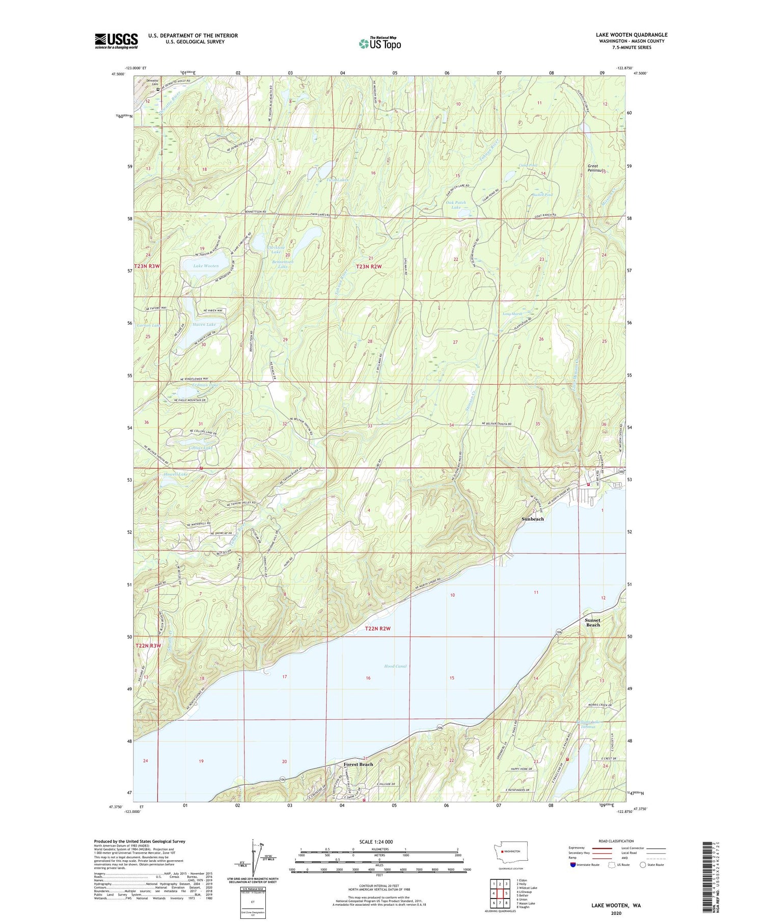
2020 topographic map quadrangle Lake Wooten in the state of Washington. Scale: 1:24000. Based on the newly updated USGS 7.5' US Topo map series, this map is in the following counties: Mason. The map contains contour data, water features, and other items you are used to seeing on USGS maps, but also has updated roads and other features. This is the next generation of topographic maps. Printed on high-quality waterproof paper with UV fade-resistant inks.
Quads adjacent to this one:
West: Lilliwaup
Northwest: Eldon
North: Holly
Northeast: Wildcat Lake
East: Belfair
Southeast: Vaughn
South: Mason Lake
Southwest: Union
Contains the following named places: Belfair State Park, Belfair-Tahuya Division, Bennettsen Lake, Bennettsen Lake Dam, Camp Pond, Camp Spillman, Christine Lake, Christine Lake Dam, Collins Lake, Dewatto Cemetery, Erdman Lake, Forest Beach, Haven Lake, Howell Lake, Lake Wooten, Little Mission Creek, Long Marsh, North Mason Regional Fire Authority Station 22, North Mason Regional Fire Authority Station 23, North Mason Regional Fire Authority Station 25, North Mason Regional Fire Authority Station 27, Oak Patch Lake, Prickett Lake, Shoofly Creek, Stimson Creek, Suckell Pond, Sunbeach, Sunset Beach, Tahuya Division, Tahuya Lookout, Twin Lakes, ZIP Code: 98528


