MyTopo
Lookout Mountain Washington US Topo Map
Couldn't load pickup availability
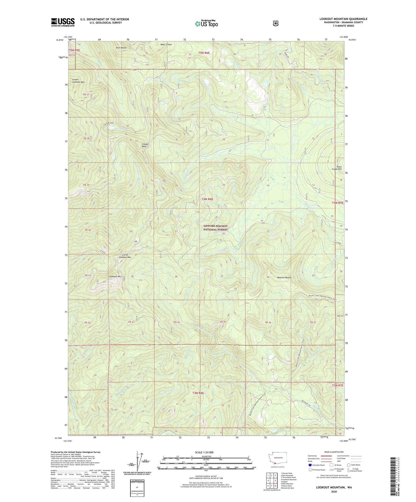
2020 topographic map quadrangle Lookout Mountain in the state of Washington. Scale: 1:24000. Based on the newly updated USGS 7.5' US Topo map series, this map is in the following counties: Skamania. The map contains contour data, water features, and other items you are used to seeing on USGS maps, but also has updated roads and other features. This is the next generation of topographic maps. Printed on high-quality waterproof paper with UV fade-resistant inks.
Quads adjacent to this one:
West: Gumboot Mountain
Northwest: Siouxon Peak
North: Bare Mountain
Northeast: Termination Point
East: Stabler
Southeast: Bonneville Dam
South: Beacon Rock
Southwest: Bobs Mountain
Contains the following named places: Compass Creek, Cougar Rock, Crater Creek, East Fork Trout Creek, Fourth of July Camp, Green Leaf Trail, Green Lookout Mountain, Grouse Creek, Layout Creek, Little Lookout Mountain, Lookout Mountain, Lookout Mountain Lookout, Meander Creek, Mowich Butte, Mowich Butte Lookout, Mowich Camp, North Fork Snag Creek, Pass Creek, Rock Creek Lake, Snag Creek, Snag Creek Trail, Soda Peaks Trail, Springs Camp, Twin Rocks, West Crater, Zig Zag Lake, Zig Zag Trail, ZIP Code: 98610