MyTopo
Monse Washington US Topo Map
Couldn't load pickup availability
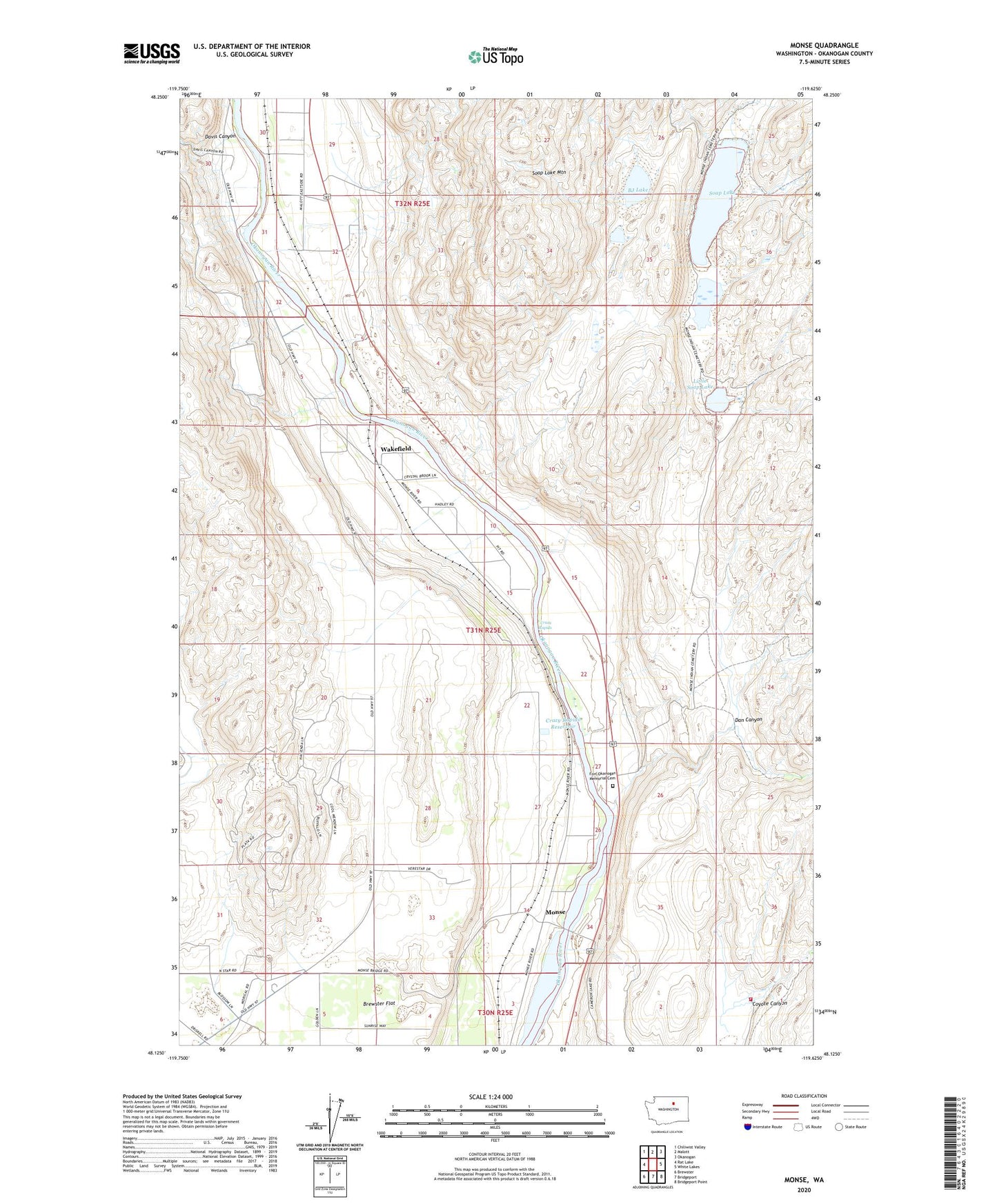
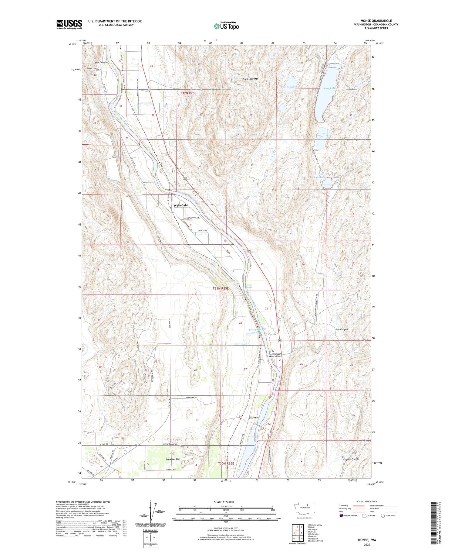
2020 topographic map quadrangle Monse in the state of Washington. Scale: 1:24000. Based on the newly updated USGS 7.5' US Topo map series, this map is in the following counties: Okanogan. The map contains contour data, water features, and other items you are used to seeing on USGS maps, but also has updated roads and other features. This is the next generation of topographic maps. Printed on high-quality waterproof paper with UV fade-resistant inks.
Quads adjacent to this one:
West: Rat Lake
Northwest: Chiliwist Valley
North: Malott
Northeast: Okanogan
East: White Lakes
Southeast: Bridgeport Point
South: Bridgeport
Southwest: Brewster
Contains the following named places: BJ Lake, Brewster Flat, Brewster Flat Earth Station, Coyote Canyon, Crazy Rapids, Crazy Rapids Reservoir, Crazy Rapids Reservoir Dam, Dan Canyon, Davis Canyon, Fort Okanogan Memorial Cemetery, Little Soap Lake, Monse, Okanogan County Fire District 8 Smith Unit, Ophir, Soap Lake, Thompson, Wakefield, ZIP Code: 98812