MyTopo
Moses Lake South Washington US Topo Map
Couldn't load pickup availability
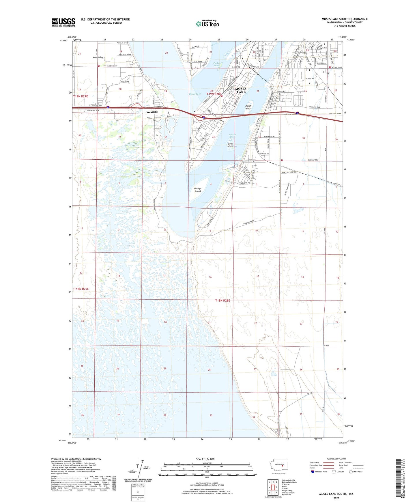
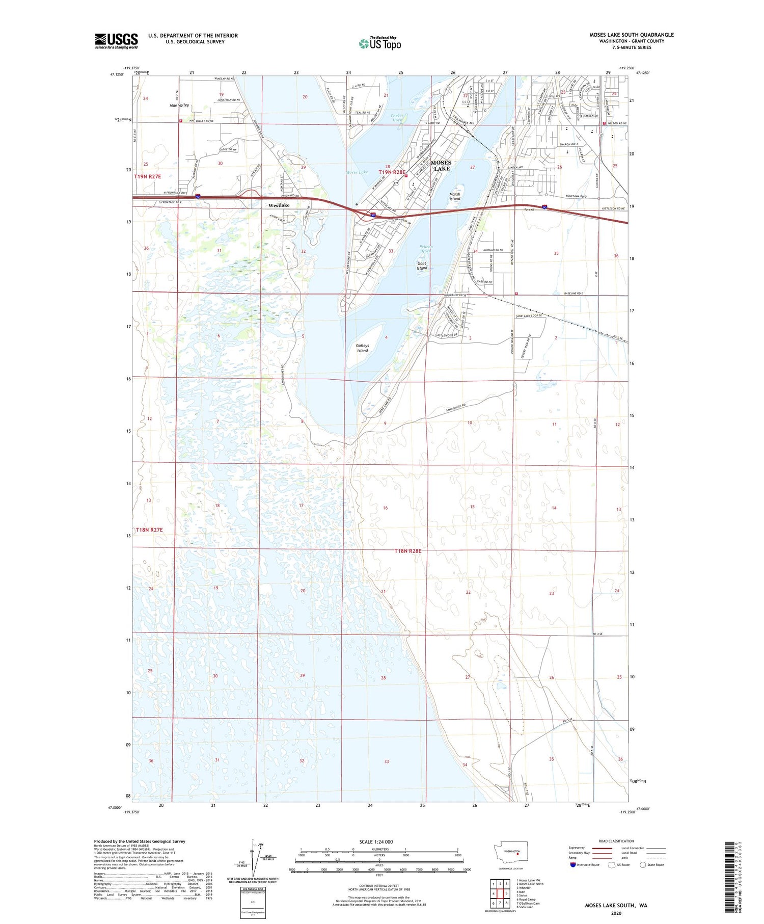
2020 topographic map quadrangle Moses Lake South in the state of Washington. Scale: 1:24000. Based on the newly updated USGS 7.5' US Topo map series, this map is in the following counties: Grant. The map contains contour data, water features, and other items you are used to seeing on USGS maps, but also has updated roads and other features. This is the next generation of topographic maps. Printed on high-quality waterproof paper with UV fade-resistant inks.
Quads adjacent to this one:
West: Mae
Northwest: Moses Lake NW
North: Moses Lake North
Northeast: Wheeler
East: Sieler
Southeast: Soda Lake
Southwest: Royal Camp
Contains the following named places: Chief Moses Middle School, Crab Creek, Gaileys Island, Garden Heights Elementary School, Goat Island, Grant County Fire District 5 Station 1 Headquarters, Grant County Fire District 5 Station 12, Grant County Fire District 5 Station 2, KBSN-AM (Moses Lake), KBSN-FM (Moses Lake), Lakeview Terrace Elementary School, Marsh Island, Midway Elementary School, Moses Lake Fire Department Station 2, Moses Lake High School, Moses Lake North Dam, Moses Lake South Dam, Moses Lake State Park, No-Outlet Sand Hills, Parker Horn, Pelican Horn, Peninsula Elementary School, Potholes Habitat Management Area, Potholes Reservoir, Westlake