MyTopo
Nordland Washington US Topo Map
Couldn't load pickup availability
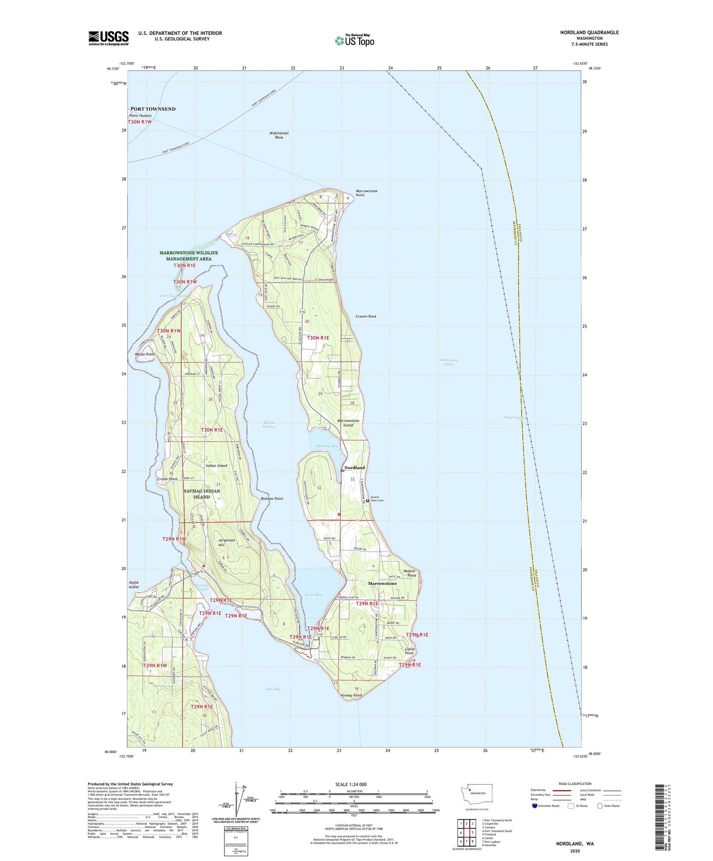
2020 topographic map quadrangle Nordland in the state of Washington. Scale: 1:24000. Based on the newly updated USGS 7.5' US Topo map series, this map is in the following counties: Jefferson, Island. The map contains contour data, water features, and other items you are used to seeing on USGS maps, but also has updated roads and other features. This is the next generation of topographic maps. Printed on high-quality waterproof paper with UV fade-resistant inks.
Quads adjacent to this one:
West: Port Townsend South
Northwest: Port Townsend North
North: Coupeville
Northeast: Camano
East: Freeland
Southeast: Hansville
South: Port Ludlow
Southwest: Center
Contains the following named places: Bishops Point, Crane Point, Craven Penninsula, Craven Rock, East Beach Park, Fort Flagler, Fort Flagler State Park, Fort Flagler State Park Sewage Treatment Plant, Indian Island, Jefferson County Fire Protection District 1 East Jefferson Fire - Rescue Station 1 - 2 Marrowstone, Jorgenson Hill, Kilisut Harbor, Kinney Point, Liplip Point, Lower Oak Bay Recreational Vehicle Park, Marrowstone, Marrowstone Census Designated Place, Marrowstone Island, Marrowstone Point, Marrowstone Point Lighthouse, Marrowstone Wildlife Management Area, Midchannel Bank, Mystery Bay, Mystery Bay State Park, Mystery Bay State Park Marina, Naval Magazine Indian Island, Navy Region Northwest Fire and Emergency Services Station, Nodule Point, Nordland, Nordland Post Office, Oak Bay Baptist Church, Oak Bay Park, Point Hudson, Point Hudson Lighthouse, Port Hadlock Marina, Portage Canal, Scow Bay, Skunk Island, Smitty's Island Recreational Vehicle Park, Sound View Cemetery, Upper Oak Bay Recreational Vehicle Park, US Geological Survey Marrowstone Marine Field Station, Walan Point, Walan Point Light, ZIP Codes: 98339, 98358