MyTopo
Okanogan Washington US Topo Map
Couldn't load pickup availability
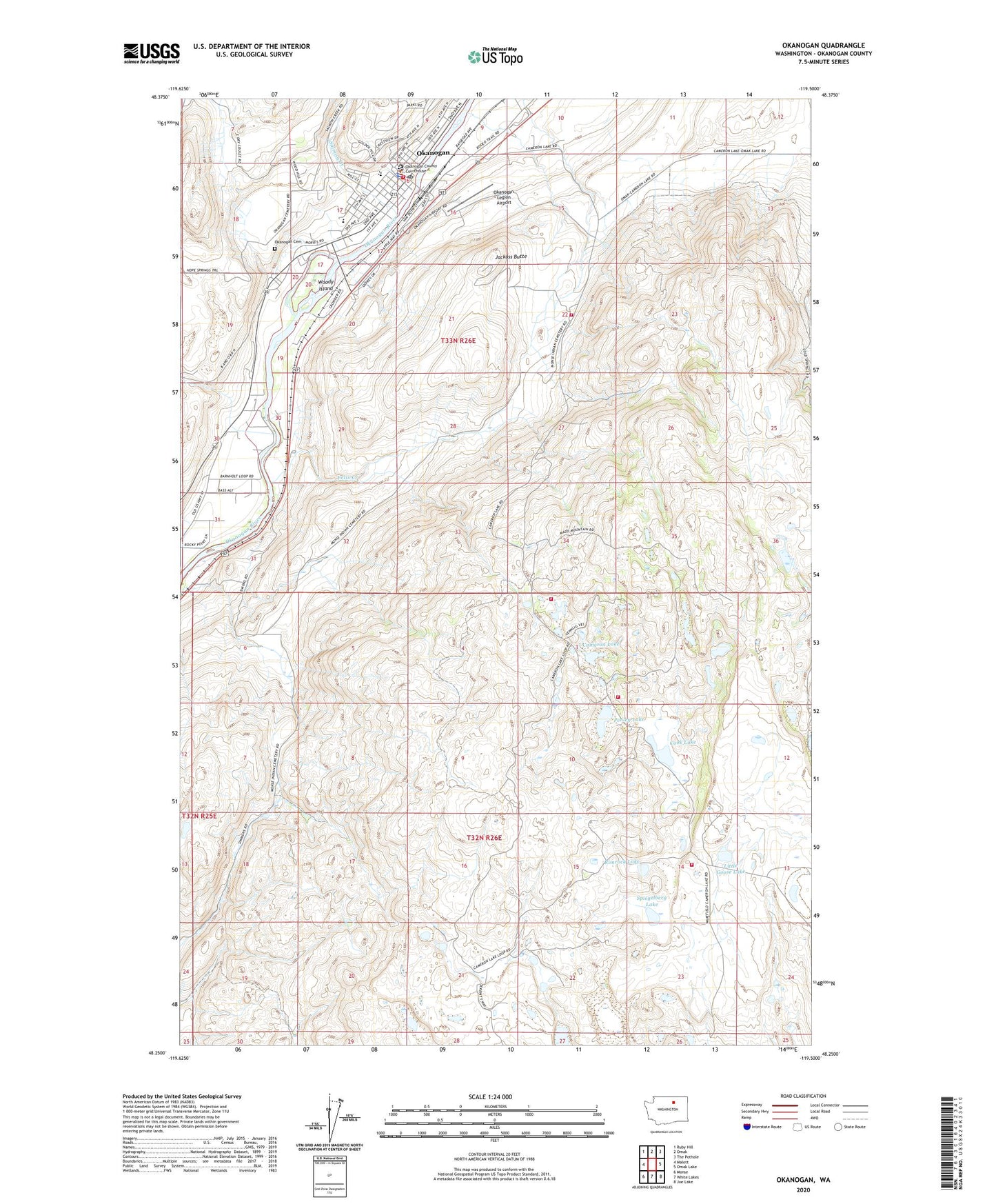
2020 topographic map quadrangle Okanogan in the state of Washington. Scale: 1:24000. Based on the newly updated USGS 7.5' US Topo map series, this map is in the following counties: Okanogan. The map contains contour data, water features, and other items you are used to seeing on USGS maps, but also has updated roads and other features. This is the next generation of topographic maps. Printed on high-quality waterproof paper with UV fade-resistant inks.
Quads adjacent to this one:
West: Malott
Northwest: Ruby Hill
North: Omak
Northeast: The Pothole
East: Omak Lake
Southeast: Joe Lake
South: White Lakes
Southwest: Monse
Contains the following named places: Alma Park, Cameron Lake, City of Okanogan, Cook Lake, Faith Missionary Baptist Church, Felix Creek, First Baptist Church, Forest Supervisor Headquarters Okanogan National Forest, Granger School, Jackass Butte, Little Goose Lake, New Life Center, Okanogan, Okanogan Central Landfill, Okanogan Church of Christ, Okanogan City Cemetery, Okanogan Community Library, Okanogan County Courthouse, Okanogan County Criminal Corrections Center, Okanogan County Fire District 8 Archer Unit, Okanogan County Fire District 8 Hajny Unit, Okanogan County Fire District 8 Kramer Unit, Okanogan County Fire District 8 Townsend Unit, Okanogan County Fire Protection District 3, Okanogan County Historical Museum, Okanogan County Sheriff Okanogan, Okanogan County Virginia Grainger Building, Okanogan High School, Okanogan Legion Airport, Okanogan Police Department, Okanogan Post Office, Okanogan United Methodist Church, Okanogan Wastewater Treatment Plant, O'Keefe Elementary School, Penley Lake, Rimrock Lake, Roundup Park, Salmon Creek, Spiegelberg Lake, Valley Care Center, Virginia Granger Elementary School, Woody Island, ZIP Code: 98840