MyTopo
Pass Creek Washington US Topo Map
Couldn't load pickup availability
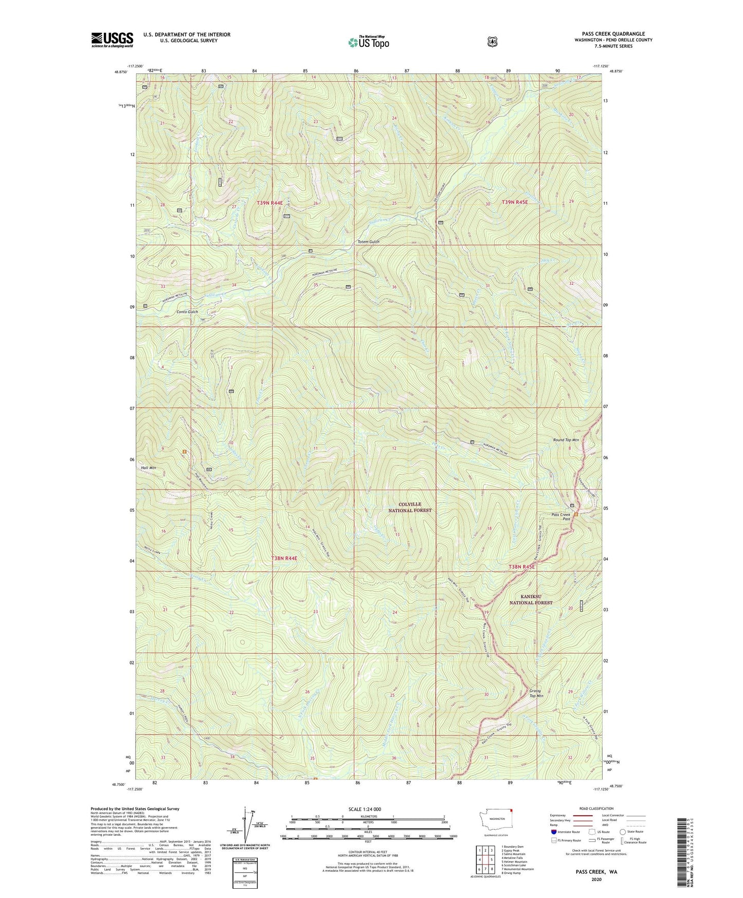
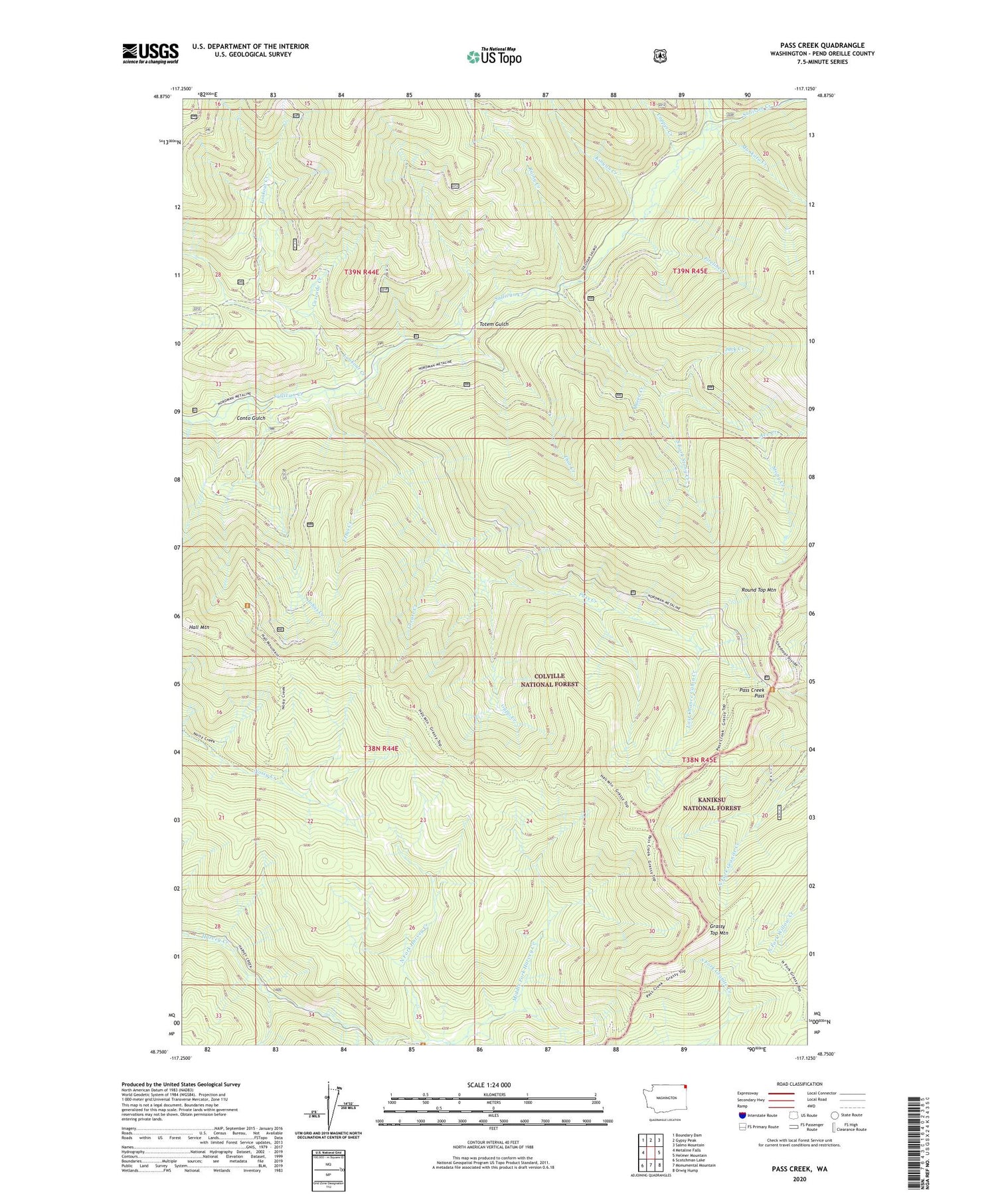
2020 topographic map quadrangle Pass Creek in the state of Washington. Scale: 1:24000. Based on the newly updated USGS 7.5' US Topo map series, this map is in the following counties: Pend Oreille. The map contains contour data, water features, and other items you are used to seeing on USGS maps, but also has updated roads and other features. This is the next generation of topographic maps. Printed on high-quality waterproof paper with UV fade-resistant inks.
Quads adjacent to this one:
West: Metaline Falls
Northwest: Boundary Dam
North: Gypsy Peak
Northeast: Salmo Mountain
East: Helmer Mountain
Southeast: Orwig Hump
South: Monumental Mountain
Southwest: Scotchman Lake
Contains the following named places: Ace Creek, Cascade Creek, Colville National Forest, Conto Gulch, Copper Creek, Fetus Creek, Fireline Creek, Grassy Top Mountain, Grease Creek, Gypo Creek, Gypsy Creek, Jack Creek, Johns Creek, Kinyon Creek, Last Chance Cabin, Last Chance Cabin Creek, Lookout Creek, Mankato Creek, Middle Fork Harvey Creek, North Fork Harvey Creek, Pass Creek, Pass Creek Pass, Queen Creek, Rainy Creek, Round Top Mountain, South Fork Stony Creek, Stony Creek, Sullivan Creek Campground Number 2, Sullivan Creek Campground Number 3, Thor Creek, Totem Gulch