MyTopo
Quartz Creek Butte Washington US Topo Map
Couldn't load pickup availability
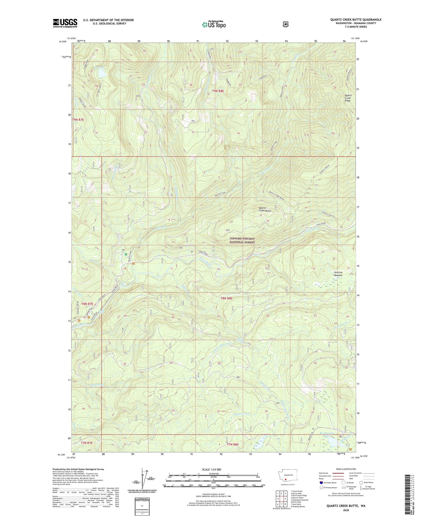
2020 topographic map quadrangle Quartz Creek Butte in the state of Washington. Scale: 1:24000. Based on the newly updated USGS 7.5' US Topo map series, this map is in the following counties: Skamania. The map contains contour data, water features, and other items you are used to seeing on USGS maps, but also has updated roads and other features. This is the next generation of topographic maps. Printed on high-quality waterproof paper with UV fade-resistant inks.
Quads adjacent to this one:
West: Spencer Butte
Northwest: French Butte
North: McCoy Peak
Northeast: East Canyon Ridge
East: Steamboat Mountain
Southeast: Sleeping Beauty
South: Lone Butte
Southwest: Burnt Peak
Contains the following named places: Alec Creek, Big Mosquito Lake, Blue Lake, Copper Creek, Gifford Pinchot National Forest, Lewis River Campground, Little Niagara Falls, Lower Tillicum Creek, Middle Falls, Platinum Creek, Quartz Creek, Quartz Creek Butte, Quartz Creek Ridge, Snagtooth Creek, Straight Creek, Strawberry Creek, Surprise Meadow, Switchback Lookout, Tillicum Creek, Upper Falls, Upper Tillicum Creek