MyTopo
Rock Lake Washington US Topo Map
Couldn't load pickup availability
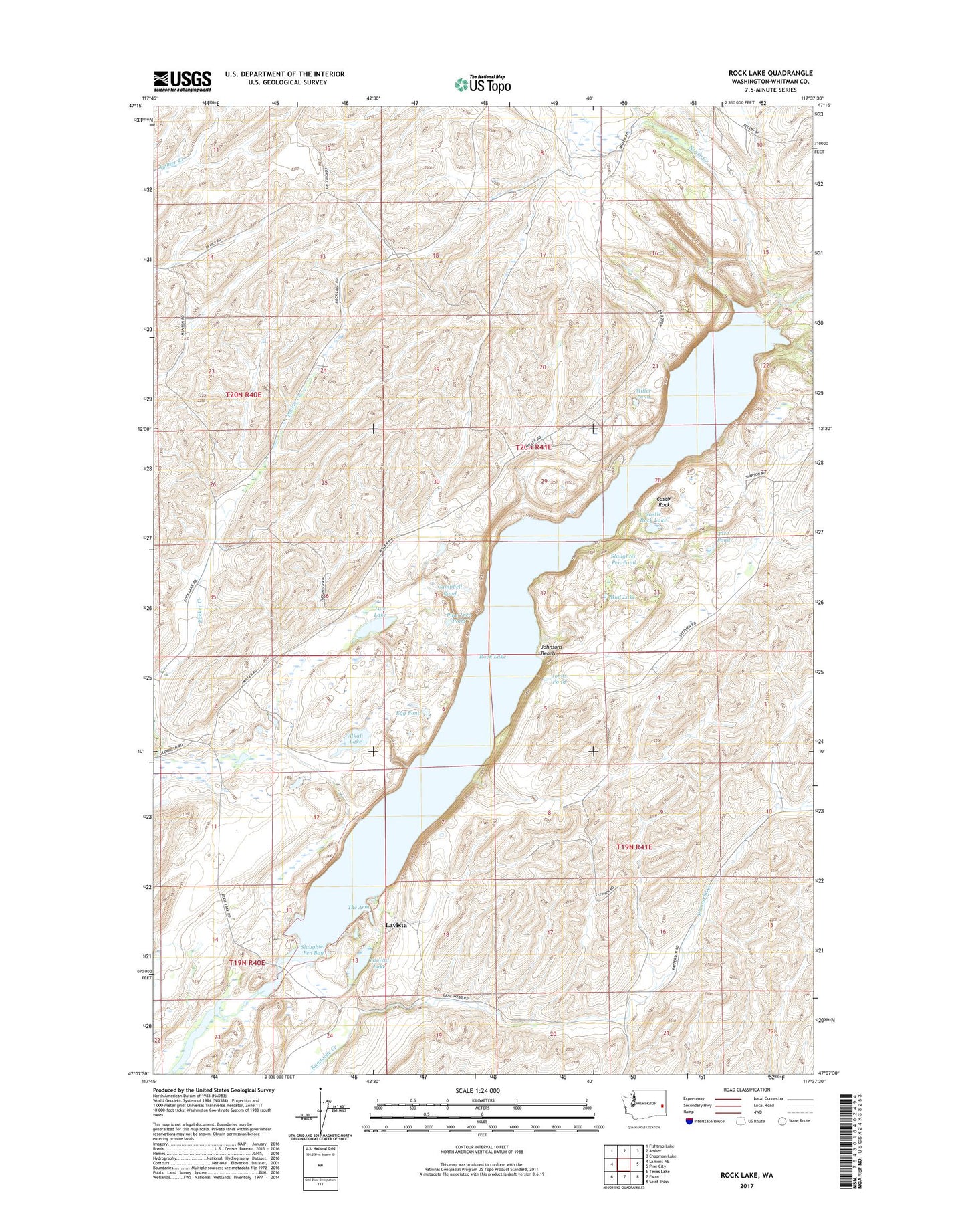
2020 topographic map quadrangle Rock Lake in the state of Washington. Scale: 1:24000. Based on the newly updated USGS 7.5' US Topo map series, this map is in the following counties: Whitman. The map contains contour data, water features, and other items you are used to seeing on USGS maps, but also has updated roads and other features. This is the next generation of topographic maps. Printed on high-quality waterproof paper with UV fade-resistant inks.
Quads adjacent to this one:
West: Lamont NE
Northwest: Fishtrap Lake
North: Amber
Northeast: Chapman Lake
East: Pine City
Southeast: Saint John
South: Ewan
Southwest: Texas Lake
Contains the following named places: Alkali Lake, Campbell Pond, Castle Rock, Castle Rock Lake, Egg Pond, Fire Pond, Johns Pond, Johnsons Beach, Lavista, Lavista Lake, Miller Pond, Mud Lake, Negro Creek, Pine Tree Pond, Rock Lake, Slaughter Pen Bay, Slaughter Pen Pond, The Arm, Tule Lake