MyTopo
Washougal Washington US Topo Map
Couldn't load pickup availability
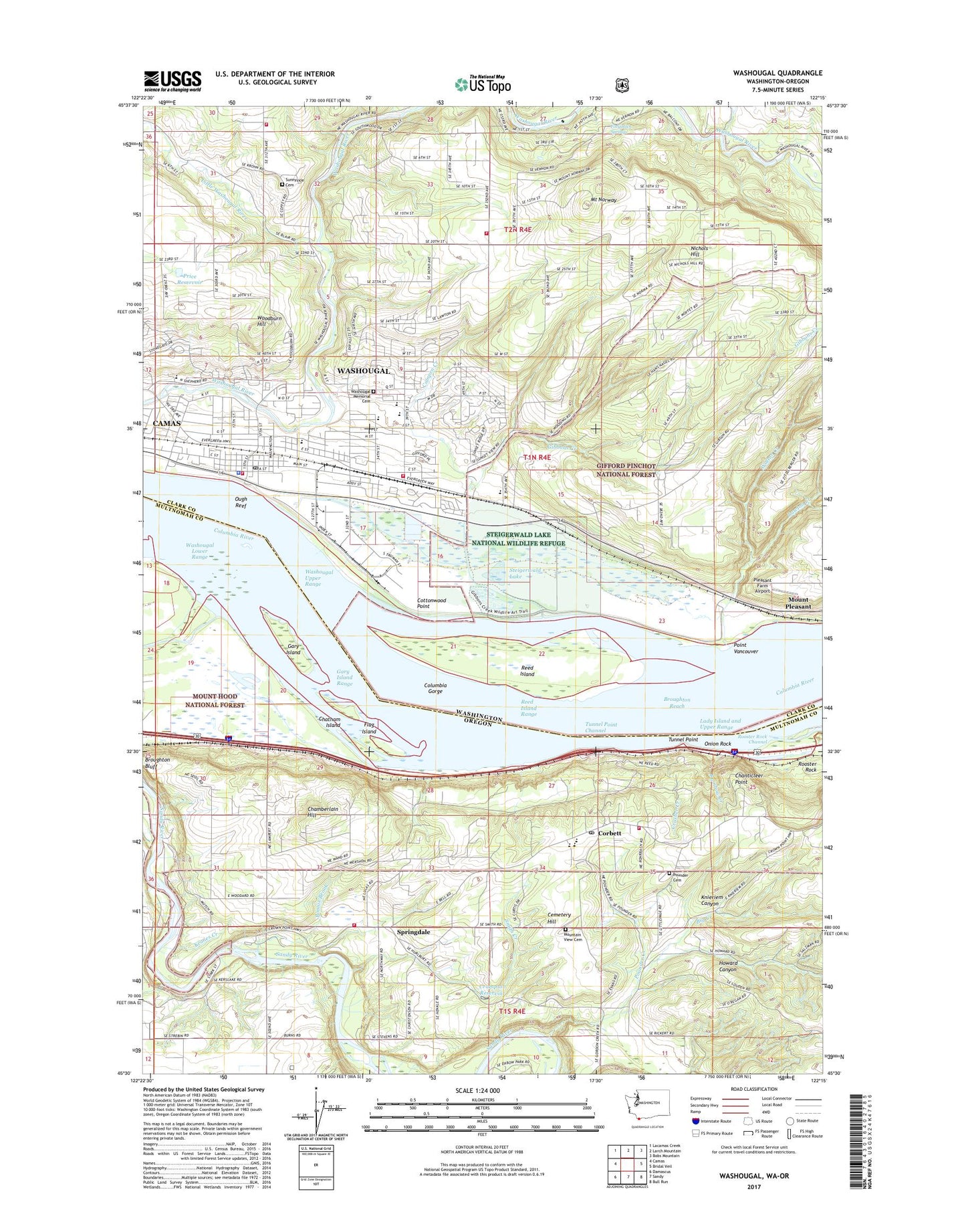
2020 topographic map quadrangle Washougal in the states of Washington, Oregon. Scale: 1:24000. Based on the newly updated USGS 7.5' US Topo map series, this map is in the following counties: Clark, Multnomah. The map contains contour data, water features, and other items you are used to seeing on USGS maps, but also has updated roads and other features. This is the next generation of topographic maps. Printed on high-quality waterproof paper with UV fade-resistant inks.
Quads adjacent to this one:
West: Camas
Northwest: Lacamas Creek
North: Larch Mountain
Northeast: Bobs Mountain
East: Bridal Veil
Southeast: Bull Run
South: Sandy
Southwest: Damascus
Contains the following named places: Big Creek, Bonnie Brook, Camas - Washougal Fire Department Station 43, Camp Collins, Campen Creek, Cemetery Hill, Chamberlain Hill, Chanticleer Point, Chatham Island, City of Washougal, Columbia Gorge, Columbia Gorge District Ranger Office, Columbia School, Corbett, Corbett Community Church, Corbett Grade School, Corbett Post Office, Corbett School, Corbett Station, Cottonwood Point, Crampton Reservoir, Crown Point State Park, Crusher, Crusher Creek, Dabney State Park, Dabney State Park Boat Ramp, East County Fire and Rescue Station 93, East County Fire and Rescue Station 94, East County Fire and Rescue Station 95, Excelsior High School, Flag Island, Flagg Island, Flagg Island Park, Forgotten Springs, Four Corners, Gage Post Office, Gary Island, Gary Island Park, Gary Island Range, Gause Elementary School, Gibbons Creek, Hathaway Elementary School, Howard Canyon, Hurlburt Post Office, Jemtegaard Middle School, Keanes Creek, Knieriem Canyon, Lady Island and Upper Range, Lawton Creek, Little Washougal River, Mount Norway, Mount Pleasant, Mountain View Cemetery, Multnomah County Rural Fire Protection District 14 Station 61 Springdale, Multnomah County Rural Fire Protection District 14 Station 62 Corbett, Nichols Hill, Omar Gause School, Onion Rock, Orbit Heliport, Orchard Hills Golf Course, Ough Reef, Oxbow Park Boat Ramp, Page Post Office, Pleasant Farm Airport, Point Vancouver, Portland Womens Forum State Park, Pounder Cemetery, Pounder Creek, Price Reservoir, Price Reservoir Dam, Rainbow Creek, Reed Island, Reed Island Range, Rooster Rock, Rooster Rock Channel, Rooster Rock Post Office, Sandy, Smith Creek, Springdale, Springdale Community Bible Church, Springdale School, Steigerwald Lake, Steigerwald Lake National Wildlife Refuge, Sunnyside Cemetery, Taylor, Taylor Post Office, Tunnel Point, Tunnel Point Channel, Walton Creek, Washougal, Washougal Bus Terminal, Washougal High School, Washougal Lower Range, Washougal Memorial Cemetery, Washougal Police Department, Washougal Post Office, Washougal Upper Range, Winkler Creek, Woodburn Hill, ZIP Code: 97060