MyTopo
Wells Dam Washington US Topo Map
Couldn't load pickup availability
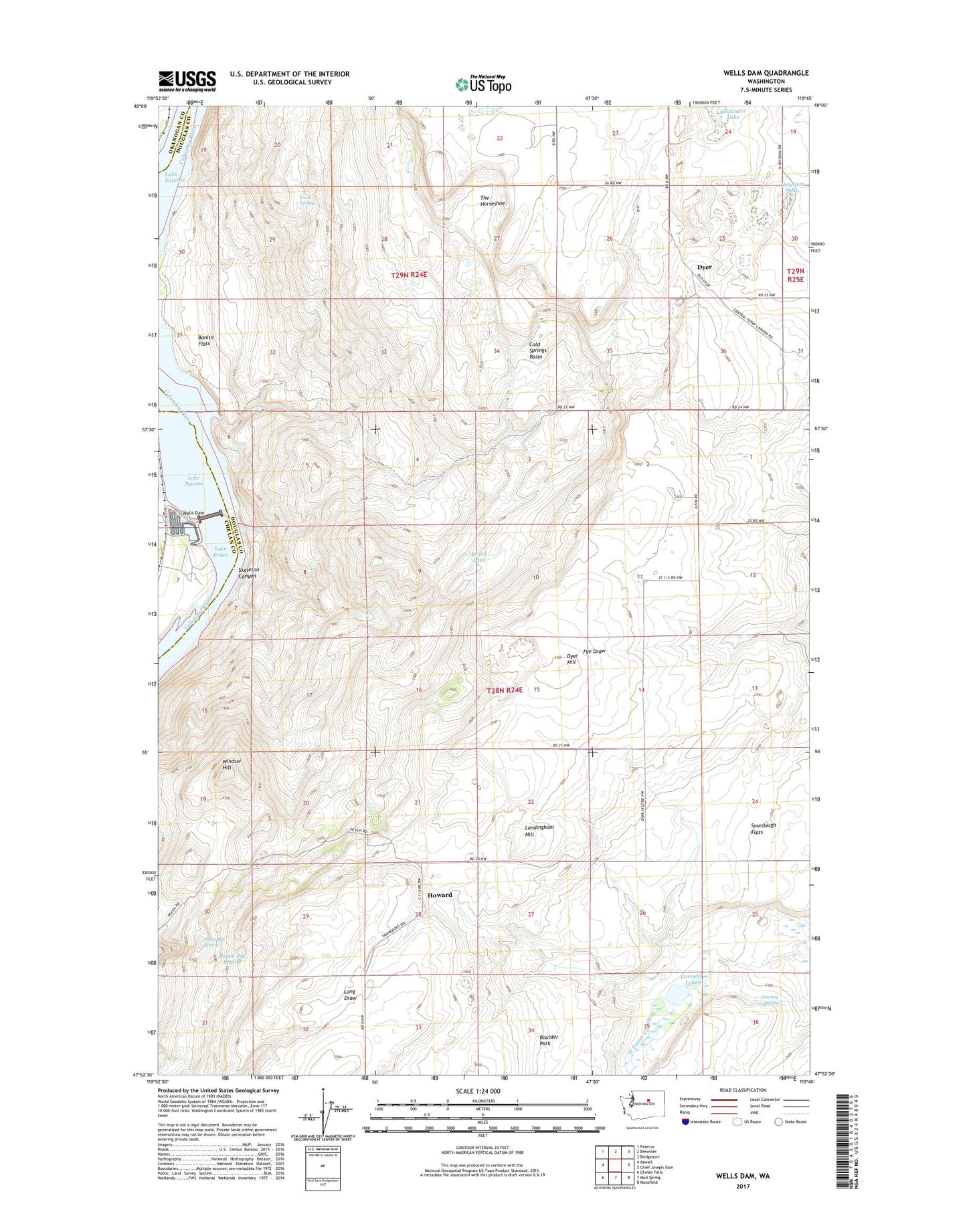
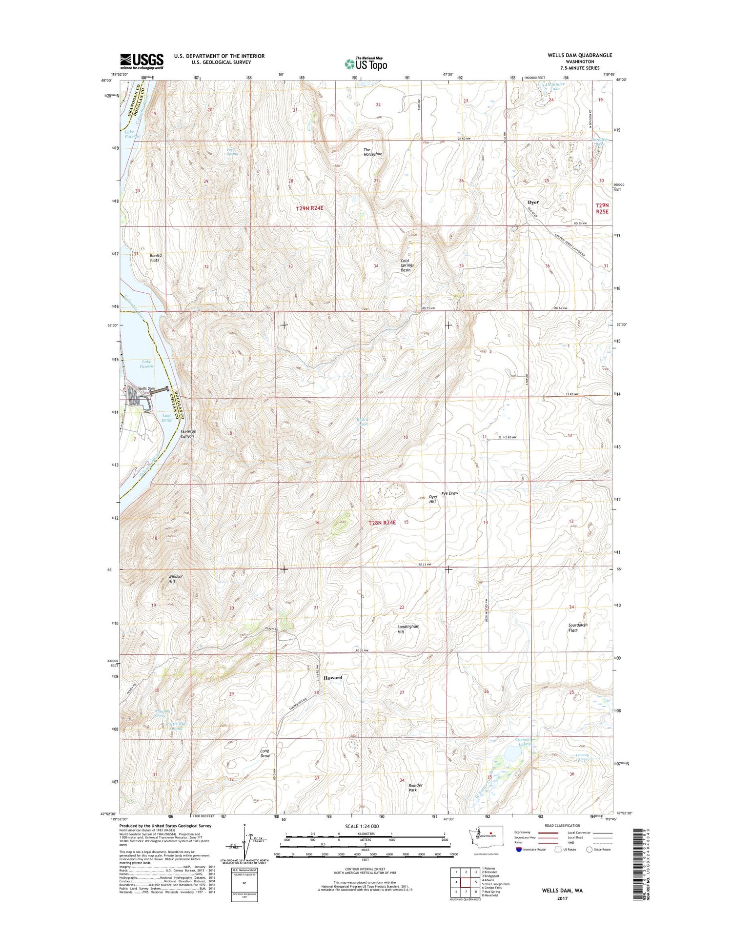
2020 topographic map quadrangle Wells Dam in the state of Washington. Scale: 1:24000. Based on the newly updated USGS 7.5' US Topo map series, this map is in the following counties: Douglas, Chelan, Okanogan. The map contains contour data, water features, and other items you are used to seeing on USGS maps, but also has updated roads and other features. This is the next generation of topographic maps. Printed on high-quality waterproof paper with UV fade-resistant inks.
Quads adjacent to this one:
West: Azwell
Northwest: Pateros
North: Brewster
Northeast: Bridgeport
East: Chief Joseph Dam
Southeast: Mansfield
South: Mud Spring
Southwest: Chelan Falls
Contains the following named places: Beard Lake, Bonita, Bonita Flats, Boulder Park, Cold Springs Basin, Cornehl Lake, Dezellem Lake, Downey Spring, Dyer, Dyer Hill, Ford Spring, Howard, Landingham Hill, Pattie Big Spring, Skeleton Canyon, Sourdough Flats, The Horseshoe, Wells Dam, Windsor Hill