
MyTopo
Alvon West Virginia US Topo Map
Couldn't load pickup availability
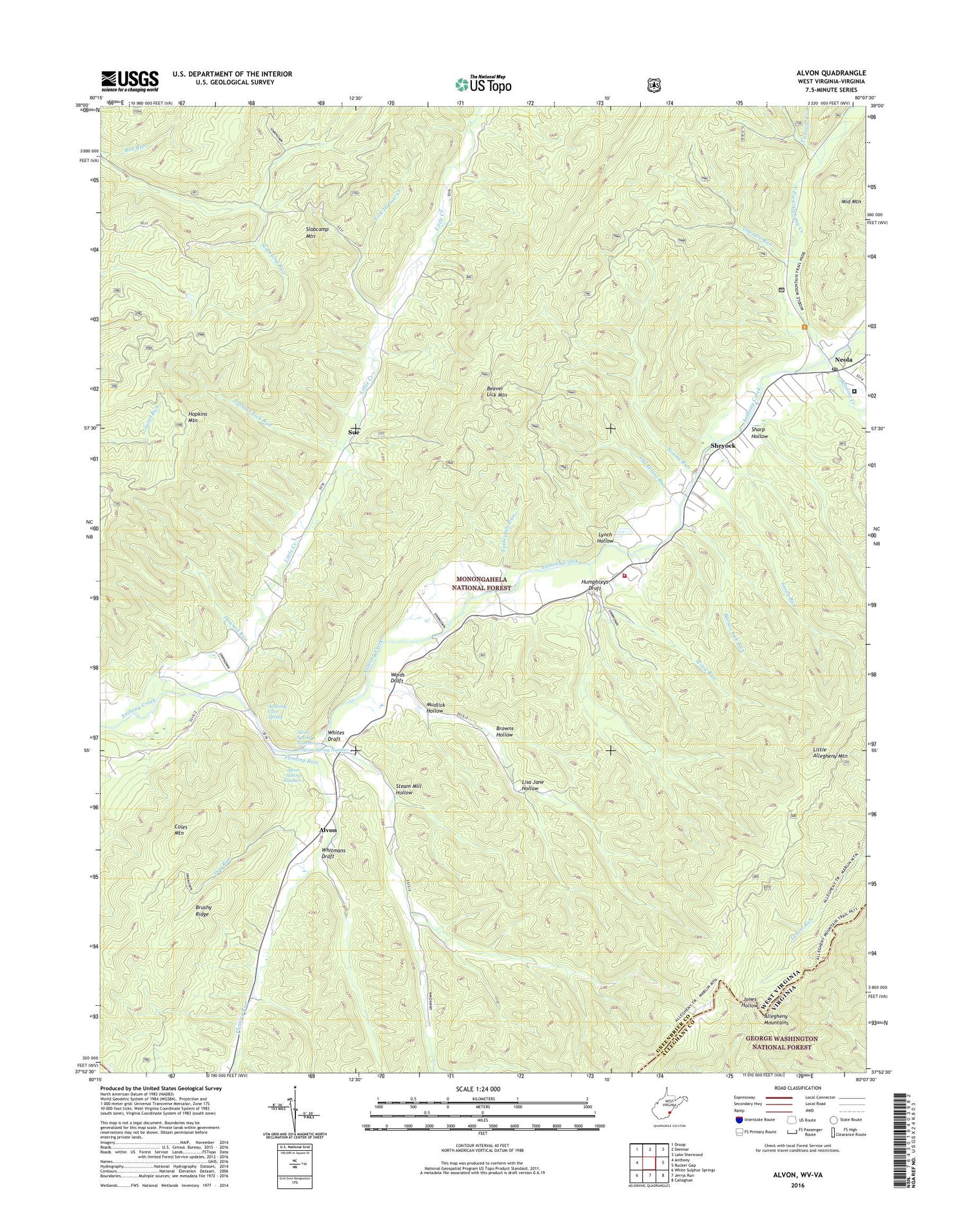
2019 topographic map quadrangle Alvon in the state of West Virginia. Scale: 1:24000. Based on the newly updated USGS 7.5' US Topo map series, this map is in the following counties: Greenbrier, Alleghany. The map contains contour data, water features, and other items you are used to seeing on USGS maps, but also has updated roads and other features. This is the next generation of topographic maps. Printed on high-quality waterproof paper with UV fade-resistant inks.
Quads adjacent to this one:
West: Anthony
Northwest: Droop
North: Denmar
Northeast: Lake Sherwood
East: Rucker Gap
Southeast: Callaghan
South: Jerrys Run
Southwest: White Sulphur Springs
Contains the following named places: Allegheny Mountain School, Alvon, Alvon Spring Number 1, Alvon Spring Number 3, Alvon Spring Number 4, Anthony Cave Spring, Anthony Correctional Center, Anthony Creek School, Anthony Creek Volunteer Fire Department and Rescue Squad, Barnes Lick Run, Beaver Lick Mountain Trail, Brown School, Browns Hollow, Brushy Ridge, Camp Wood, Campslab, Coles Mountain, Dawson Run, Dry Run, Fleming Run, Hopkins Mountain Lookout Tower, Hull School, Humphreys Draft, Humphreys Draft Trail, Lick Hollow Creek, Lisa Jane Hollow, Little Allegheny Mountain, Little Allegheny Mountain Trail, Little Creek, Little Creek Church, Lynch Hollow, Meadow Creek, Middle Fork Anthonys Creek, Mudlick Hollow, Neola, Neola Church of God, Neola Post Office, Neola Wildlife Management Area, North Fork Anthony Creek, Old House Run, Onemile Run, Panther Lick Run, Sharp Hollow, Shryock, Simms Run, Slabcamp School, Slabcamp Trail, Steam Mill Hollow, Stony Run, Sue, Turkeypen Run, Twomile Run, Upper Little Creek School, Waids Draft, Whites Draft, Whites Draft School, Whitmans Draft, Wiley Run, ZIP Code: 24986


