MyTopo
Clay West Virginia US Topo Map
Couldn't load pickup availability
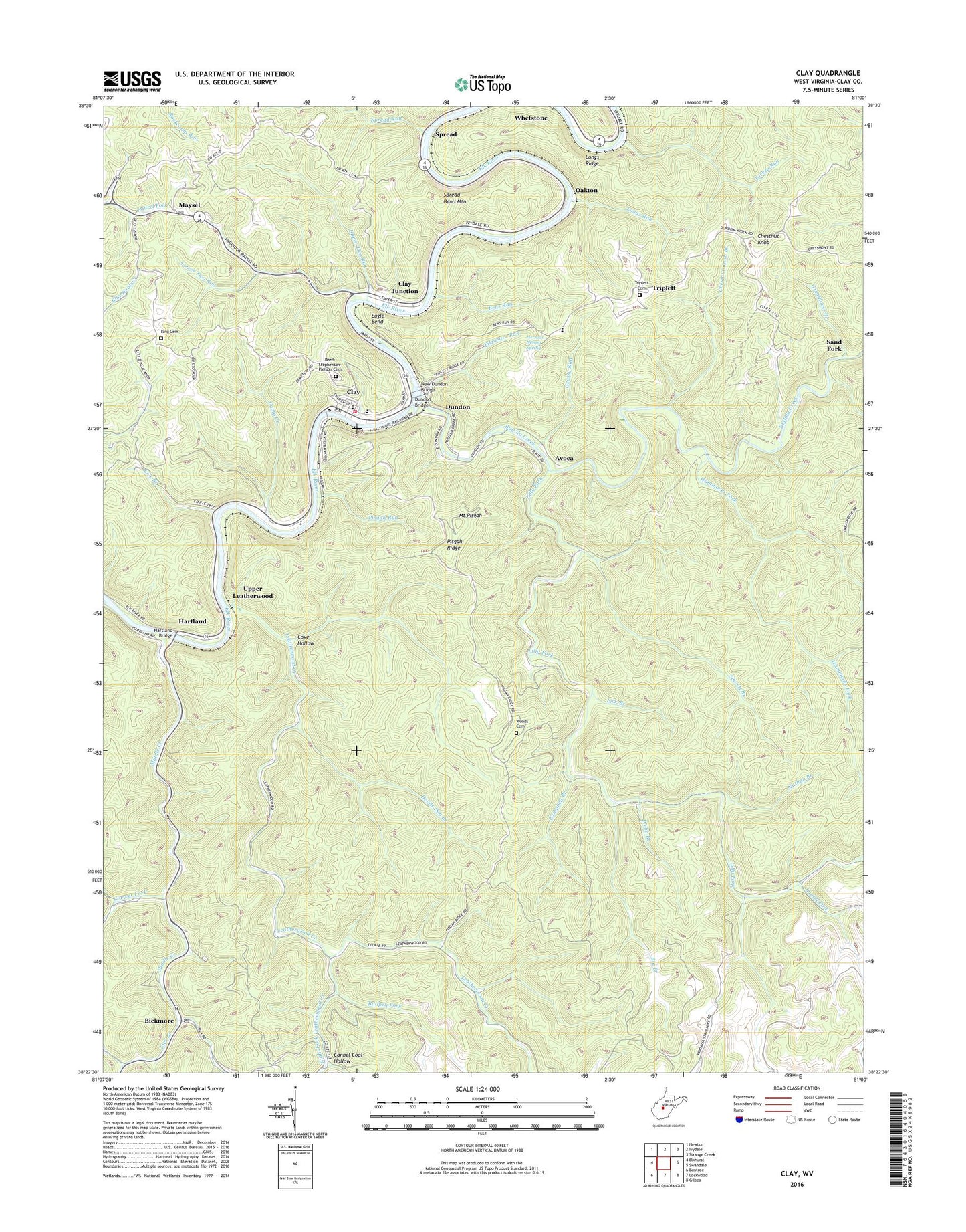
2019 topographic map quadrangle Clay in the state of West Virginia. Scale: 1:24000. Based on the newly updated USGS 7.5' US Topo map series, this map is in the following counties: Clay. The map contains contour data, water features, and other items you are used to seeing on USGS maps, but also has updated roads and other features. This is the next generation of topographic maps. Printed on high-quality waterproof paper with UV fade-resistant inks.
Quads adjacent to this one:
West: Elkhurst
Northwest: Newton
North: Ivydale
Northeast: Strange Creek
East: Swandale
Southeast: Gilboa
South: Lockwood
Southwest: Bentree
Contains the following named places: Avoca, Bens Run, Bickmore, Bickmore Post Office, Bickmore School, Big Branch, Buffalo Creek, Buffalo Valley Baptist Church, Bullpen Fork, Camp Creek, Campbell Branch, Cannel Coal Hollow, Carver Fork, Chestnut Knob, Chestnut Knob Branch, Clay, Clay Christian Academy, Clay Community Church, Clay County, Clay County Courthouse, Clay County Elementary School, Clay County Emergency Ambulance Service Station 100, Clay County High School, Clay County Middle School, Clay County Public Library, Clay County Sheriff's Office, Clay Courthouse Station, Clay First Baptist Church, Clay Junction, Clay Methodist Church, Clay Post Office, Clay Volunteer Fire Department, Cove Hollow, Cove Hollow School, Devils Den Branch, District B, Dundon, Dundon Bridge, Eagle Bend, Elkview Schoolhouse, Fairview Baptist Church, Fitzwater Run, Franks Branch, Grassy Run, Greathouse Branch, Hammocks Fork, Hartland, Hartland Bridge, Herman Nelson Spring, Jamestown, King Cemetery, Laurel Fork, Leatherwood Creek, Lick Branch, Lilly Fork, Longs Ridge, Longs Run, Lower Two Run, Maysel, Maysel Missionary Baptist Church, Maysel Post Office, Maysel School, Middle Creek, Morocco, Mount Pisgah, Nathan Branch, New Dundon Bridge, Oakton, Osborne Fork, Pisgah Ridge, Pisgah Run, Reed - Stephenson - Pierson Cemetery, Right Fork Leatherwood Creek, Sand Fork, Sinnett Branch, Spread, Spread Bend Mountain, Town of Clay, Triplett, Triplett Cemetery, Triplett School, Turkey Run, Two Run, Upper Leatherwood, Upper Two Run, Webb Branch, Woods Cemetery, ZIP Code: 25043