MyTopo
Crumpler West Virginia US Topo Map
Couldn't load pickup availability
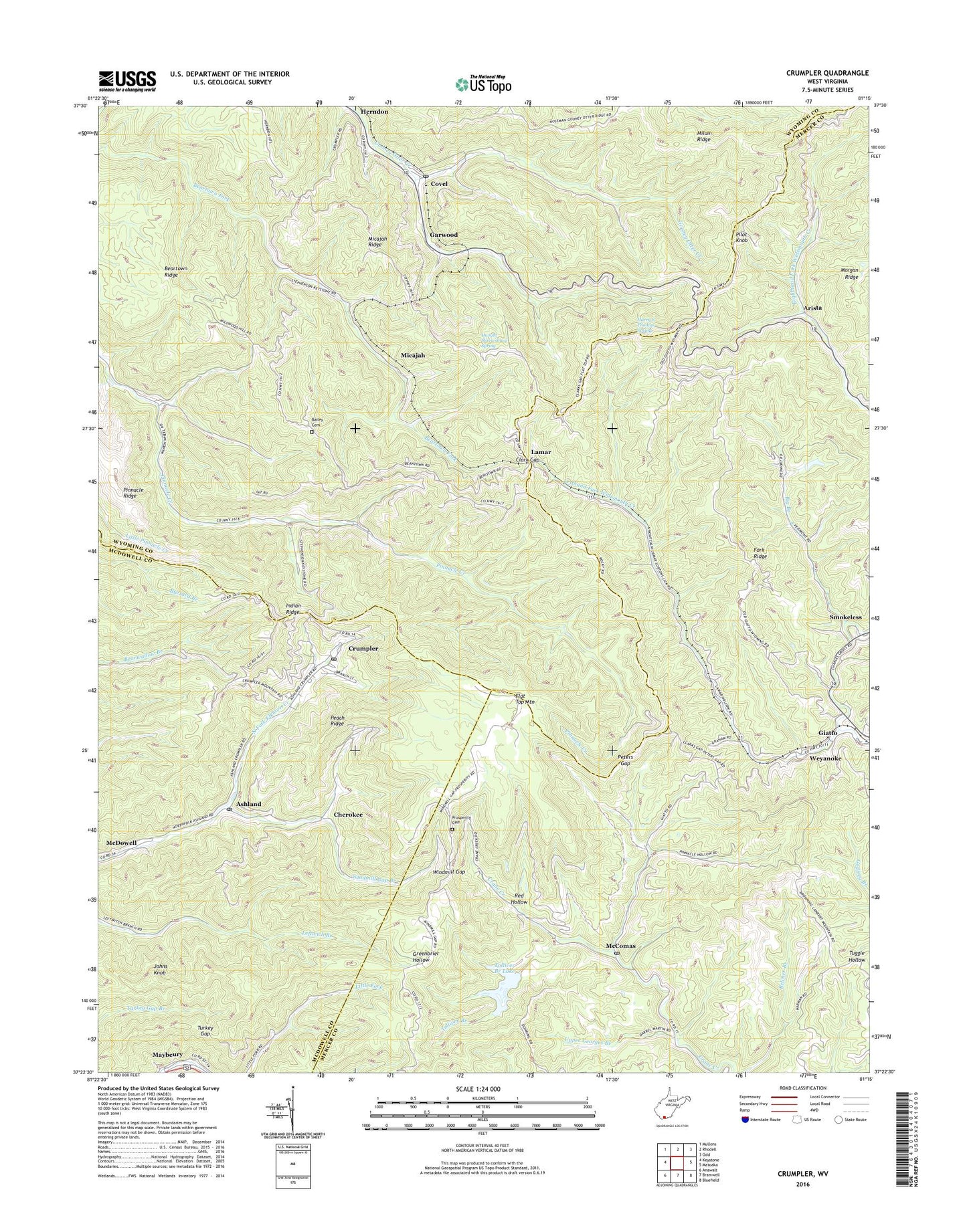
2019 topographic map quadrangle Crumpler in the state of West Virginia. Scale: 1:24000. Based on the newly updated USGS 7.5' US Topo map series, this map is in the following counties: Wyoming, Mercer, McDowell. The map contains contour data, water features, and other items you are used to seeing on USGS maps, but also has updated roads and other features. This is the next generation of topographic maps. Printed on high-quality waterproof paper with UV fade-resistant inks.
Quads adjacent to this one:
West: Keystone
Northwest: Mullens
North: Rhodell
Northeast: Odd
East: Matoaka
Southeast: Bluefield
South: Bramwell
Southwest: Anawalt
Contains the following named places: Algonquin, Angle Hollow, Arista, Ashland, Ashland Post Office, Bailey Cemetery, Bailey Chapel, Beartown Church, Beartown Fork Dam, Beartown Ridge, Big Branch, Black, Boyds Branch Refuse Dam, Cherokee, Clark Gap, Clark Gap Church, Covel, Covel Census Designated Place, Covel Missionary Baptist Church, Covel Post Office, Crane Creek Church, Crumpler, Crumpler Census Designated Place, Crumpler Impoundment Number Two, Crumpler Post Office, Dwight Shrewsbury Spring, East Fork of Crane Creek Dam, Fork Ridge, Garwood, Giatto, Giatto School, Gooney Otter Creek Dam, Harry S Thomas Spring, Johns Knob, Lamar, Lefthand Fork Dam, Lefthand Fork Widemouth Creek, Lowe, McComas, McComas High School, McComas Post Office, Micajah, Payne Branch Dam, Peach Ridge, Peters Gap, Piedmont, Pilot Knob, Pilot Knob Lookout Tower, Pinnacle Ridge, Prosperity Cemetery, Prosperity School, Red Hollow, Righthand Fork Widemouth Creek, Smokeless, Taylor School, Tolliver Branch, Tolliver Branch Dam, Tolliver Branch Lake, Turkey Gap, Upper Georges Branch, Weyanoke, Widemouth, Windmill Gap, Windmill Gap Branch, ZIP Codes: 24716, 24719, 24729, 24736, 24747