MyTopo
Dorothy West Virginia US Topo Map
Couldn't load pickup availability
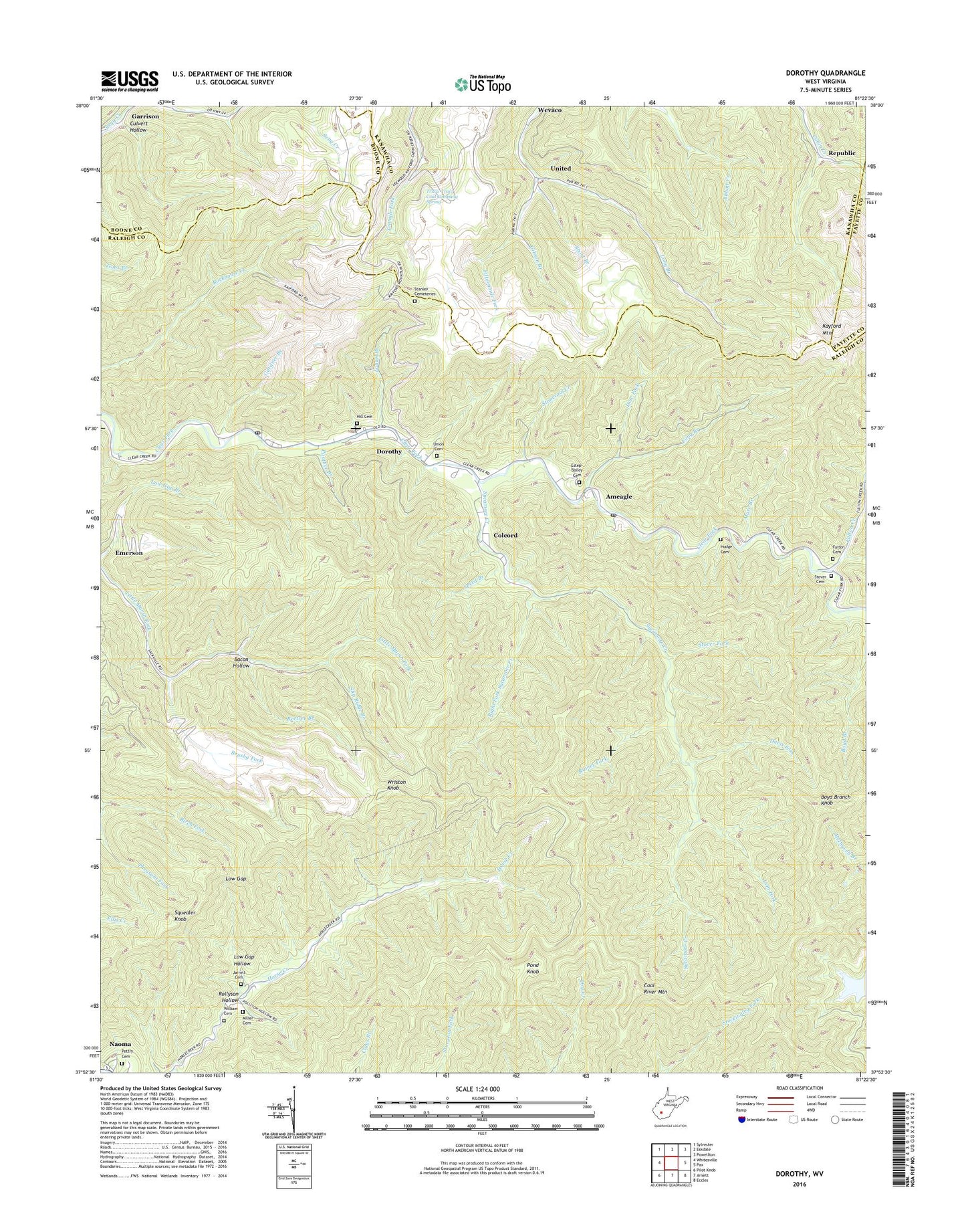
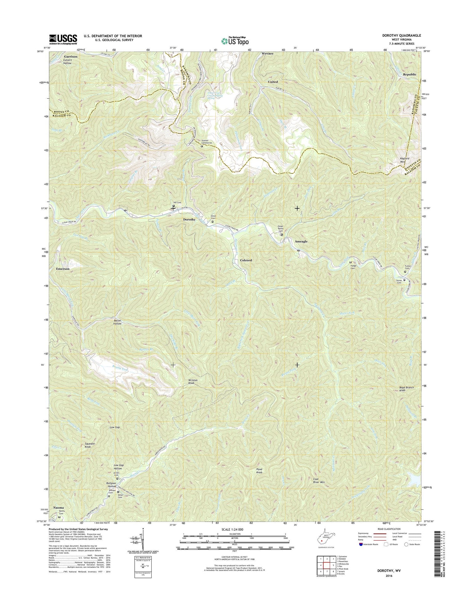
2019 topographic map quadrangle Dorothy in the state of West Virginia. Scale: 1:24000. Based on the newly updated USGS 7.5' US Topo map series, this map is in the following counties: Raleigh, Kanawha, Boone, Fayette. The map contains contour data, water features, and other items you are used to seeing on USGS maps, but also has updated roads and other features. This is the next generation of topographic maps. Printed on high-quality waterproof paper with UV fade-resistant inks.
Quads adjacent to this one:
West: Whitesville
Northwest: Sylvester
North: Eskdale
Northeast: Powellton
East: Pax
Southeast: Eccles
South: Arnett
Southwest: Pilot Knob
Contains the following named places: Ameagle, Ameagle Post Office, Bacon Hollow, Beetree Branch, Boyd Branch Knob, Brushy Fork, Coal River Mountain, Colcord, Colcord Census Designated Place, Culvert Hollow, Davis Fork, Dorothy, Dorothy Census Designated Place, Dorothy Post Office, Dow Fork, Emerson, Estep-Bailey Cemetery, Fulton Cemetery, Fulton Creek, Fulton School, Gardner Branch, Gibson Branch, High Coal, Hill Cemetery, Hodge Cemetery, Hope School, Horse Creek Church, Jarrell Cemetery, Jarrell School, Kayford Mountain, Laurel Branch, Lem Fork, Long Branch, Low Gap, Low Gap Hollow, Mare Branch, Miller Cemetery, Notomine, Panther Branch, Pettry Cemetery, Pheasant Fork, Pond Knob, Raines Fork, Right Fork Sycamore Creek, Rollyson Hollow, Short Branch, Slip Ridge Branch, Speed Branch, Squealer Knob, Stanley Cemeteries, Stonecoal Creek, Stover Cemetery, Stover Fork, Sycamore Creek, Sycamore School, Truax-Traer Coal Company Spring, Union Cemetery, United, William Cemetery, Wriston Knob, Wriston Knob Lookout Tower, ZIP Codes: 25048, 25060, 25062