
MyTopo
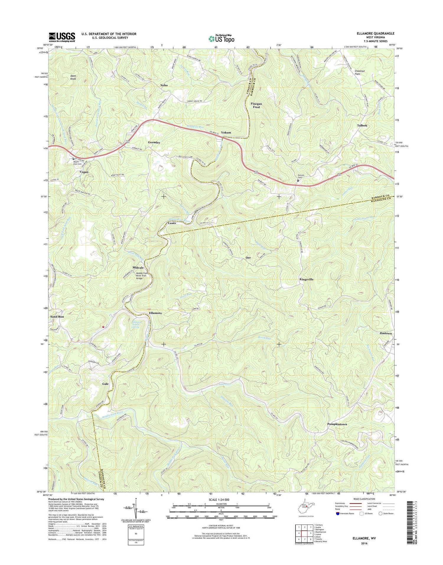
Ellamore West Virginia US Topo Map
Couldn't load pickup availability
2019 topographic map quadrangle Ellamore in the state of West Virginia. Scale: 1:24000. Based on the newly updated USGS 7.5' US Topo map series, this map is in the following counties: Randolph, Upshur, Barbour. The map contains contour data, water features, and other items you are used to seeing on USGS maps, but also has updated roads and other features. This is the next generation of topographic maps. Printed on high-quality waterproof paper with UV fade-resistant inks.
Quads adjacent to this one:
West: Buckhannon
Northwest: Century
North: Audra
Northeast: Belington
East: Junior
Southeast: Beverly West
South: Cassity
Southwest: Alton
Contains the following named places: Bentley Y, Brook Run, Burke School, Burnt Bridge, Camp Mahoneqan, Chestnut Flats, Deen Knob, Devil Run, Durrett Cemetery, Durrett Church, Ellamore, Ellamore School Spring, Ellamore Volunteer Fire Department, Fair Hope School, Fairview Church, Fairview School, Finegan Ford, Gale, Gormley, Gormley School, Gum Run, Hanging Run School, Hooppole Run, Jimtown, Kettle Run, Kettle Run School, King Summit School, Kingsville, Kingsville Post Office, Lantz, Latham School, Laurel Creek, Laurel Creek School, Laurel Run, Loop, Middle Fork, Middle Fork River Trail Bridge, Midvale, Mount Nebo Church, Mount Zion Cemetery, Nay Chapel, Nebo, Nebo School, Orr, Osborne Run, Phillips Church, Pumpkintown, Right Fork Middle Fork River, Roaring Creek District, Sand Fork, Sand Run, Service Run, Short Run, Straight Run, Talbott, Talbott Methodist Episcopal Church, Tall Oaks Roadside Park, Vegan, Water Camp School, White Oak Run, Yokum, ZIP Codes: 26257, 26267


