MyTopo
Flat Top West Virginia US Topo Map
Couldn't load pickup availability
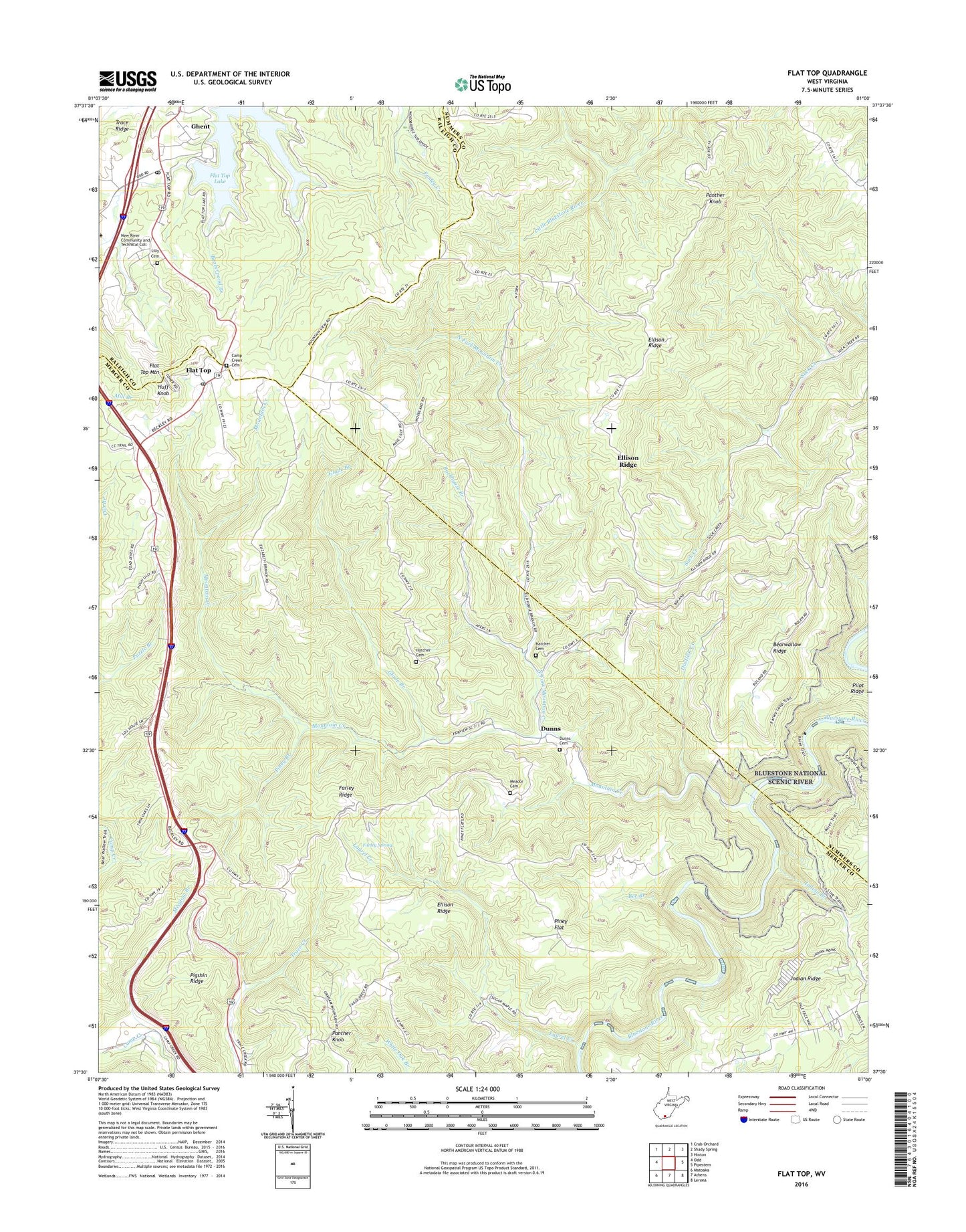
2019 topographic map quadrangle Flat Top in the state of West Virginia. Scale: 1:24000. Based on the newly updated USGS 7.5' US Topo map series, this map is in the following counties: Mercer, Summers, Raleigh. The map contains contour data, water features, and other items you are used to seeing on USGS maps, but also has updated roads and other features. This is the next generation of topographic maps. Printed on high-quality waterproof paper with UV fade-resistant inks.
Quads adjacent to this one:
West: Odd
Northwest: Crab Orchard
North: Shady Spring
Northeast: Hinton
East: Pipestem
Southeast: Lerona
South: Athens
Southwest: Matoaka
Contains the following named places: Bearwallow Ridge, Beaverpond Branch, Bee Branch, Bluestone View Church, Bluestone View School, Camp Creek Cemetery, Camp Creek Primitive Baptist Church, Clark School, Cub Branch, Dunns, Dunns Cemetery, Dunns Consolidated School, Dustlick Creek, Ellison Church, Ellison Ridge, Fairview School, Farley Ridge, Farley Spring, Flat Top, Flat Top Mountain, Flat Top Post Office, Flat Top School, Gadd School, Ghent, Ghent Census Designated Place, Ghent Post Office, Glade Branch, Hatcher Cemetery, Huff Knob, Huff Knob Lookout Tower, Indian Branch, Indian Ridge, Laurel Creek, Laurel Valley School, Lilly Heights School, Lilly School, Meador Cemetery, Meadow Branch, Mountain Creek, Mountain Creek Missionary Baptist Church, North Fork Mountain Creek, Panther Knob, Pigshin Ridge, Pilot Ridge, Piney Branch, Piney Flat, Piney Flat School, Rockhouse Branch, Sand Knob School, Suck School, Tom Lilly Cemetery, WJLS-FM (Beckley), ZIP Codes: 25841, 25843, 25969