MyTopo
Glady West Virginia US Topo Map
Couldn't load pickup availability
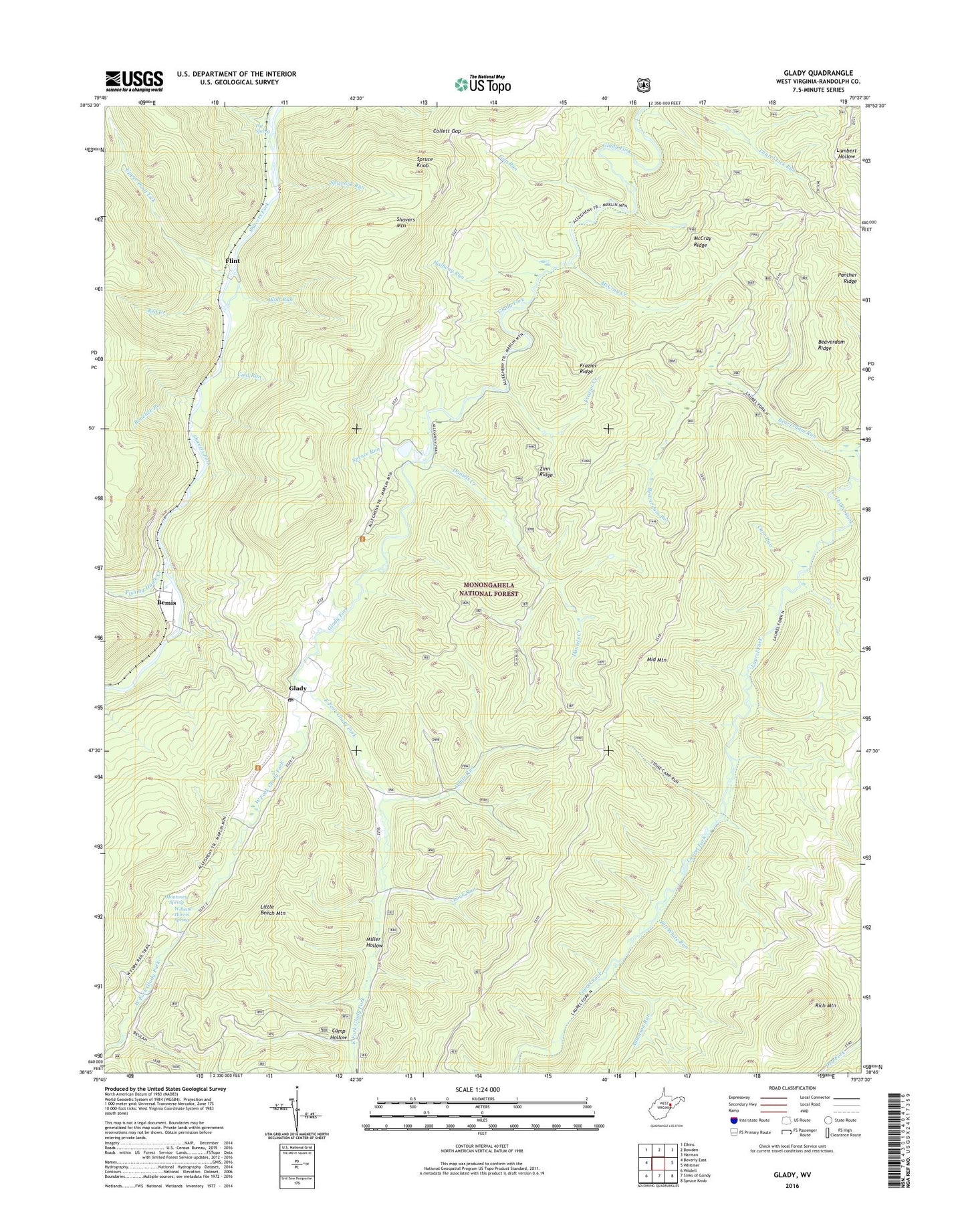
2019 topographic map quadrangle Glady in the state of West Virginia. Scale: 1:24000. Based on the newly updated USGS 7.5' US Topo map series, this map is in the following counties: Randolph. The map contains contour data, water features, and other items you are used to seeing on USGS maps, but also has updated roads and other features. This is the next generation of topographic maps. Printed on high-quality waterproof paper with UV fade-resistant inks.
Quads adjacent to this one:
West: Beverly East
Northwest: Elkins
North: Bowden
Northeast: Harman
East: Whitmer
Southeast: Spruce Knob
South: Sinks of Gandy
Southwest: Wildell
Contains the following named places: Adamson Run, Beaver Dam Wildlife Management Area, Beaverdam Ridge, Beaverdam Run, Bemis, Bill White Run, Bonelick Branch, Camp Hollow, Carr Run, Coal Run, Collett Gap, Daniels Creek, East Fork Glady Fork, Fishing Hawk Creek, Flint, Frazier Creek, Frazier Ridge, Gap Run, Glady, Glady Church of the Brethren, Glady Post Office, Halfway Run, Laurel Fork North Wilderness, Laurel Fork Trail, Laurel Lick Run Trail, Laurel Lick Trail, Little Beech Mountain, Louk Run, Lower Pond Lick, McCray Creek, McCray Creek Trail, McCray Ridge, Middle Mountain Trail, Miller Hollow, Montes, Montoncy Spring, Mud Run, Panther Ridge, Pat Spring, Pine Grove School, Red Creek, Spicelick Run, Spruce Knob, Spruce Run, Stone Camp Run Trail, Upper Pond Lick, West Fork Glady Fork, Wheeler, White Run, William Harris Spring, Wolf Run, Zinn Ridge, Zinn Ridge Trail