MyTopo
Hanging Rock West Virginia US Topo Map
Couldn't load pickup availability
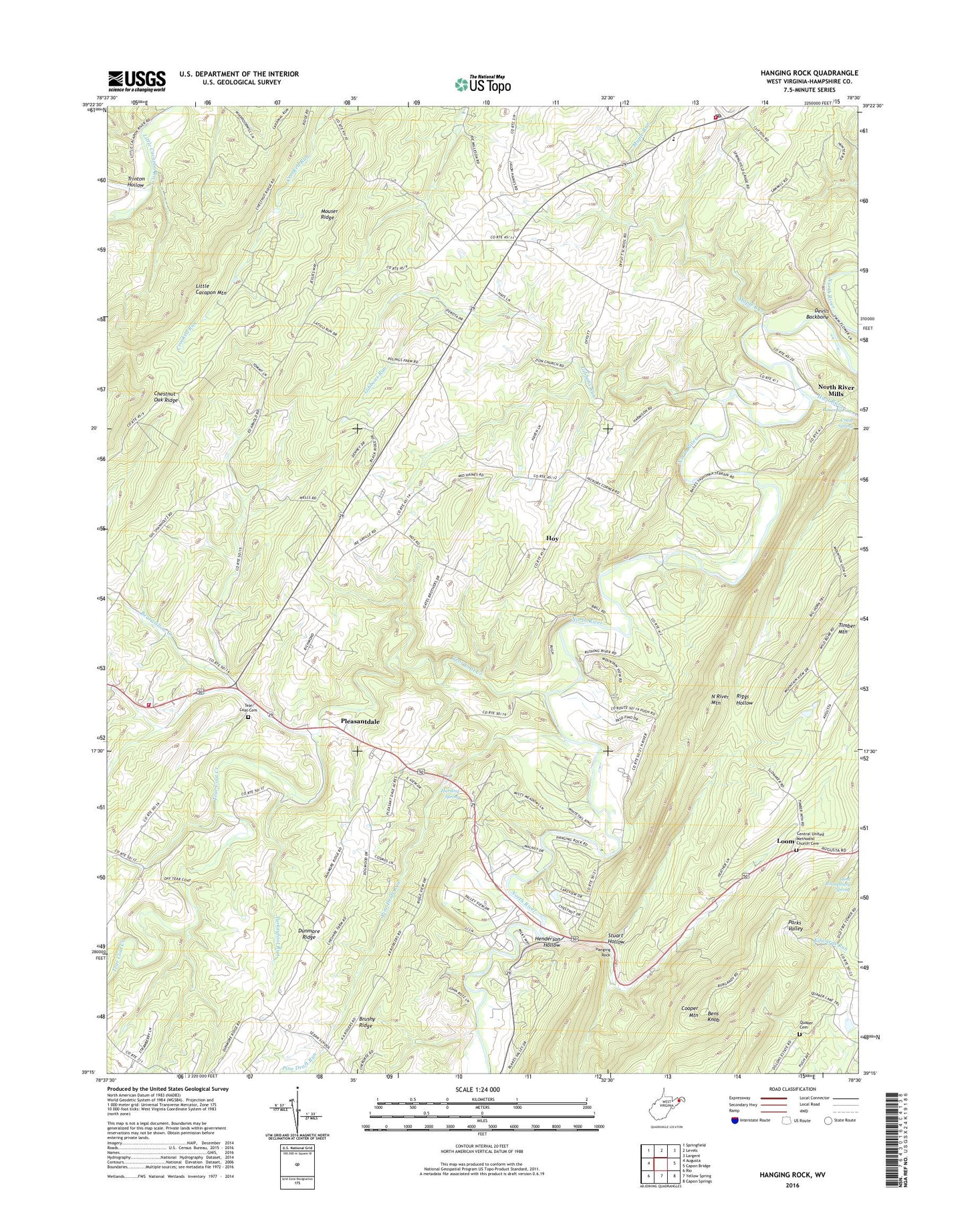
2019 topographic map quadrangle Hanging Rock in the state of West Virginia. Scale: 1:24000. Based on the newly updated USGS 7.5' US Topo map series, this map is in the following counties: Hampshire. The map contains contour data, water features, and other items you are used to seeing on USGS maps, but also has updated roads and other features. This is the next generation of topographic maps. Printed on high-quality waterproof paper with UV fade-resistant inks.
Quads adjacent to this one:
West: Augusta
Northwest: Springfield
North: Levels
Northeast: Largent
East: Capon Bridge
Southeast: Capon Springs
South: Yellow Spring
Southwest: Rio
Contains the following named places: Augusta Volunteer Fire Company, Bearwallow Creek, Bens Knob, Bens Knob Lookout Tower, Bitner Spring, Central School, Central United Methodist Church, Central United Methodist Church Cemetery, Chestnut Oak Ridge, Cooper Mountain, Craig Spring, Devils Backbone, Dunmore Ridge, Gibbons Run, Haines Store, Hampshire County, Hanging Rock, Harding Spring, Henderson Hollow, Hiett Run, Hopewell School, Hoy, Hoy School, Independence School, Kedron School, Little Cacapon Mountain, Loom, Luna Roomsburg Spring, Maple Run, Mouser Ridge, New Junction School, North River Mills, North River Mills United Methodist Church, Pine Draft Run, Pleasantdale, Quaker Cemetery, Rosedale School, Slanesville, Slanesville Elementary School, Slanesville Post Office, Slanesville Presbyterian Church, Slanesville Volunteer Ambulance Service, Slanesville Volunteer Fire Company, Stuart Hollow, Tear Coat Cemetery, Tear Coat Church, Tear Coat Creek, Timber Mountain, Timber Mountain School, Trinton Hollow, Turkeyfoot Run, Union Church, Woodlawn School, ZIP Code: 26704