MyTopo
Hinton West Virginia US Topo Map
Couldn't load pickup availability
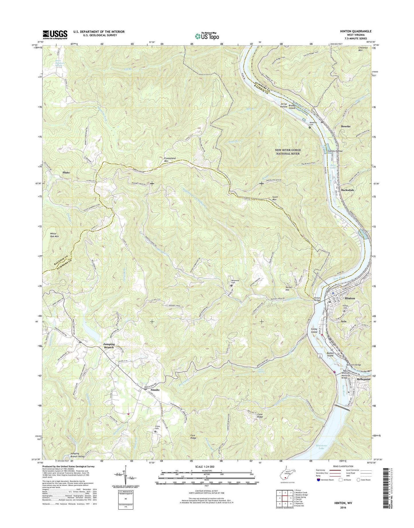
2019 topographic map quadrangle Hinton in the state of West Virginia. Scale: 1:24000. Based on the newly updated USGS 7.5' US Topo map series, this map is in the following counties: Summers, Raleigh. The map contains contour data, water features, and other items you are used to seeing on USGS maps, but also has updated roads and other features. This is the next generation of topographic maps. Printed on high-quality waterproof paper with UV fade-resistant inks.
Quads adjacent to this one:
West: Shady Spring
Northwest: Prince
North: Meadow Creek
Northeast: Meadow Bridge
East: Talcott
Southeast: Forest Hill
South: Pipestem
Southwest: Flat Top
Contains the following named places: Alum Spring, Avis, Barksdale, Bass Lake, Beech Run, Beech Run Church, Beech Run School, Bellepoint, Bellepoint Baptist Church, Bellepoint Elementary School, Bellepoint Station, Bellpoint Bridge, Bessie Meadows Spring, Big Branch, Bluestone Church, Bluestone Dam, Bragg School, Brier Branch, Brooklin, Brooklyn United Methodist Church, Brooks, Brooks Branch, Brooks Falls, Brooks Island, Brooks Missionary Baptist Church, Brooks Post Office, Bushes Island, Camp Brookside, Cave Ridge, Cave Ridge School, Chestnut Grove School, City of Hinton, Collins Hollow, Coney Island, Crews Cemetery, Dick Raymond School, Fall Branch, First Baptist Church, Fork Ridge, Freezeland Mountain, Greenbrier River, Greenbrier School, Hilltop Cemetery, Hinton, Hinton Area Elementary School, Hinton Bridge, Hinton Historic District, Hinton Junior-Senior High School, Hinton Police Department, Hinton Post Office, Hinton Volunteer Fire Department, Jack Deeds School, Jacob Bennet School, Jerrys Hollow, Jumping Branch, Jumping Branch - Nimitz Volunteer Fire Department, Jumping Branch Elementary School, Jumping Branch Post Office, Jumping Branch Valley, Jumping Branch-Nimitz W S Dam, Kates Branch, Leatherwood Creek, Leatherwood School, Little Bluestone Primitive Baptist Church, Low Gap Church, Madam Creek, Madam Creek School, Martha Chapel, Meadows Family Cemetery, Mill Branch, Miller Memorial Methodist Church, Mount Olivet Church, Nimitz, Nimitz Missionary Baptist Church, Nimitz Post Office, O'Donohue School, Owens Branch, Packs Ferry, Pluto, Restwood Cemetery, Righthand Fork Madam Creek, Saint Patricks Catholic Church, Sewell Mountain School, Spranklin Creek, Stewart Creek, Summers County Courthouse, Summers County Emergency Medical Services Incorporated Station 2, Summers County Emergency Medical Services Station 1, Summers County High School, Summers County Public Library, Summers County Sheriff's Office, Summers County Volunteer Fire Department, Summers Middle School, Sunset Hill, Swell Mountain, Tug Creek, Veterans Memorial Bridge, West Virginia State Police Troop 6 - Hinton Detachment, White Oak Branch, White Oak Mountain, WMTD-AM (Hinton), WMTD-FM (Hinton)