MyTopo
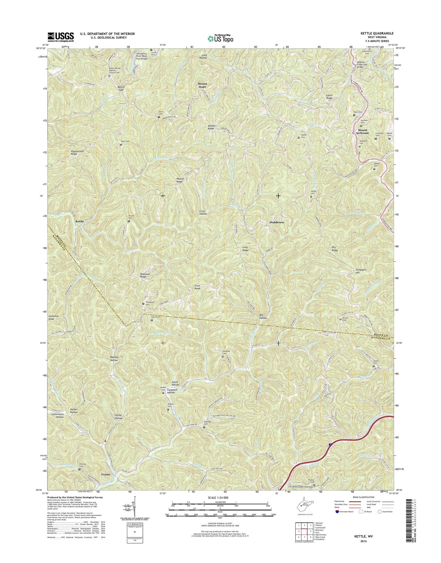
Kettle West Virginia US Topo Map
Couldn't load pickup availability
2019 topographic map quadrangle Kettle in the state of West Virginia. Scale: 1:24000. Based on the newly updated USGS 7.5' US Topo map series, this map is in the following counties: Roane, Kanawha. The map contains contour data, water features, and other items you are used to seeing on USGS maps, but also has updated roads and other features. This is the next generation of topographic maps. Printed on high-quality waterproof paper with UV fade-resistant inks.
Quads adjacent to this one:
West: Romance
Northwest: Kentuck
North: Walton
Northeast: Looneyville
East: Clio
Southeast: Clendenin
South: Blue Creek
Southwest: Big Chimney
Contains the following named places: Abbott Cemetery, Ambler Ridge, Ambler School, Anderson Lick Run, Atkinson Church, Bear Branch, Bethel Church, Big Fork, Big Hollow, Billy Hunt Cemetery, Bufflick School, Campbell Branch, Campbell Hill, Campbell Hollow, Canterbury Hollow, Chandler Cemetery, Clint Hollow, Coleman Fork, Cromwell Cemetery, Doddtown, Donahue Cemetery, Dry Ridge, Fairview School, Foreman Knob Lookout Tower, Frail Knob, Frame, Frame Volunteer Fire Department, Green Creek Oil Field, Gunstock Knob, Harper Cemetery, Harper Hollow, Hively Cemetery, Hubbard Cemetery, Hunt Cemetery, Hunt Fork, Hunt School, Hurricane Branch, I-79 Willis Creek Overpass, Jakes Run, Jarvis Cemetery, Johns Fork, Jordan Light Church, July Run, Kettle, Larch Cemetery, Laurel Fork, Left Fork Green Creek, Left Hand Run, Long Fork, Long Hollow, Long Ridge, Lynch Ridge, Lynncamp Run, Mars Hill Church, Mattie, Mattie Gap, McKown Creek Chapel, McKown Creek Oil Field, McKown Creek Slab Bridge, Mount Hope, Mount Hope Community Church, Mount Moriah Cemetery, Mount Moriah Church, Mount Welcome, Patterson Fork, Pauley Cemetery, Paxton Cemetery, Paxton Ridge, Pigeonroost Ridge, Poca Fork, Pocatalico River Road Truss Bridge, Ramsey Hollow, Ritchea Cemetery, Robinson Ridge, Robinson Run, Rock Creek Oil Field, Rock Creek School, Rocky Fork, Rucker Cemetery, Rucker Fork, Ruffner Fork, Rush Fork, Ryan Cemetery, Sandy Knob School, Sandy Valley Church, Shafer Cemetery, Sheets Cemetery, Simons Branch, Smith Hollow, Staats Cemetery, Stump Hollow, Tarsaville School, Thompson Cemetery, Trace Fork, Trail Branch, Upper July Run, Upper Wills Creek School, Walker Cemetery, Withrow Cemetery, Wolf Creek, ZIP Code: 25286