MyTopo
Onego West Virginia US Topo Map
Couldn't load pickup availability
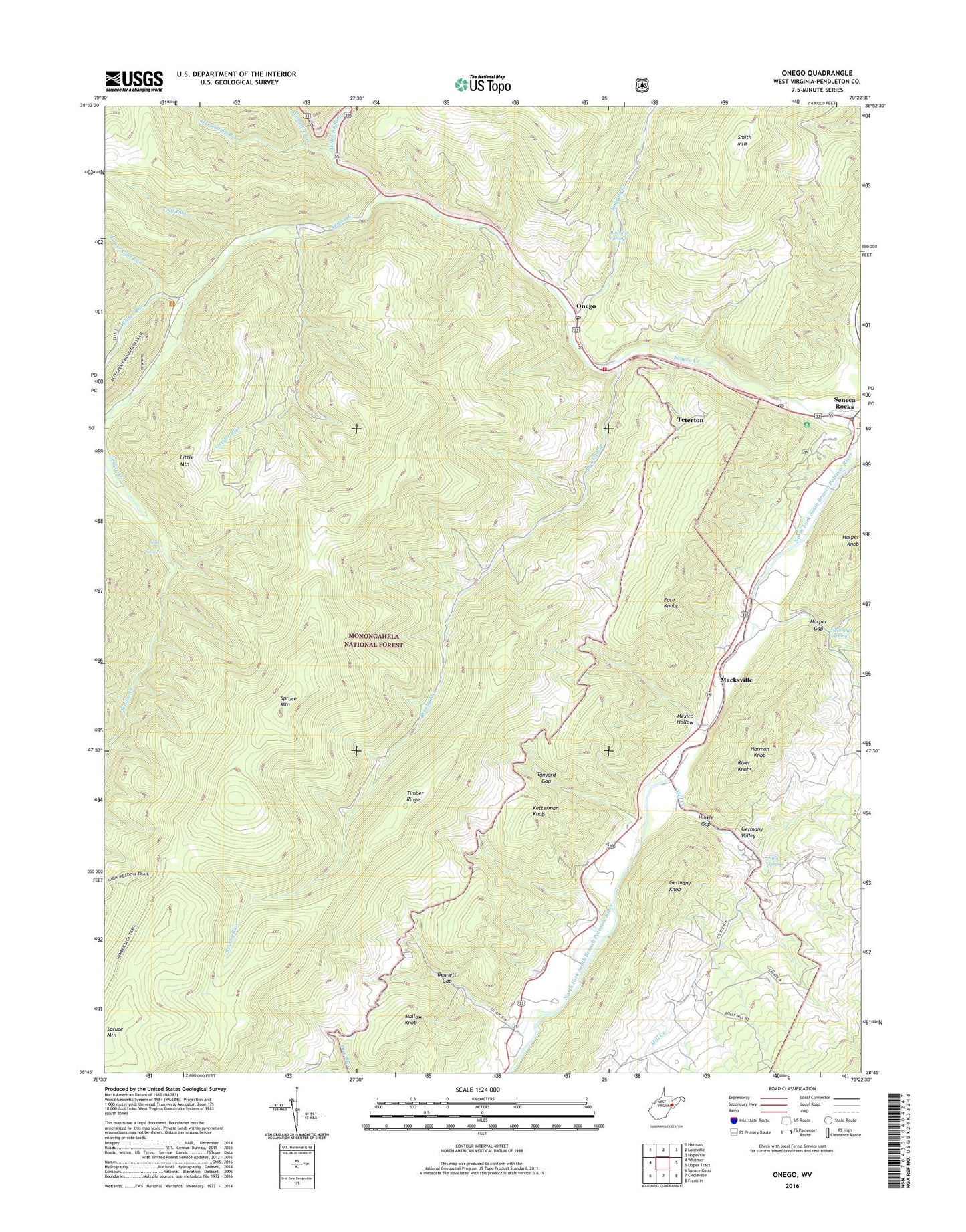
2019 topographic map quadrangle Onego in the state of West Virginia. Scale: 1:24000. Based on the newly updated USGS 7.5' US Topo map series, this map is in the following counties: Pendleton. The map contains contour data, water features, and other items you are used to seeing on USGS maps, but also has updated roads and other features. This is the next generation of topographic maps. Printed on high-quality waterproof paper with UV fade-resistant inks.
Quads adjacent to this one:
West: Whitmer
Northwest: Harman
North: Laneville
Northeast: Hopeville
East: Upper Tract
Southeast: Franklin
South: Circleville
Southwest: Spruce Knob
Contains the following named places: Bennett Gap, Boggs School, Brushy Run, Brushy Run School, Cave School, Falls of Seneca, Germany Knob, Germany Valley, Gulf Run, Harman Knob, Harper Gap, Harper Gap School, High Meadows Trail, High Rock Church, Hinkle Gap, Horsecamp Run, Judy Spring, Keel Spring School, Ketterman Knob, Key, Little Mountain, Lower Gulf Run, Macksville, Mallow Knob, Mallow School, McDonald Springs, McIntosh Run, Mexico Hollow, Mill Creek, Onego, Onego Post Office, Potomac Wildlife Management Area, Roaring Creek, Roaring Springs, Seneca Campground, Seneca Church, Seneca Rocks, Seneca Rocks Post Office, Seneca Rocks Volunteer Fire Department, Seneca Shadows Recreation Site, Spruce Knob-Seneca Rocks National Recreation Area, Strader Run, Tanyard Gap, Tanyard School, Teterton, Timber Ridge, Wamsley Run, Western District, Whites Run, ZIP Code: 26814