MyTopo
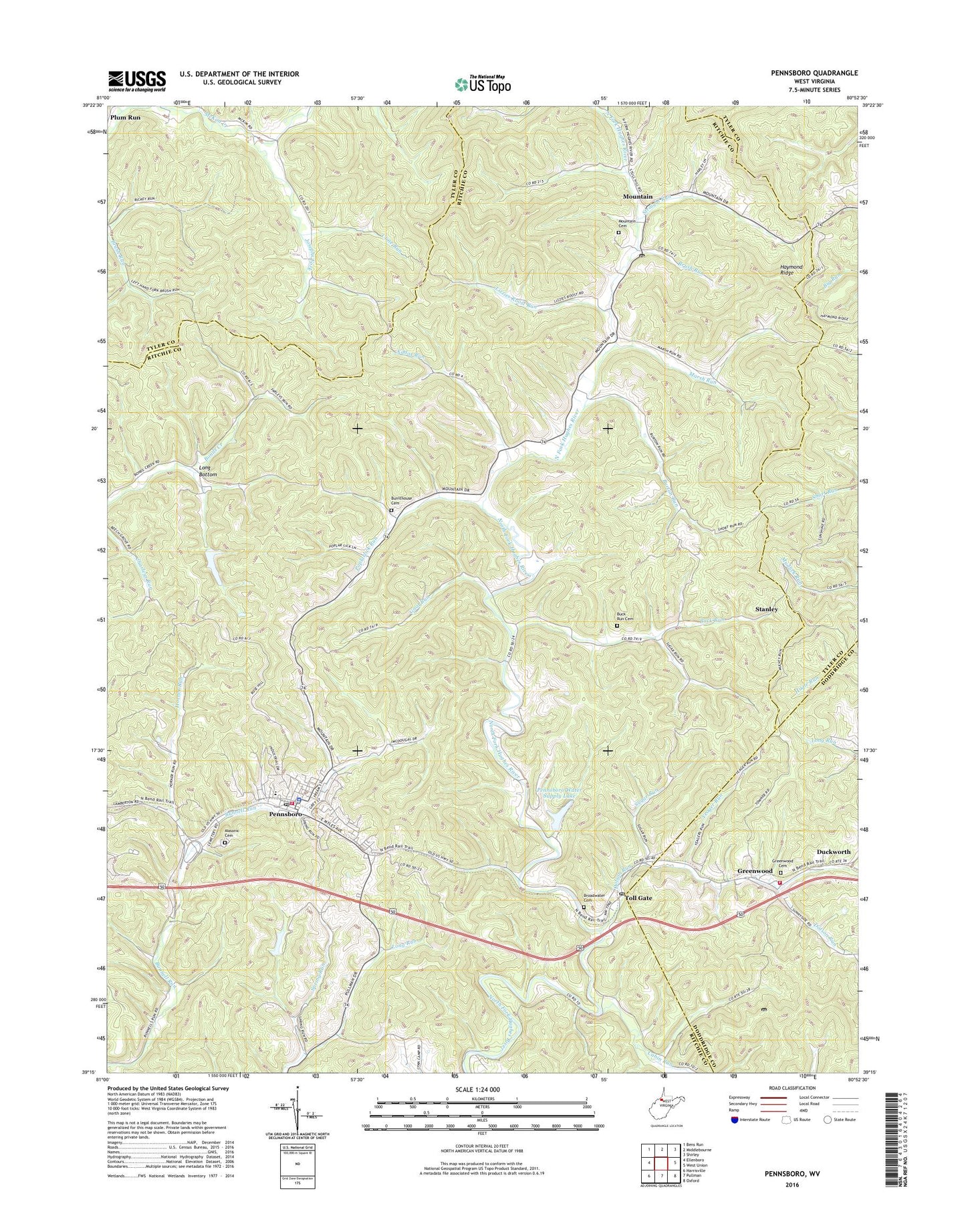
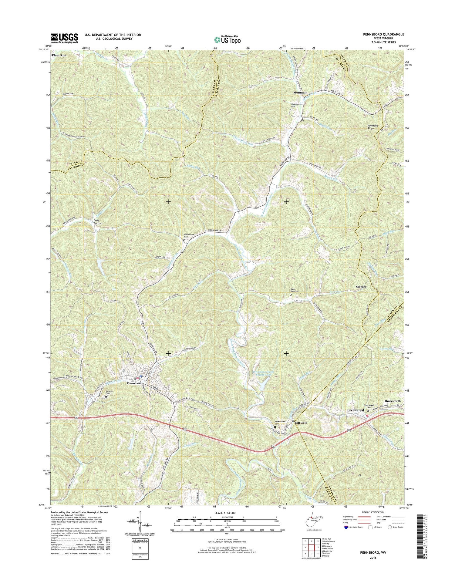
Pennsboro West Virginia US Topo Map
Couldn't load pickup availability
2019 topographic map quadrangle Pennsboro in the state of West Virginia. Scale: 1:24000. Based on the newly updated USGS 7.5' US Topo map series, this map is in the following counties: Ritchie, Tyler, Doddridge. The map contains contour data, water features, and other items you are used to seeing on USGS maps, but also has updated roads and other features. This is the next generation of topographic maps. Printed on high-quality waterproof paper with UV fade-resistant inks.
Quads adjacent to this one:
West: Ellenboro
Northwest: Bens Run
North: Middlebourne
Northeast: Shirley
East: West Union
Southeast: Oxford
South: Pullman
Southwest: Harrisville
Contains the following named places: Bonds Creek Structure One Dam, Broadwater Cemetery, Brush Run, Buck Run, Buck Run Cemetery, Buck Run School, Bunnell Run School, Burnthouse Cemetery, Burton Run, Cabin Run, Charleys Run, Chestnut Grove School, City of Pennsboro, Clay District, Cline Run, Creed Collins Elementary School, Dotson Run, Duckworth, Gnat Run, Gnat Run Church, Greenwood, Greenwood Cemetery, Greenwood Post Office, Greenwood Volunteer Fire Department, Horner Run, Joseph School, Josephs Fork, Lizzies Roost Run, Long Bottom, Long Run, Marsh Run, Masonic Cemetery, Mole Hill Cemetery, Mole Hill Chapel, Mount Vernon School, Mountain, Mountain Post Office, Oak Grove Church, Pennsboro, Pennsboro Police Department, Pennsboro Post Office, Pennsboro Public Library, Pennsboro Volunteer Fire Department, Pennsboro Water Supply Lake, Plum Road School, Plum Run, Poplar Church, Poplarlick Run, Reservoir Run Dam, Ritchie County Ambulance Authority Station 41, Stanley, Straight Run, Sugar Run, Sunshine School, Taylor School, Toll Gate, Toll Gate Post Office, Xddox Run, Yeager Run, ZIP Code: 26415