MyTopo
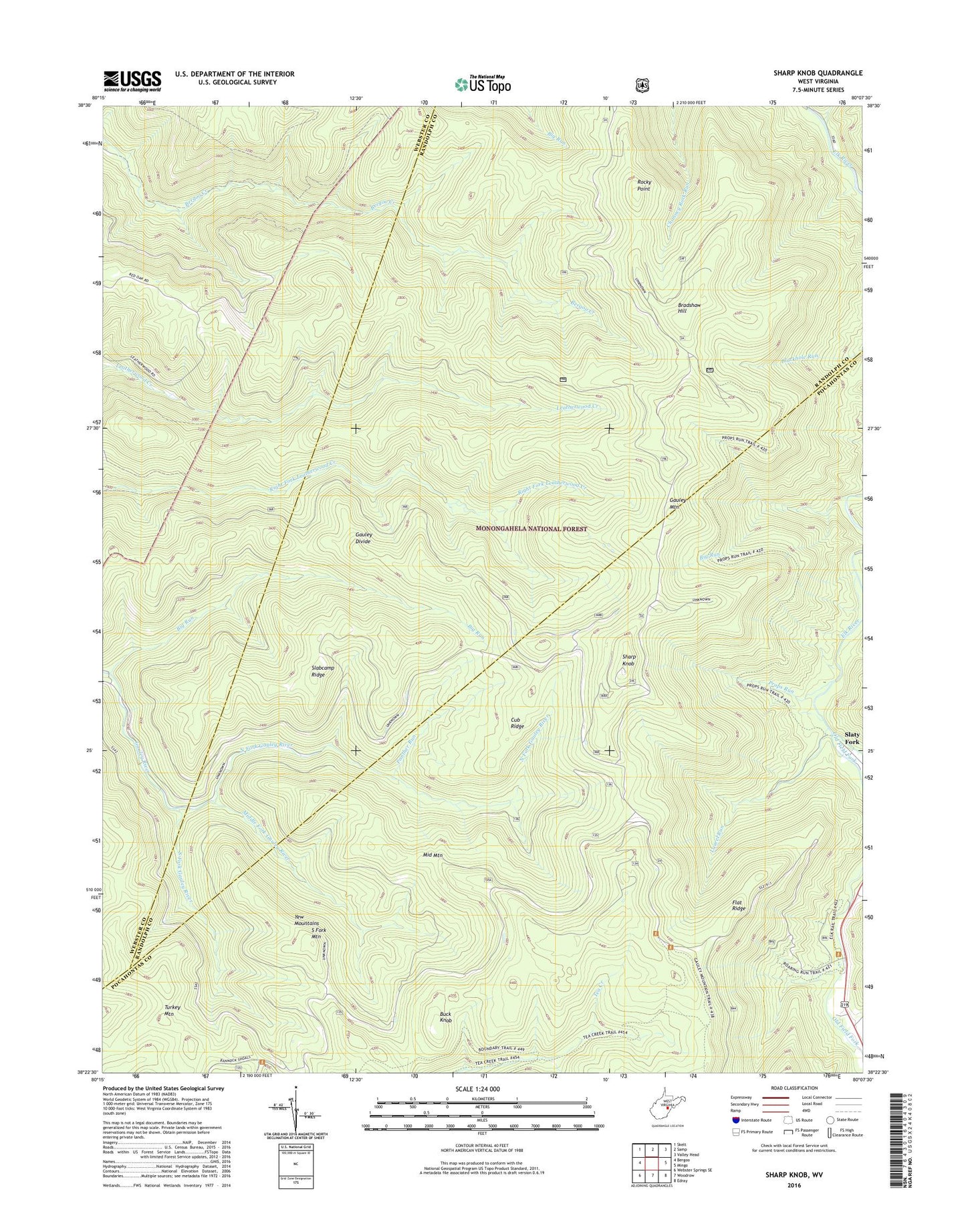
Sharp Knob West Virginia US Topo Map
Couldn't load pickup availability
2019 topographic map quadrangle Sharp Knob in the state of West Virginia. Scale: 1:24000. Based on the newly updated USGS 7.5' US Topo map series, this map is in the following counties: Pocahontas, Randolph, Webster. The map contains contour data, water features, and other items you are used to seeing on USGS maps, but also has updated roads and other features. This is the next generation of topographic maps. Printed on high-quality waterproof paper with UV fade-resistant inks.
Quads adjacent to this one:
West: Bergoo
Northwest: Skelt
North: Samp
Northeast: Valley Head
East: Mingo
Southeast: Edray
South: Woodrow
Southwest: Webster Springs SE
Contains the following named places: Big Run, Big Spring Fork, Bradshaw Hill, Brush Camp Low Place, Buck Knob, Cub Ridge, Flat Ridge, Gauley Divide, Gauley Mountain, Laurel Run, Middle Fork Gauley River, Middle Mountain, North Fork Gauley River, Old Field Fork, Panther Run, Props Run, Rocky Point, Rough Gap Run, Sharp Knob, Sharps Knob Lookout Tower, Slabcamp Ridge, Slaty Fork, South Fork Gauley River, South Fork Mountain, Swacker School, Tea Creek Wildlife Management Area, Three Forks of Gauley, ZIP Code: 26291