MyTopo
Swandale West Virginia US Topo Map
Couldn't load pickup availability
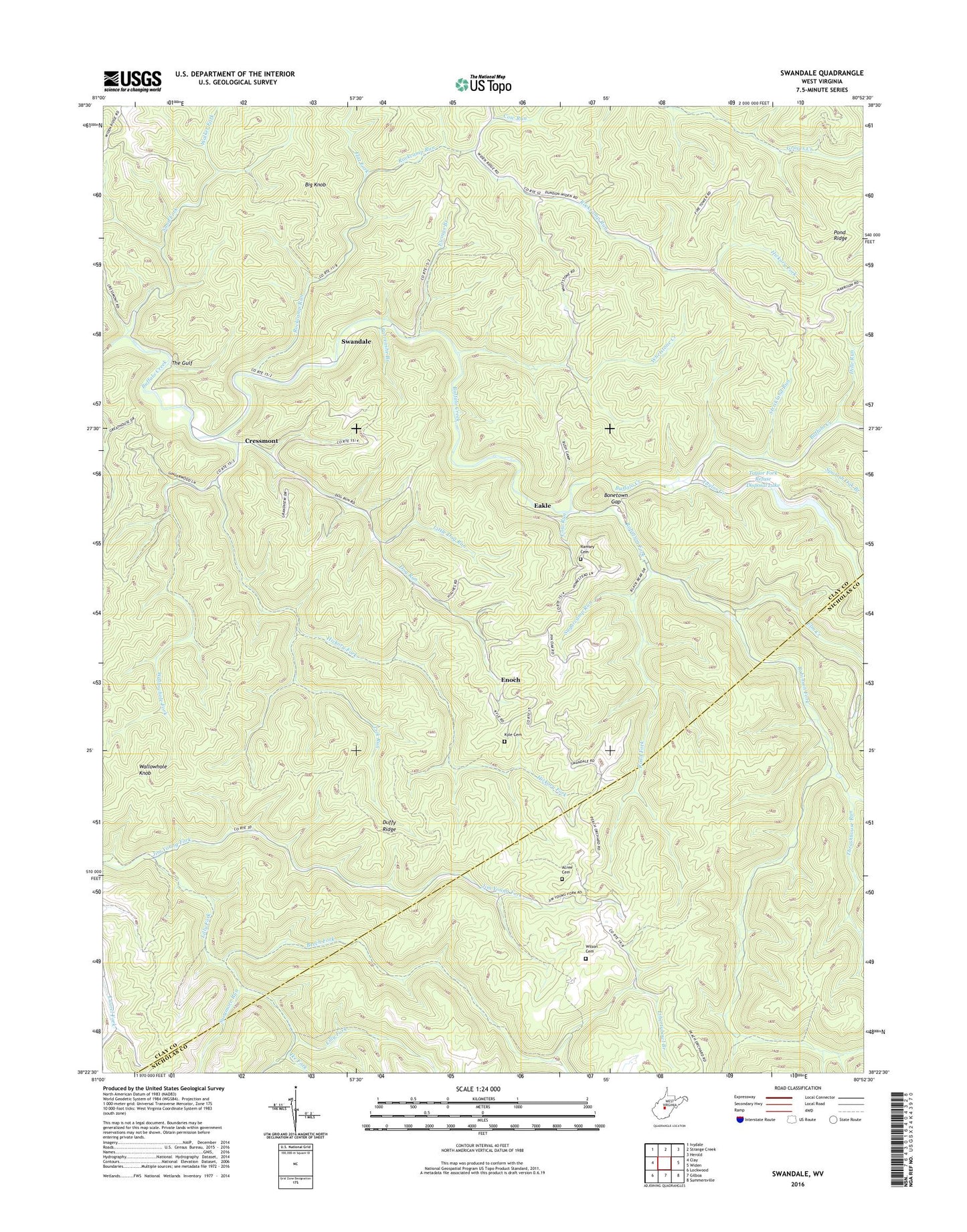
2019 topographic map quadrangle Swandale in the state of West Virginia. Scale: 1:24000. Based on the newly updated USGS 7.5' US Topo map series, this map is in the following counties: Clay, Nicholas. The map contains contour data, water features, and other items you are used to seeing on USGS maps, but also has updated roads and other features. This is the next generation of topographic maps. Printed on high-quality waterproof paper with UV fade-resistant inks.
Quads adjacent to this one:
West: Clay
Northwest: Ivydale
North: Strange Creek
Northeast: Herold
East: Widen
Southeast: Summersville
South: Gilboa
Southwest: Lockwood
Contains the following named places: Acree Cemetery, Adkins Branch, Barrenshe Branch, Beech Fork, Big Knob, Bonetown Gap, Cow Run, Cressmont, Dille Run, Dog Run, Duffy Ridge, Eakle, Elm Creek, Enoch, Enoch Baptist Church, Ewings Branch, Flat Fork, Hickory Fork, Hogpen Run, Ike Fork, Jim Young Fork, Kyle Cemetery, Libertybowl Branch, Lick Run, Little Dog Run, Lostlick Run, Mount Ovis Primitive Baptist Church, New Antioch Baptist Church, Pleasant Dale Missionary Baptist Church, Pond Ridge, Pond Ridge Lookout Tower, Ramsey Cemetery, Ramsey School, Road Fork, Robinson Fork, Rockcamp Run, Sand Fork, Spanish Oak Branch, Strickland Run, Sugarcamp Run, Swandale, Sycamore Run, Taylor Creek, Taylor Fork Refuse Disposal Lake, The Gulf, Thrashhouse Run, Walker Fork, Wallowhole Fork, Wallowhole Knob, Whetstone Creek, Widen-Taylor Fork Dam, Wilson Cemetery, ZIP Code: 25211