MyTopo
Waiteville West Virginia US Topo Map
Couldn't load pickup availability
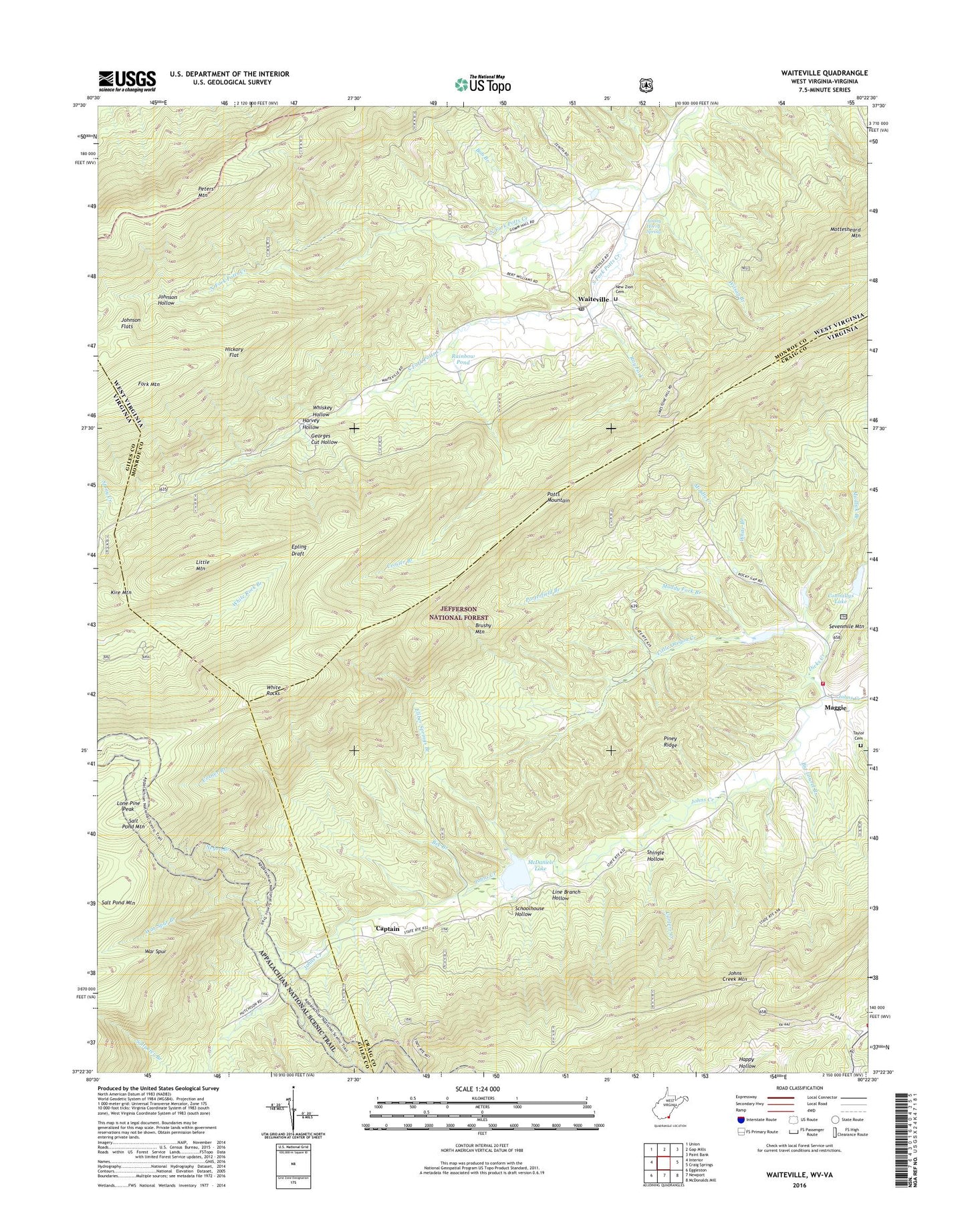
2019 topographic map quadrangle Waiteville in the states of Virginia, West Virginia. Scale: 1:24000. Based on the newly updated USGS 7.5' US Topo map series, this map is in the following counties: Monroe, Craig, Giles. The map contains contour data, water features, and other items you are used to seeing on USGS maps, but also has updated roads and other features. This is the next generation of topographic maps. Printed on high-quality waterproof paper with UV fade-resistant inks.
Quads adjacent to this one:
West: Interior
Northwest: Union
North: Gap Mills
East: Craig Springs
Southeast: McDonalds Mill
South: Newport
Southwest: Eggleston
Contains the following named places: Bee Branch, Big Laurel Branch, Bob Branch, Brushy Mountain, Captain, Connallys Lake, Corner Branch, Crosier Branch, Dicks Creek, Eliber Springs Branch, Fork Mountain, Georges Cut Hollow, Harvey Hollow, Hickory Flat, Jefferson National Forest, Jimmy Horry Spring, Johns Creek Mountain Trail, Johns Creek Number Four Dam, Johns Creek Number One Dam, Johns Creek Number Three Dam, Johns Creek Number Two Dam, Johns Creek Volunteer Fire Department, Johnson Flats, Johnson Hollow, Kire Mountain, Line Branch Hollow, Little Mountain, Little Oregon Creek, Lone Pine Peak, Maggie, McDaniels Lake, Middle Creek, Mountain Lake Wilderness, Muddy Fork Branch, Mudlick Branch, Negro Branch, New Zion Cemetery, New Zion Union Church, North Fork Potts Creek, Piney Ridge, Porterfield Branch, Potts Creek Baptist Church, Potts Creek Wildlife Management Area, Potts Mountain, Rainbow Pond, Ray Fork, Ray Siding, Saltpeter Branch, Schoolhouse Hollow, Shingle Hollow, South Fork Potts Creek, Taylor Cemetery, Virginias Walk Trail, Waiteville, Waiteville Post Office, War Spur Branch, War Spur Connector, War Spur Shelter, War Spur Trail, Whiskey Hollow, White Branch, White Rock Recreation Area, White Rocks, Wilson Branch, ZIP Code: 24984