MyTopo
Amherst Wisconsin US Topo Map
Couldn't load pickup availability
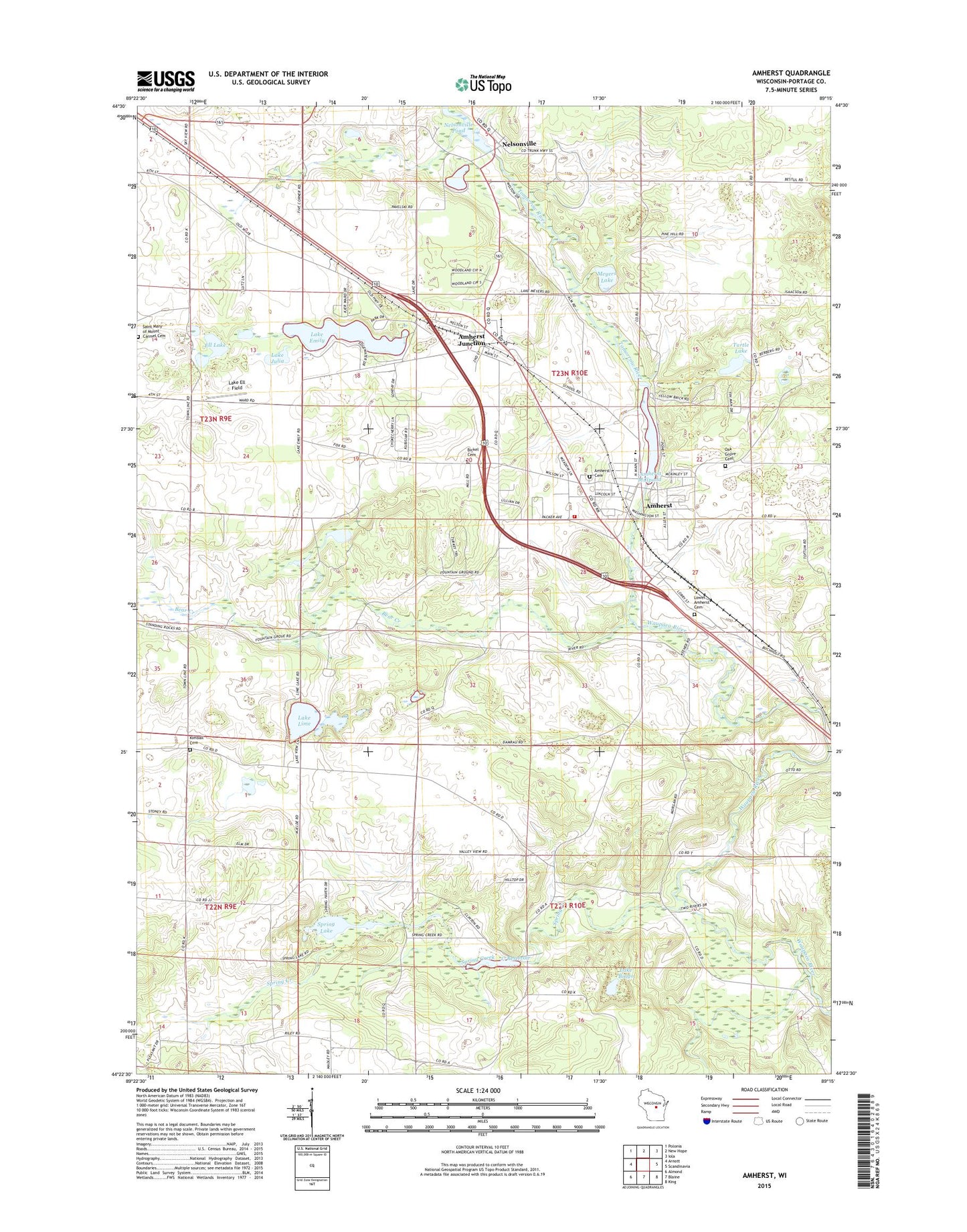
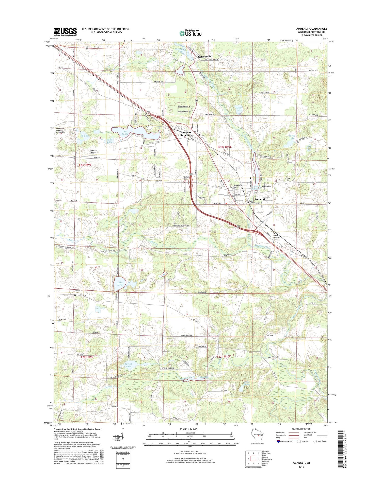
2018 topographic map quadrangle Amherst in the state of Wisconsin. Scale: 1:24000. Based on the newly updated USGS 7.5' US Topo map series, this map is in the following counties: Portage. The map contains contour data, water features, and other items you are used to seeing on USGS maps, but also has updated roads and other features. This is the next generation of topographic maps. Printed on high-quality waterproof paper with UV fade-resistant inks.
Quads adjacent to this one:
West: Arnott
Northwest: Polonia
North: New Hope
Northeast: Iola
East: Scandinavia
Southeast: King
South: Blaine
Southwest: Almond
Contains the following named places: 17 Reservoir, 54406, 54458, Amherst, Amherst Dam, Amherst Elementary School, Amherst Fire District, Amherst High School, Amherst Junction, Amherst Junction Post Office, Amherst Middle School, Amherst Millpond 90, Amherst Post Office, Bear Creek, Bickel Cemetery, Camp Mikquand, Ell Lake, Fancher School, Fountain Grove School, General Irwin School, Greenwood Cemetery, Kimball Cemetery, Lake Bingo, Lake Ell Field, Lake Emily, Lake Julia, Lake Lime, Lower Amherst Cemetery, Meyers Lake, Nelsonville, Nelsonville Dam, Nelsonville Pond, Nelsonville Post Office, Oak Grove Cemetery, Polley School, Saint Mary of Mount Carmel Cemetery, Spring Creek, Spring Creek 3 WR 878 Dam, Spring Lake, Tomorrow River, Town of Amherst, Turtle Lake, Valley View School, Village of Amherst, Village of Amherst Junction, Village of Nelsonville