MyTopo
Argonne Wisconsin US Topo Map
Couldn't load pickup availability
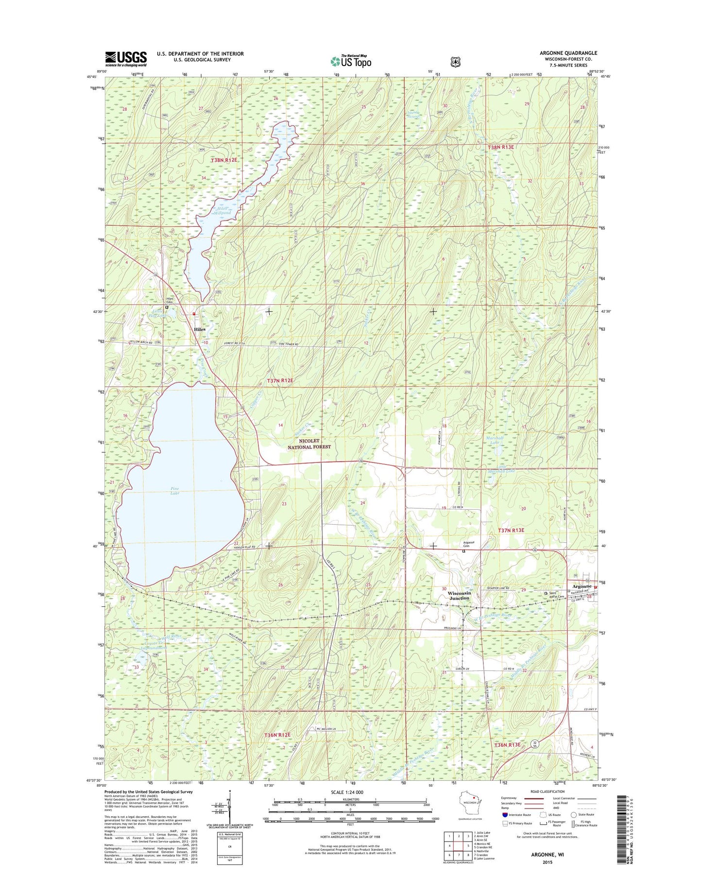
2018 topographic map quadrangle Argonne in the state of Wisconsin. Scale: 1:24000. Based on the newly updated USGS 7.5' US Topo map series, this map is in the following counties: Forest. The map contains contour data, water features, and other items you are used to seeing on USGS maps, but also has updated roads and other features. This is the next generation of topographic maps. Printed on high-quality waterproof paper with UV fade-resistant inks.
Quads adjacent to this one:
West: Monico NE
Northwest: Julia Lake
North: Alvin SW
Northeast: Alvin SE
East: Crandon NE
Southeast: Lake Lucerne
South: Crandon
Southwest: Nashville
Contains the following named places: Argonne, Argonne Cemetery, Argonne Census Designated Place, Argonne Experimental Forest, Argonne Fire Department, Argonne Post Office, Copper Creek, Coyote Creek Impoundment, Forster Muller Lumber Company 1891C238 Dam, Headwaters of Wolf River Point of Interest, Hiles, Hiles Cemetery, Hiles Fire Department - Station 1, Hiles Lookout Tower, Hiles Millpond, Island Swamp, Little Marshall Lake, Little Pine Lake, Marshall Lake, Pine Creek, Pine Lake, Pine Lake Campground, Saint Marys Cemetery, Sucker Creek, West Branch Peshtigo River, Wildcat Creek, Wisconsin Junction