MyTopo
Arkdale Wisconsin US Topo Map
Couldn't load pickup availability
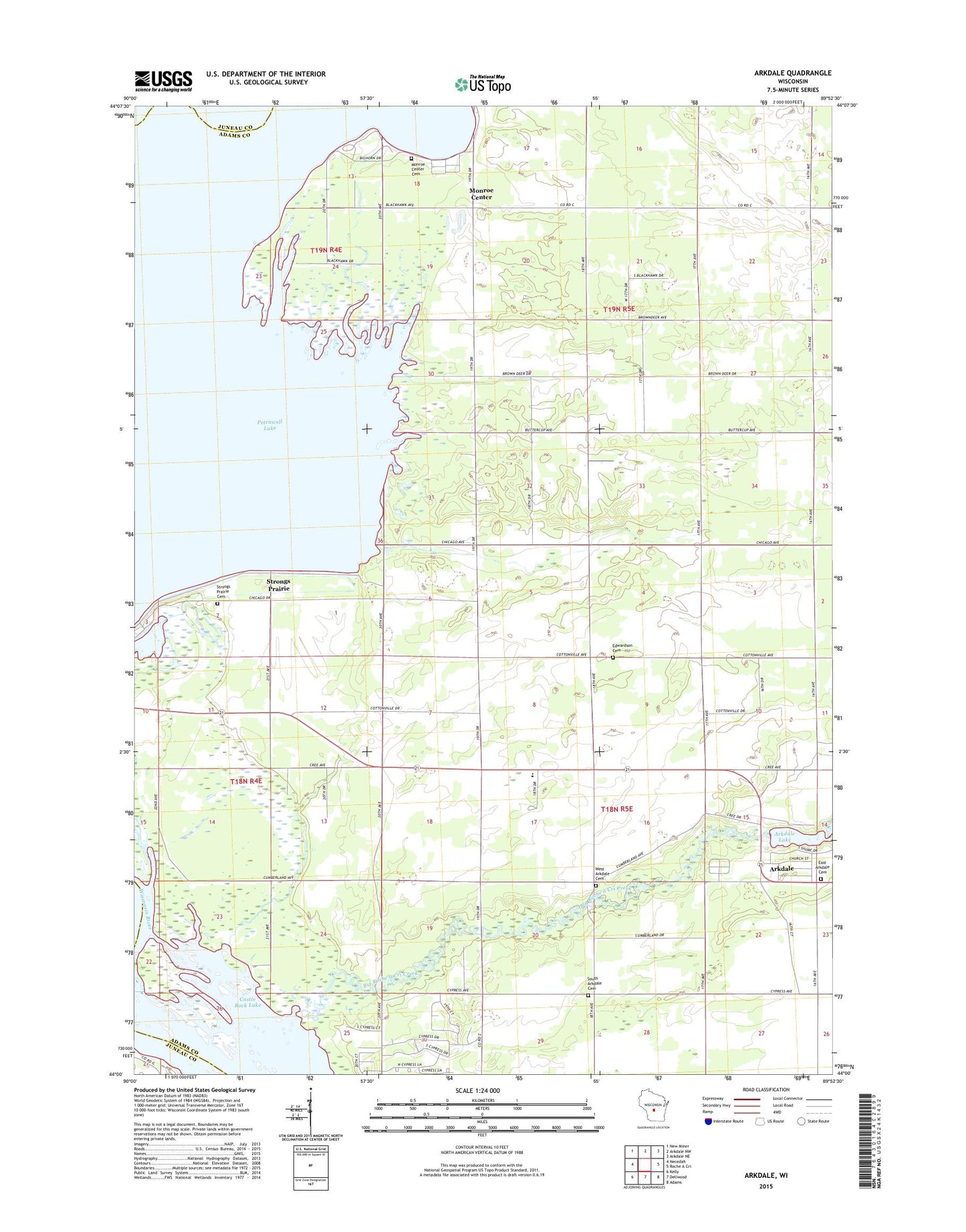
2018 topographic map quadrangle Arkdale in the state of Wisconsin. Scale: 1:24000. Based on the newly updated USGS 7.5' US Topo map series, this map is in the following counties: Adams, Juneau. The map contains contour data, water features, and other items you are used to seeing on USGS maps, but also has updated roads and other features. This is the next generation of topographic maps. Printed on high-quality waterproof paper with UV fade-resistant inks.
Quads adjacent to this one:
West: Necedah
Northwest: New Miner
North: Arkdale NW
Northeast: Arkdale NE
East: Roche A Cri
Southeast: Adams
South: Dellwood
Southwest: Kelly
Contains the following named places: Arkdale, Arkdale 3WR1429 Dam, Arkdale Census Designated Place, Arkdale Lake, Arkdale Post Office, Big Roche a Cri Creek, East Arkdale Cemetery, Edwardson Cemetery, Monroe Cemetery, Monroe Center, Petenwell County Park, Roche-A-Cri Elementary School, South Arkdale Cemetery, Strongs Prairie, Strongs Prairie Cemetery, Town of Monroe, Town of Strongs Prairie, West Arkdale Cemetery, ZIP Code: 54613