MyTopo
Balsam Lake Wisconsin US Topo Map
Couldn't load pickup availability
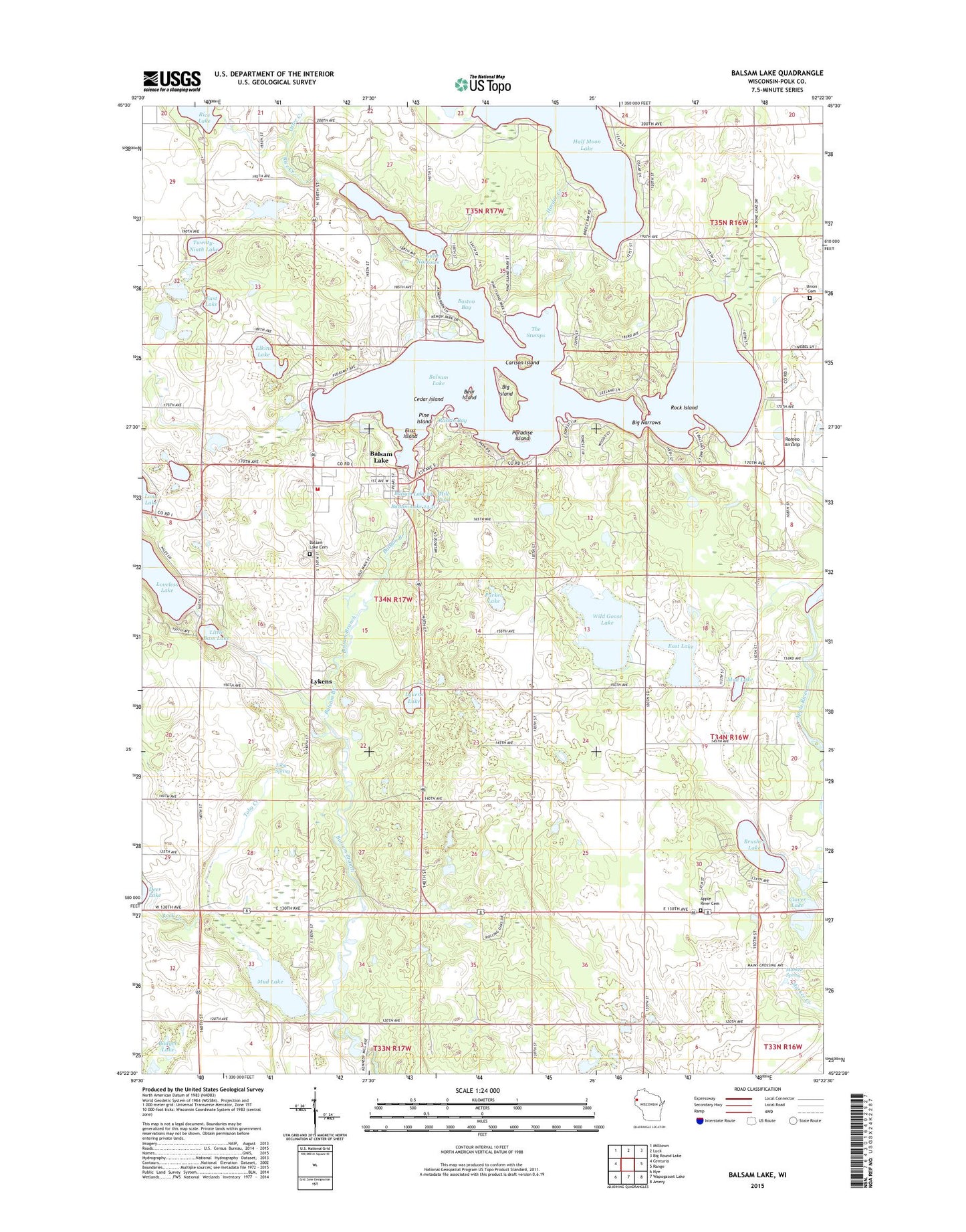
2018 topographic map quadrangle Balsam Lake in the state of Wisconsin. Scale: 1:24000. Based on the newly updated USGS 7.5' US Topo map series, this map is in the following counties: Polk. The map contains contour data, water features, and other items you are used to seeing on USGS maps, but also has updated roads and other features. This is the next generation of topographic maps. Printed on high-quality waterproof paper with UV fade-resistant inks.
Quads adjacent to this one:
West: Centuria
Northwest: Milltown
North: Luck
Northeast: Big Round Lake
East: Range
Southeast: Amery
South: Wapogasset Lake
Southwest: Nye
Contains the following named places: Apple River Cemetery, Badger Lake, Balsam Church, Balsam Lake, Balsam Lake Cemetery, Balsam Lake Police Department, Balsam Lake Post Office, Balsam Lake Volunteer Fire Department, Bear Island, Big Island, Big Narrows, Boston Bay, Brusher Lake, Camp Neibel, Carlson Island, Cedar Island, Clover Lake, Deer Lake School, East Balsam Church, East Balsam School, East Lake, Elkins Lake, First Island, Goose Lake School, Half Moon Lake, Harder Creek, Laurel Lake, Little Bass Lake, Little Narrows, Loveless Lake, Lower Balsam Lake Dam, Lykens, Lykens Lake, Maple Grove School, Markee Spring, Mill Pond, Mud Lake, Otter Creek, Paradise Island, Parker Lake, Pine Grove School, Pine Island, Polk County, Polk County Courthouse, Polk County Jail, Polk County Sheriff's Office, Raskin Bay, Rice Creek, Rock Island, Romeo Airstrip, Shiloh School, The Stumps, Toby Creek, Toby Spring, Town of Balsam Lake, Twenty-Ninth Lake, Union Cemetery, Unity Elementary School, Unity High School, Unity Middle School, Upper Balsam Lake WP92 Dam, Village of Balsam Lake, Wild Goose Lake