
MyTopo
Bayfield Wisconsin US Topo Map
Couldn't load pickup availability
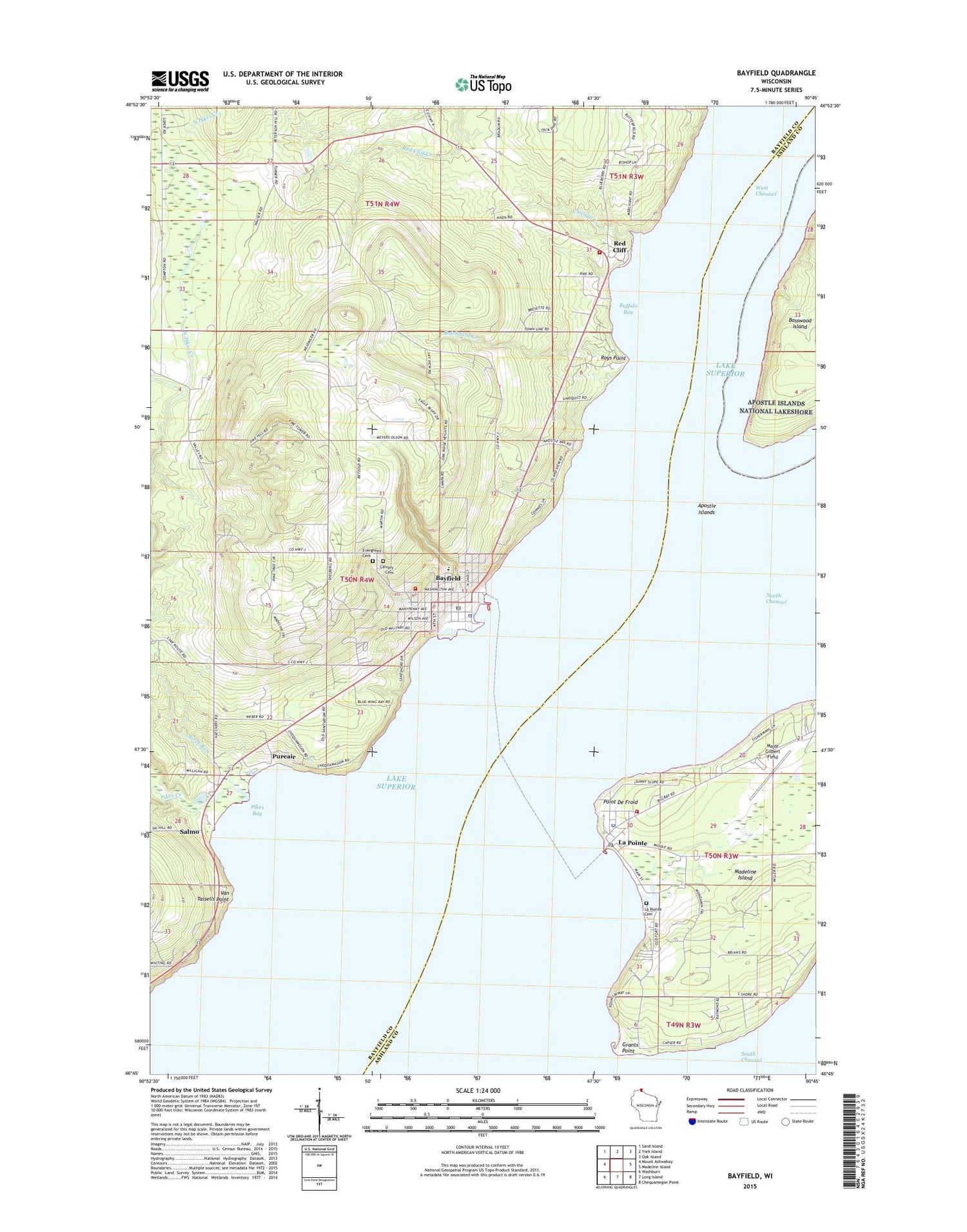
2018 topographic map quadrangle Bayfield in the state of Wisconsin. Scale: 1:24000. Based on the newly updated USGS 7.5' US Topo map series, this map is in the following counties: Bayfield, Ashland. The map contains contour data, water features, and other items you are used to seeing on USGS maps, but also has updated roads and other features. This is the next generation of topographic maps. Printed on high-quality waterproof paper with UV fade-resistant inks.
Quads adjacent to this one:
West: Mount Ashwabay
Northwest: Sand Island
North: York Island
Northeast: Oak Island
East: Madeline Island
Southeast: Chequamegon Point
South: Long Island
Southwest: Washburn
Contains the following named places: Apple Hill Orchard, Bass Island Brownstone Company Quarry, Bayfield, Bayfield Carnegie Library, Bayfield Community Ambulance Service, Bayfield Elementary School, Bayfield High School, Bayfield Historic District, Bayfield Lookout Tower, Bayfield Middle School, Bayfield Police Department, Bayfield Post Office, Bayfield Presbyterian Church, Bayfield State Fish Hatchery, Bayfield Volunteer Fire Department, Bethesda Lutheran Church, Betzold's Orchards, Birch Run, Blue Vista Farm, Brickyard Creek, Buffalo Bay, Calvary Cemetery, Chicago Creek, Christ Episcopal Church, City of Bayfield, Dalrymple Campground, Erickson Orchard, Evergreen Cemetery, Faith Baptist Church, Grants Point, Highland Valley Orchard, Hillcrest Orchard, Holy Family Catholic Church, Holy Family-Saint Francis School, La Pointe, La Pointe Elementary School, La Pointe Indian Cemetery, La Pointe Light, La Pointe Police Department, La Pointe Post Office, La Pointe Volunteer Fire Department, Lakeview Place Shopping Center, Madeline Island Ambulance, Madeline Island Golf Club, Madeline Island Historical Museum, Madeline Island Public Library, Madeline Island Yacht Club, Major Gilbert Field, Middleport, Ojibwa Memorial Park, Old Bayfield County Courthouse, Old Fort, Pikes Bay, Pikes Creek, Point De Froid, Pureair, Pureair Sanitorium, Rabideaux Orchard, Red Cliff, Red Cliff Police Department, Red Cliff Tribal Ambulance, Red Cliff Tribal Fire Department, Roys Point, Saint Francis Catholic Church, Saint Johns United Church of Christ, Saint Joseph Cemetery, Saint Josephs Catholic Church, Salmo, Sunset Valley Orchard, Superior View Farm, Torbick Orchard, Valley View Orchard, Van Tassells Point, Weber Orchard, West Channel


