MyTopo
Big Round Lake Wisconsin US Topo Map
Couldn't load pickup availability
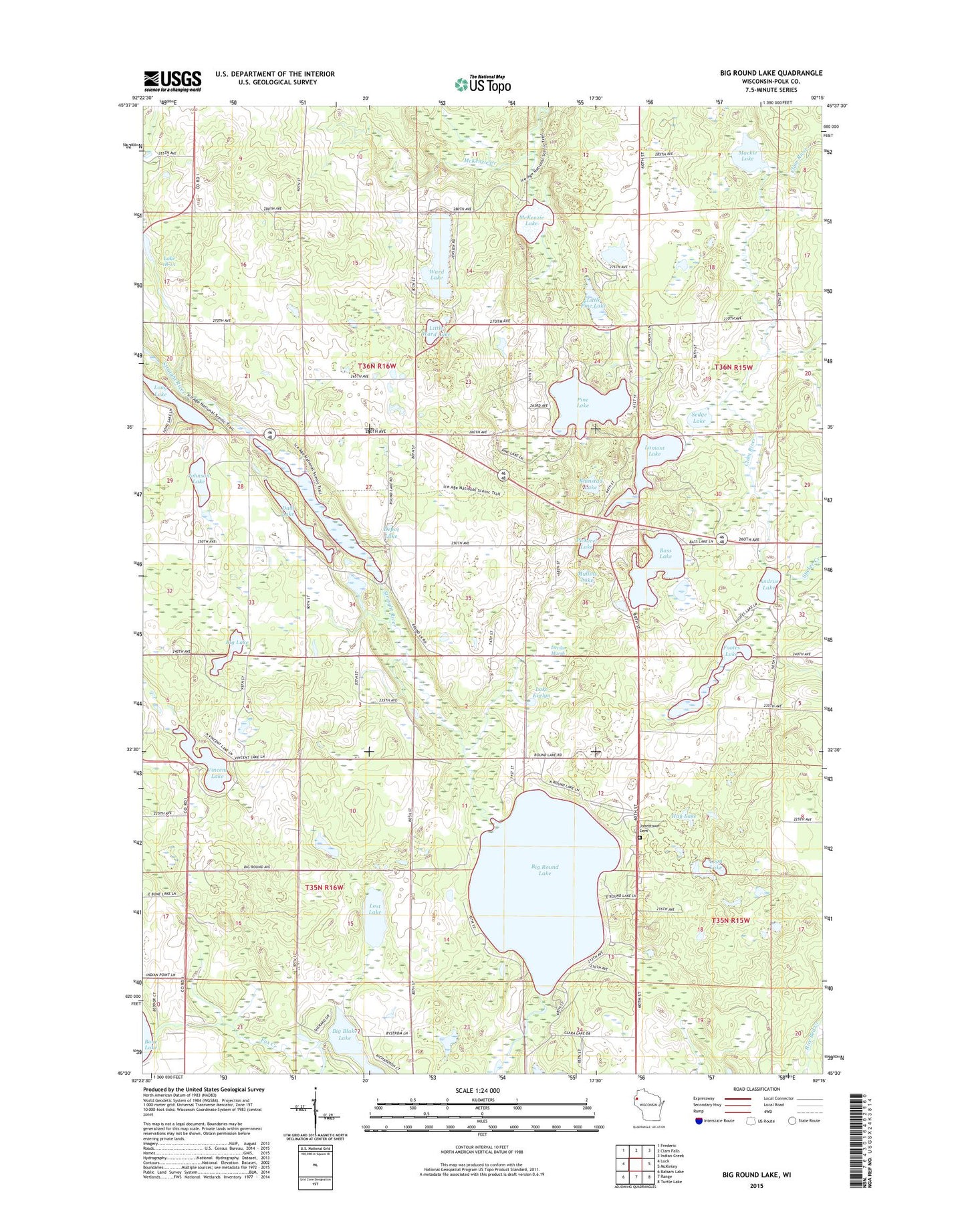
2018 topographic map quadrangle Big Round Lake in the state of Wisconsin. Scale: 1:24000. Based on the newly updated USGS 7.5' US Topo map series, this map is in the following counties: Polk. The map contains contour data, water features, and other items you are used to seeing on USGS maps, but also has updated roads and other features. This is the next generation of topographic maps. Printed on high-quality waterproof paper with UV fade-resistant inks.
Quads adjacent to this one:
West: Luck
Northwest: Frederic
North: Clam Falls
Northeast: Indian Creek
East: McKinley
Southeast: Turtle Lake
South: Range
Southwest: Balsam Lake
Contains the following named places: Andrus Lake, Bass Lake, Big Lake, Big Round Lake, Cragwood Corporation Number 2 H810 Dam, Dahl Lake, Depot Lake, Devils Marsh, Footes Lake, Hay Lake, Holst School, Johnson Lake, Johnstown Cemetery, LaFollette School, Lake 18-1 1, Lake Evelyn, Lamont Lake, Little Pine Lake, Little Ward Lake, Long Lake, Loon Lake, Lost Lake, Mackie Lake, McKenzie Lake, Mullins Lake, Pickerel Lake, Pine Lake, Rhinstad Lake, Round Lake Chapel, Saint Croix Reservation, Saint Paul Church, Sedge Lake, Straight River, Sucker Creek, Town of Bone Lake, Town of Georgetown, Vincent Lake, Ward Lake, Zion Church