MyTopo
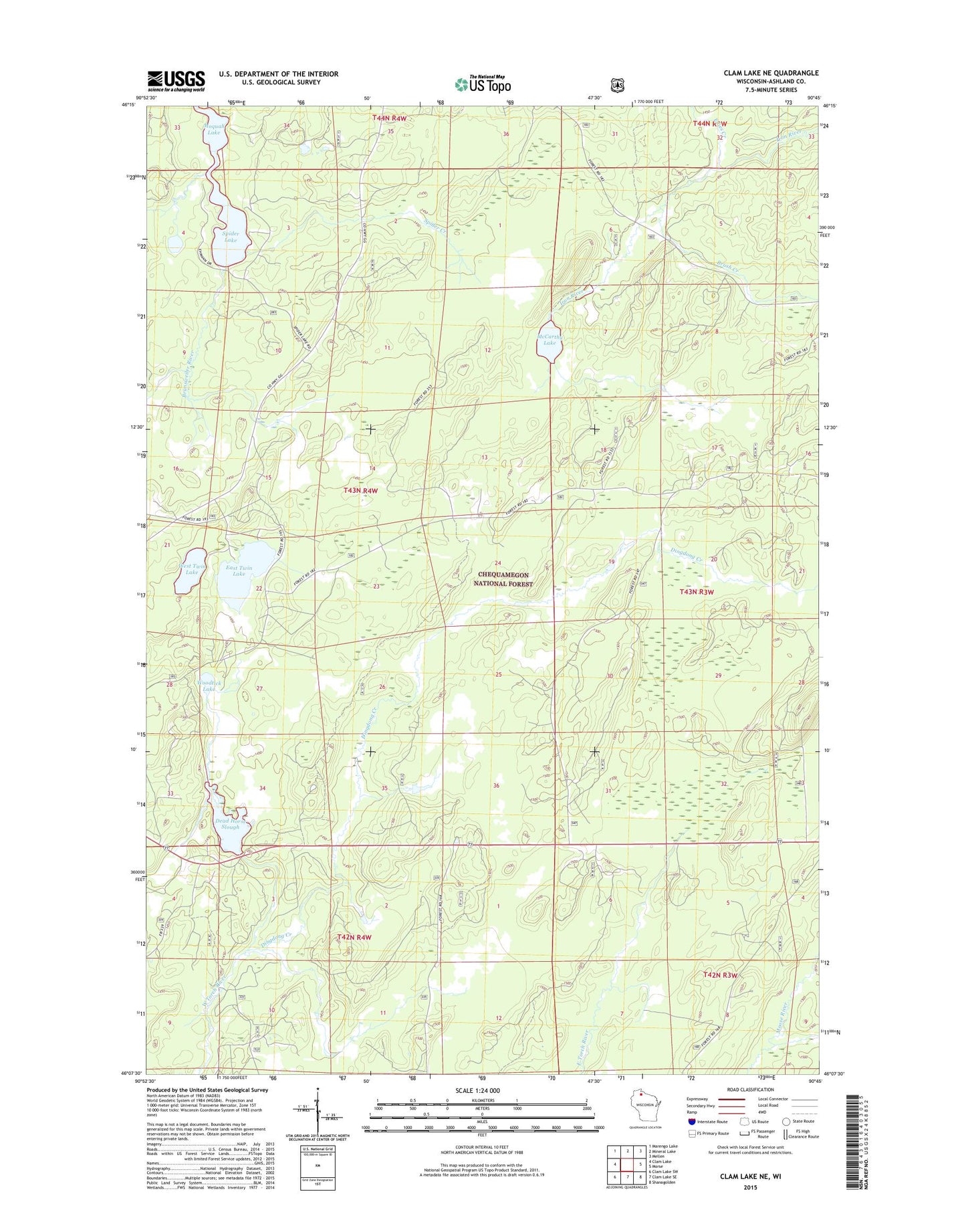
Clam Lake NE Wisconsin US Topo Map
Couldn't load pickup availability
2018 topographic map quadrangle Clam Lake NE in the state of Wisconsin. Scale: 1:24000. Based on the newly updated USGS 7.5' US Topo map series, this map is in the following counties: Ashland. The map contains contour data, water features, and other items you are used to seeing on USGS maps, but also has updated roads and other features. This is the next generation of topographic maps. Printed on high-quality waterproof paper with UV fade-resistant inks.
Quads adjacent to this one:
West: Clam Lake
Northwest: Marengo Lake
North: Mineral Lake
Northeast: Mellen
East: Morse
Southeast: Shanagolden
South: Clam Lake SE
Southwest: Clam Lake SW
Contains the following named places: Brush Creek, Clam Lake Civilian Conservation Corps Camp, Dead Horse Slough, Dingdong Creek, East Twin Lake, East Twin Lake Campground, Edies Creek, Great Divide Snowmobile Trail, McCarthy Lake, McCarthy Lake And Cedars State Natural Area, Moquah Lake, Spider Creek, Spider Lake, West Twin Lake, Woodtick Lake