MyTopo
Cushing Wisconsin US Topo Map
Couldn't load pickup availability
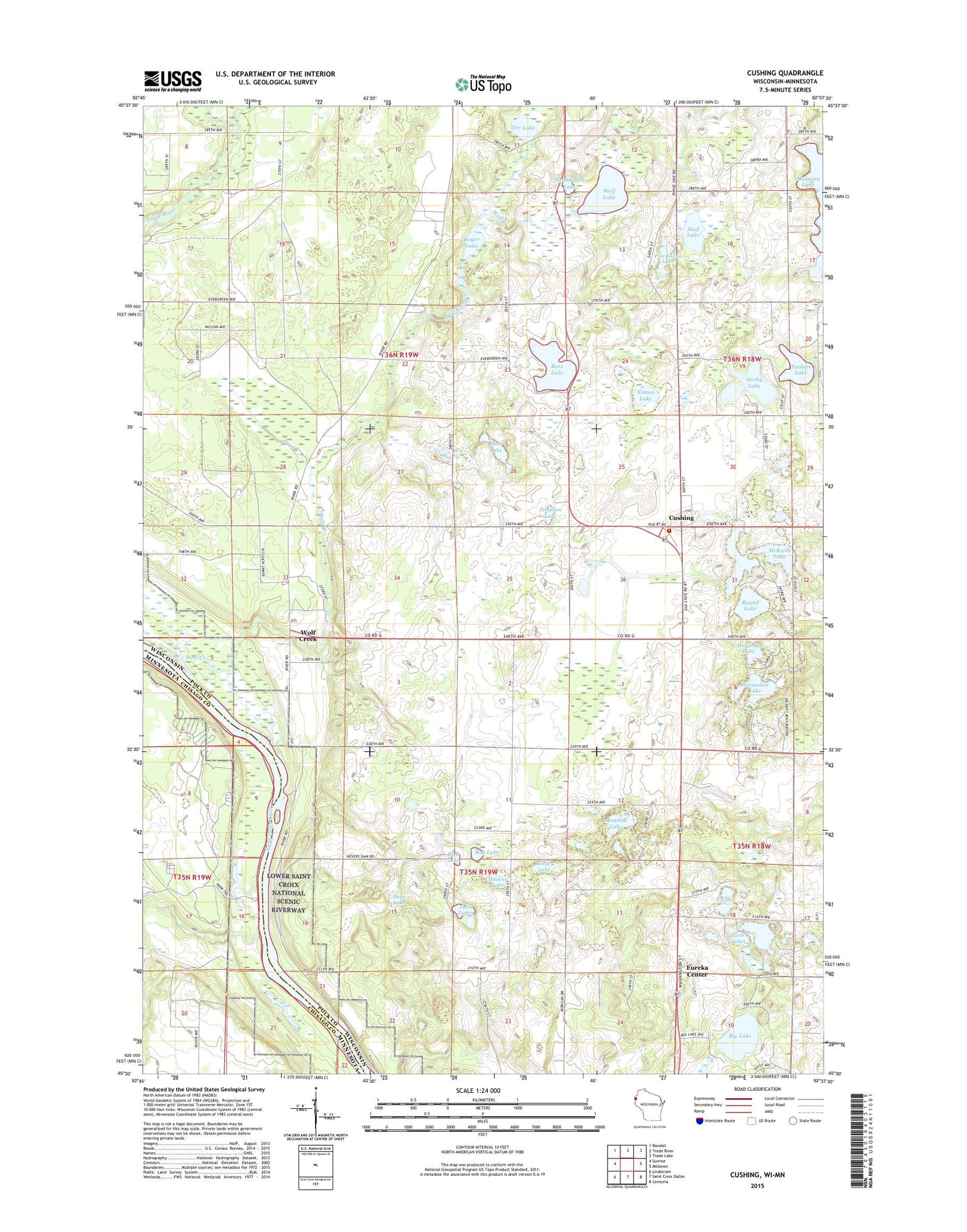
2019 topographic map quadrangle Cushing in the states of Wisconsin, Minnesota. Scale: 1:24000. Based on the newly updated USGS 7.5' US Topo map series, this map is in the following counties: Polk, Chisago. The map contains contour data, water features, and other items you are used to seeing on USGS maps, but also has updated roads and other features. This is the next generation of topographic maps. Printed on high-quality waterproof paper with UV fade-resistant inks.
Quads adjacent to this one:
West: Sunrise
Northwest: Randall
North: Trade River
Northeast: Trade Lake
East: Milltown
Southeast: Centuria
South: Saint Croix Dalles
Southwest: Lindstrom
Contains the following named places: Amiks Pond, Bass Lake, Bass Lake School, Big Lake, Bog Lake, Cushing, Cushing Post Office, Cushing Rural Fire Department, Cushing School, Deer Creek, Deer Lake, Dry Creek, Eureka Center, Grandquist Lake, Herby Lake, Hoover Lake, Horseshoe Lake, Knife Lake, L Horseshoe Lake, Little Horseshoe Lake, Manitou Lake, Manitou Lake School, McKeith Lake, Mud Lake, Nevers Dam, Nimon Lake, Orr Lake, Orr School, Pine Island Lake, Rice Lake, Roger Lake, Round Lake, Simpson Lake, Sterling Townhall, T Lake, Tarbert Lake, Twin Lakes, Wolf Creek, Wolf Lake, ZIP Codes: 54006, 54024