
MyTopo
Diamond Lake Wisconsin US Topo Map
Couldn't load pickup availability
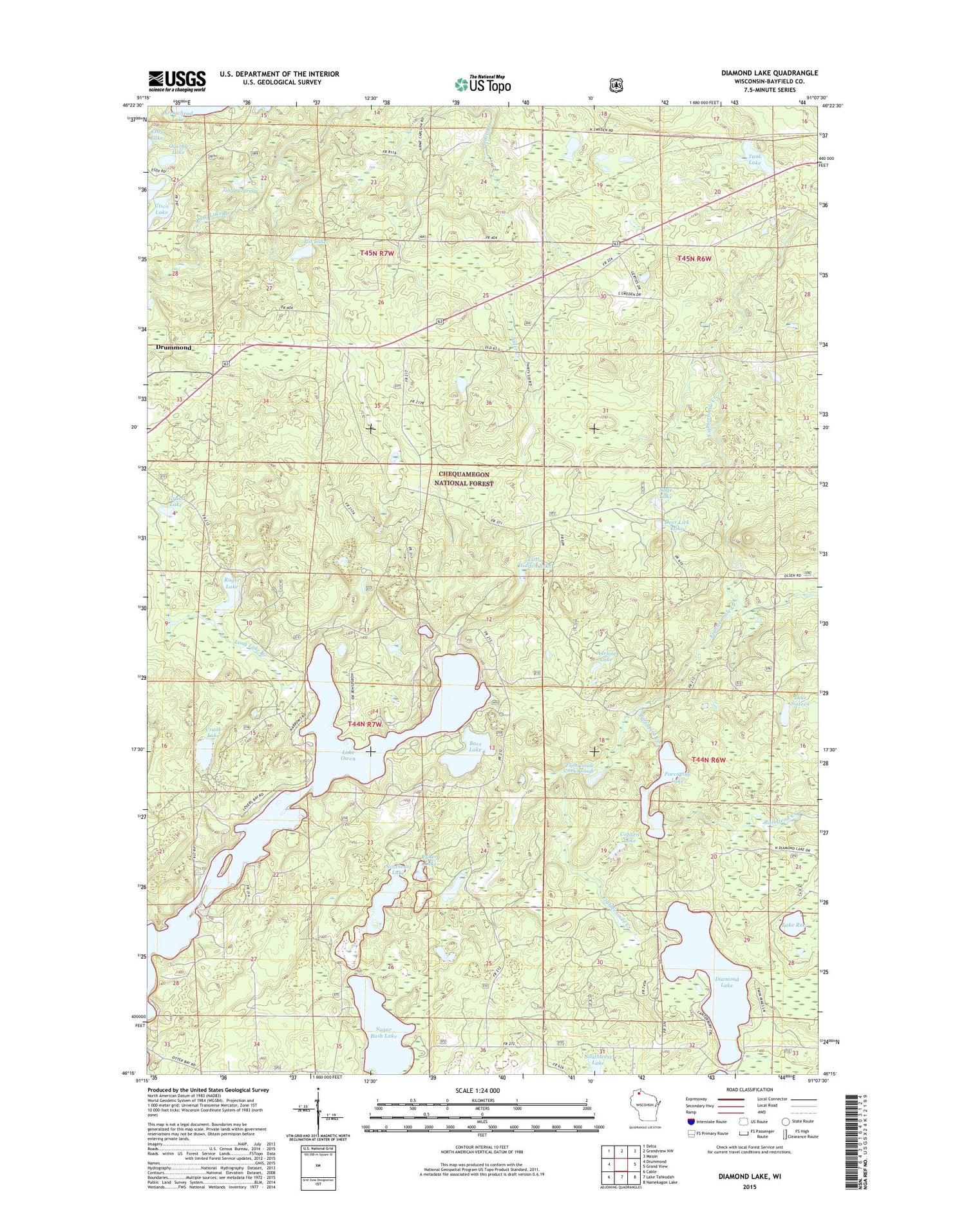
2018 topographic map quadrangle Diamond Lake in the state of Wisconsin. Scale: 1:24000. Based on the newly updated USGS 7.5' US Topo map series, this map is in the following counties: Bayfield. The map contains contour data, water features, and other items you are used to seeing on USGS maps, but also has updated roads and other features. This is the next generation of topographic maps. Printed on high-quality waterproof paper with UV fade-resistant inks.
Quads adjacent to this one:
West: Drummond
Northwest: Delta
North: Grandview NW
Northeast: Mason
East: Grand View
Southeast: Namekagon Lake
South: Lake Tahkodah
Southwest: Cable
Contains the following named places: Adeline Lake, Bass Lake, Coburn Lake, Crane Lake, Deer Lick Lake, Diamond Lake, Drummond Census Designated Place, Eighteenmile Creek Springs, Grass Lake, Johnson Spring Flowage 1, Johnson Springs, Johnson Springs 3WR211 Dam, Lake Owen, Lake Owen Dam, Lake Owen Outlet Picnic Area, Lake Owen Picnic Area, Lake Owen Summer Homes Group, Lake Ree, Lake Sixteen, Little Hidden Lake, North Country Trail, Northeast Lake, Overby Lake, Porcupine Creek, Porcupine Lake, Porcupine Lake Wilderness, Pot Lake, Ramstead Creek, Roger Lake, Ryberg Lake, Sage Lake, Sugar Bush Lake, Tank Lake, Two Lakes Campground, Virgin Pine Trail, ZIP Code: 54839


