MyTopo
Germania Wisconsin US Topo Map
Couldn't load pickup availability
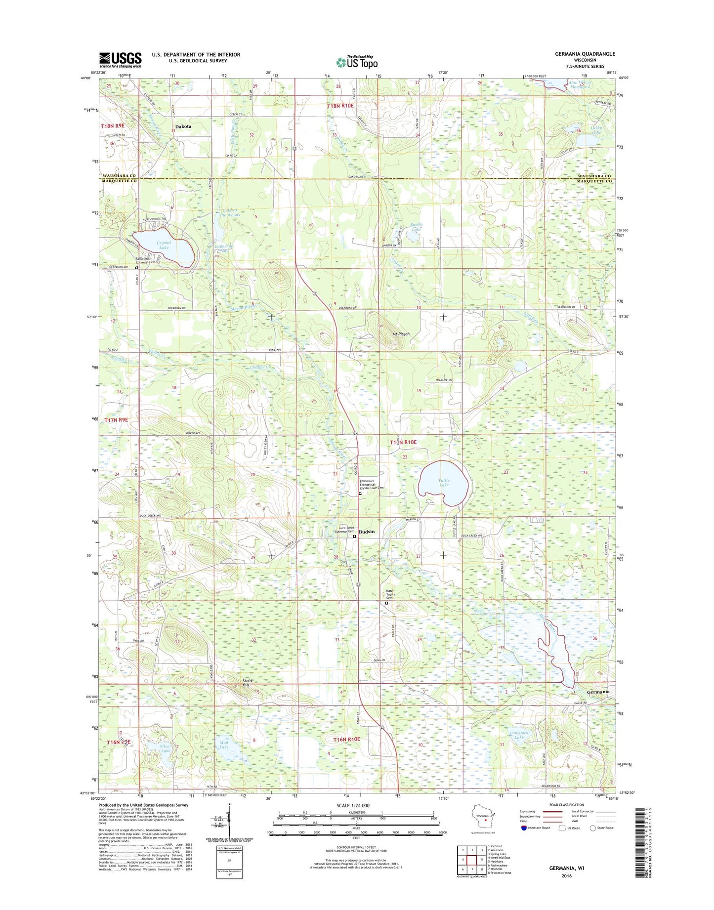
2018 topographic map quadrangle Germania in the state of Wisconsin. Scale: 1:24000. Based on the newly updated USGS 7.5' US Topo map series, this map is in the following counties: Marquette, Waushara. The map contains contour data, water features, and other items you are used to seeing on USGS maps, but also has updated roads and other features. This is the next generation of topographic maps. Printed on high-quality waterproof paper with UV fade-resistant inks.
Quads adjacent to this one:
West: Westfield East
Northwest: Richford
North: Wautoma
Northeast: Spring Lake
East: Neshkoro
Southeast: Princeton West
South: Montello
Southwest: Packwaukee
Contains the following named places: 155 Reservoir, Budsin, Chaffee Creek, Comstock Bog-Meadow State Natural Area, Comstock Lake, Crystal Lake, Dakota, Emmanuel Evangelical Crystal Lake Cemetery, Germania, Germania 2wp1344 Dam, Germania Marsh State Wildlife Area, Germania Wet Prairie State Natural Area, Lake of the Woods, Lang G 781.4 Dam, Little Pine Creek, Little Pine Pond 20, Lucky Lake, Matz Tagatz Cemetery, Mount Pisgah, Mud Lake, Needham Pond, Saint Johns Church, Saint Johns Lutheran Cemetery, Saint Paul Lutheran Cemetery, Sandy Lake, Silver Lake, Stone Church, Stone Hill, Town of Crystal Lake, Tuttle Lake, United Brethren Church, Wedde Creek, Wilcox E1423 Dam, Wilcox G2982 Dam