MyTopo
High Bridge Wisconsin US Topo Map
Couldn't load pickup availability
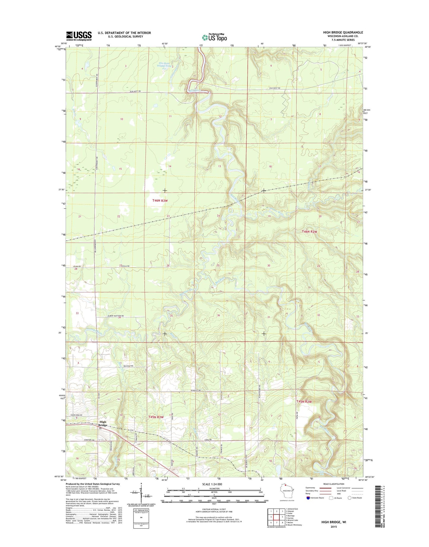
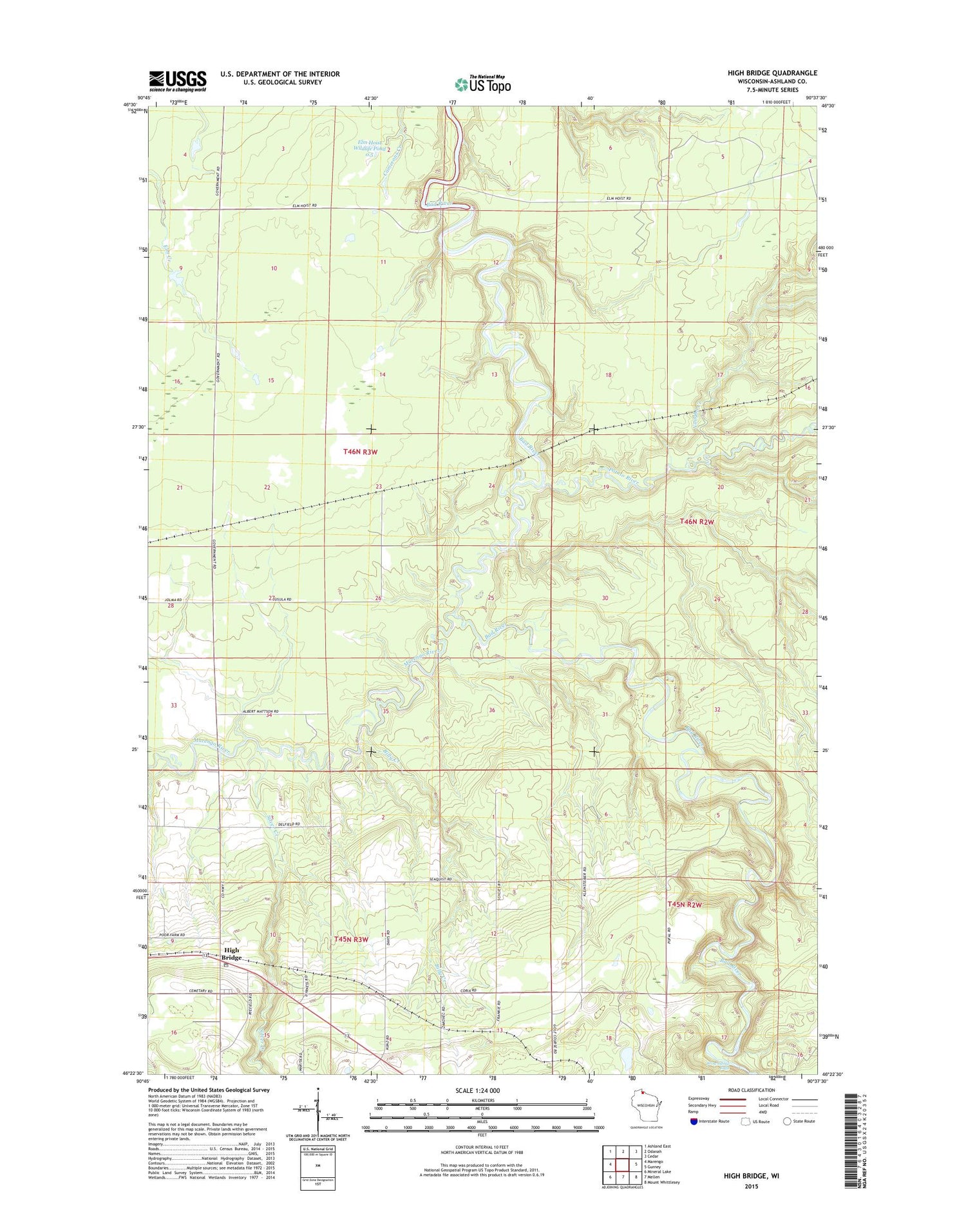
2018 topographic map quadrangle High Bridge in the state of Wisconsin. Scale: 1:24000. Based on the newly updated USGS 7.5' US Topo map series, this map is in the following counties: Ashland. The map contains contour data, water features, and other items you are used to seeing on USGS maps, but also has updated roads and other features. This is the next generation of topographic maps. Printed on high-quality waterproof paper with UV fade-resistant inks.
Quads adjacent to this one:
West: Marengo
Northwest: Ashland East
North: Odanah
Northeast: Cedar
East: Gurney
Southeast: Mount Whittlesey
South: Mellen
Southwest: Mineral Lake
Contains the following named places: Billy Creek, Brownstone Falls, Copper Falls State Natural Area, Elm Hoist Wildlife G963 9 Dam, Elm Hoist Wildlife Pond 0.5, High Bridge, High Bridge Post Office, Jolmaville Census Designated Place, Marengo River, Potato River, Silver Creek, Town of Ashland, Tyler Forks, Vaughn Creek, ZIP Code: 54846