MyTopo
Kalinke Wisconsin US Topo Map
Couldn't load pickup availability
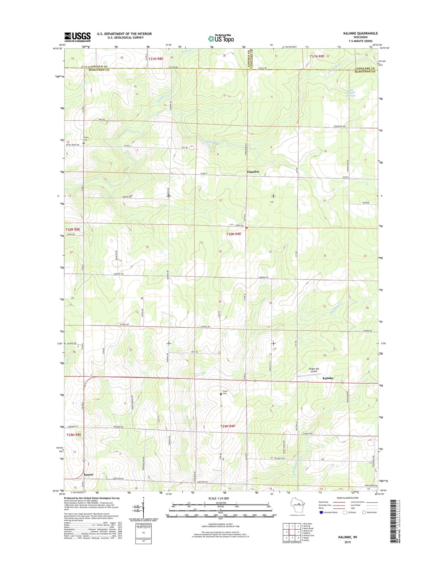
2018 topographic map quadrangle Kalinke in the state of Wisconsin. Scale: 1:24000. Based on the newly updated USGS 7.5' US Topo map series, this map is in the following counties: Marathon, Lincoln, Langlade. The map contains contour data, water features, and other items you are used to seeing on USGS maps, but also has updated roads and other features. This is the next generation of topographic maps. Printed on high-quality waterproof paper with UV fade-resistant inks.
Quads adjacent to this one:
West: Nutterville
Northwest: Pine Dells
North: Doering
Northeast: Black Brook
East: Hogarty
Southeast: Hatley
South: Ringle
Southwest: Wausau East
Contains the following named places: Blue Ridge Dairy, Calvary Cemetery, Deffner Farms, Farrell School, Glandon, Hewitt - Texas Elementary School, Hewitt Townhall, Hewitt Township Volunteer Fire Department, Kalinke, Knight Sky Airport, Little Nienow Flowage, McMynn School, Motl 1 G12 121 Dam, Prospect Creek, Skunk Creek, Spring Hill Farm, Sunrise School, Sunset, Town of Hewitt, Trappe River School, Trinity Church, WYCO-FM (Wausau), Zion Cemetery, Zion Church