
MyTopo
Long Lake Wisconsin US Topo Map
Couldn't load pickup availability
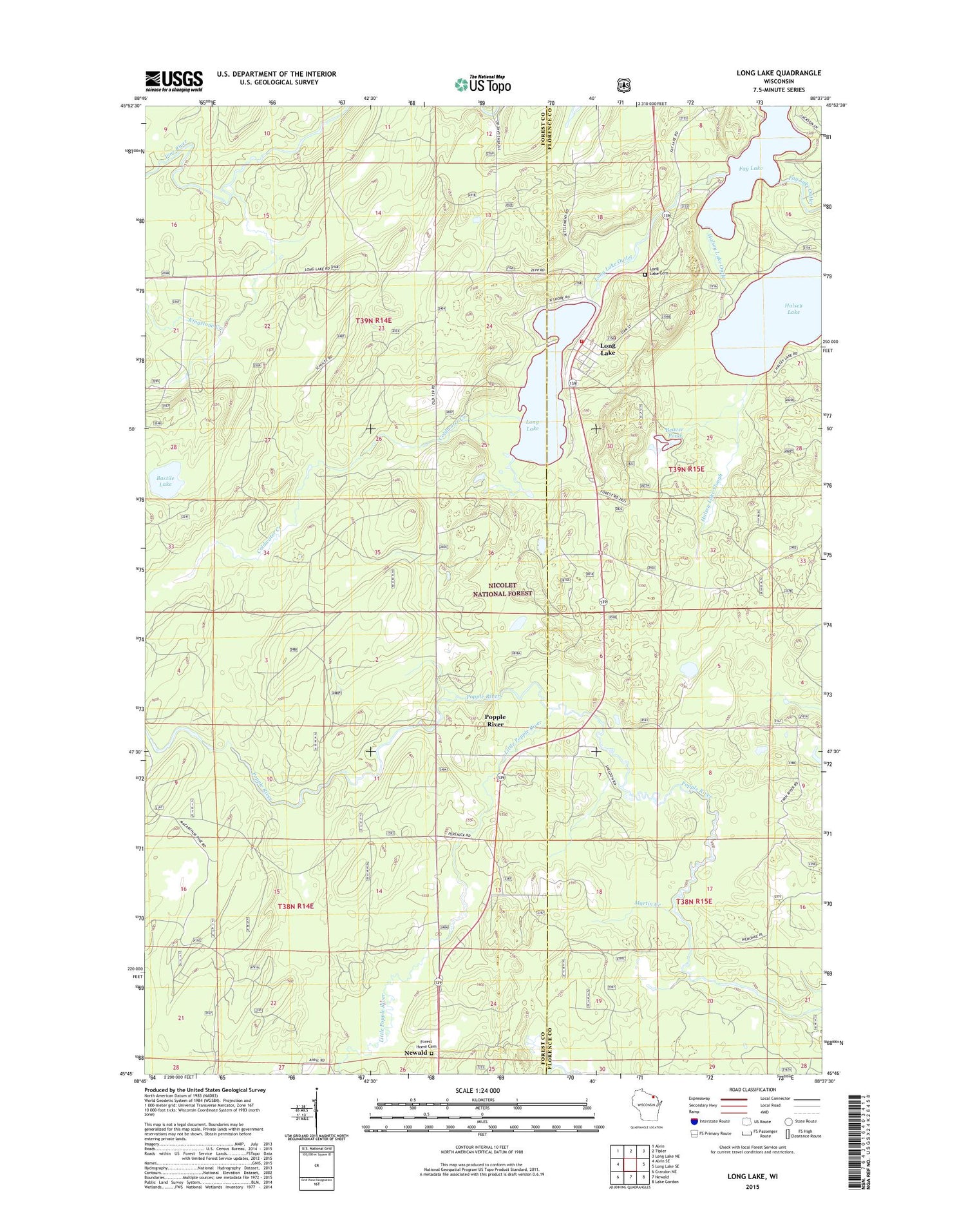
2018 topographic map quadrangle Long Lake in the state of Wisconsin. Scale: 1:24000. Based on the newly updated USGS 7.5' US Topo map series, this map is in the following counties: Forest, Florence. The map contains contour data, water features, and other items you are used to seeing on USGS maps, but also has updated roads and other features. This is the next generation of topographic maps. Printed on high-quality waterproof paper with UV fade-resistant inks.
Quads adjacent to this one:
West: Alvin SE
Northwest: Alvin
North: Tipler
Northeast: Long Lake NE
East: Long Lake SE
Southeast: Lake Gordon
South: Newald
Southwest: Crandon NE
Contains the following named places: Bastile Lake, Bastile Lake State Natural Area, Beaver Pond, Brice Spur, Coldwater Creek, Fay Lake, Forest Home Cemetery, Halsey Lake, Halsey Lake Outlet, Halsey Lake Slough, Kingstone Creek, Little Popple River, Long Lake, Long Lake Cemetery, Long Lake Census Designated Place, Long Lake Civilian Conservation Corps Camp, Long Lake Lookout Lower, Long Lake Outlet, Long Lake Post Office, Long Lake Volunteer Fire Department, Martin Creek, Moore and Montambo Spur, North School, Peterson Spur, Popple River, Popple River Townhall, Quinlan Spur, South School, Town of Popple River


