MyTopo
Luck Wisconsin US Topo Map
Couldn't load pickup availability
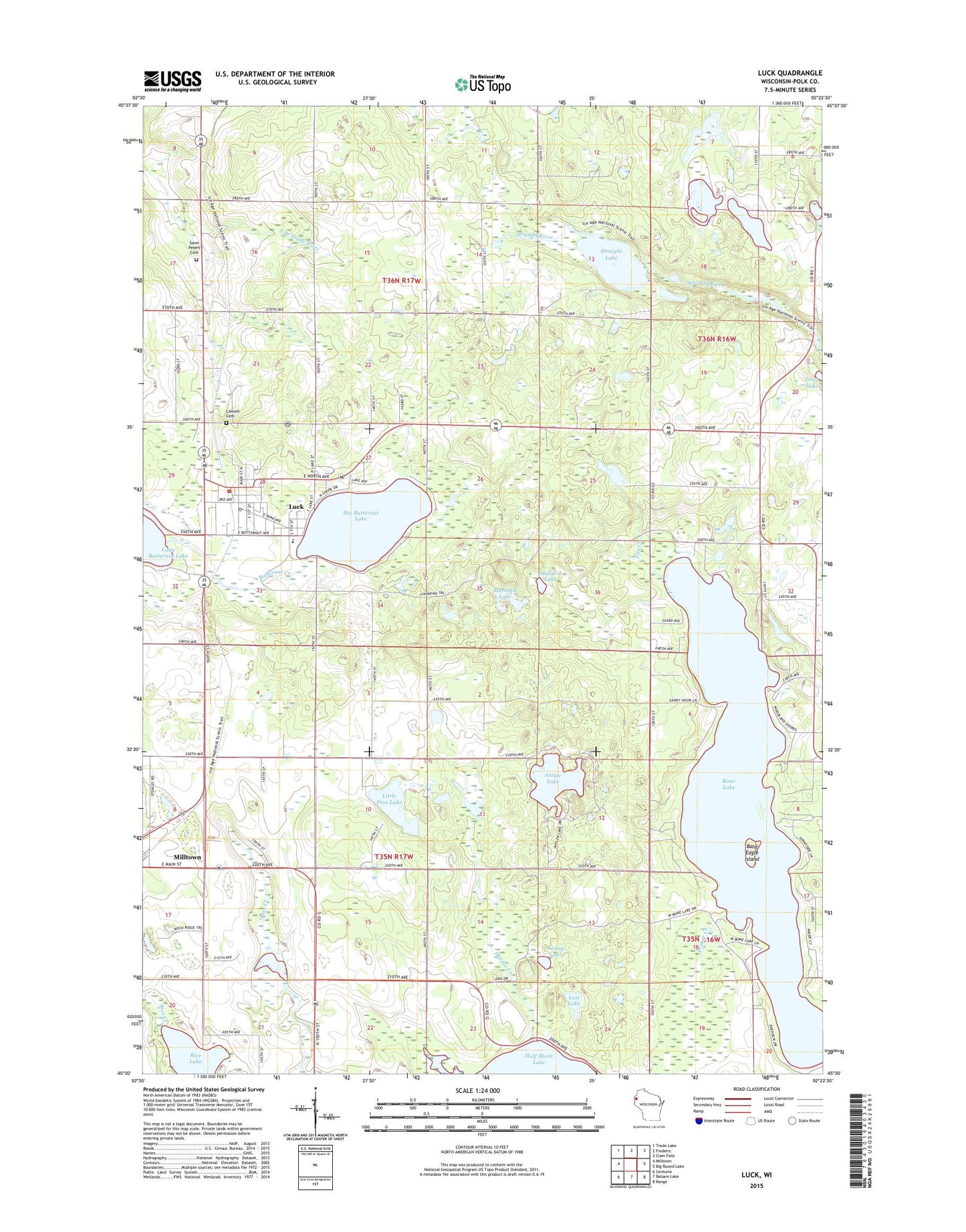
2018 topographic map quadrangle Luck in the state of Wisconsin. Scale: 1:24000. Based on the newly updated USGS 7.5' US Topo map series, this map is in the following counties: Polk. The map contains contour data, water features, and other items you are used to seeing on USGS maps, but also has updated roads and other features. This is the next generation of topographic maps. Printed on high-quality waterproof paper with UV fade-resistant inks.
Quads adjacent to this one:
West: Milltown
Northwest: Trade Lake
North: Frederic
Northeast: Clam Falls
East: Big Round Lake
Southeast: Range
South: Balsam Lake
Southwest: Centuria
Contains the following named places: Antler Lake, Bald Eagle Island, Big Butternut Lake, Big Butternut Lake Park, Bone Lake, Bone Lake Church, Kenny Lake, Lawson Cemetery, Lincoln School, Little Pine Lake, Lost Lake, Luck, Luck Elementary School, Luck Fire Department, Luck Middle - High School, Luck Police Department, Luck Post Office, Mallard Lake, Murdock Lake, North Land Municipal Ambulance, North Star School, Prokor Creek, Rice Lake, Saint Peters Lutheran Cemetery, Sherwood-Ryan Flowage G4559 Dam, Springbrook School, Straight Lake, Town of Luck, Town of Milltown, Village of Luck, ZIP Codes: 54853, 54858