MyTopo
Mather Wisconsin US Topo Map
Couldn't load pickup availability
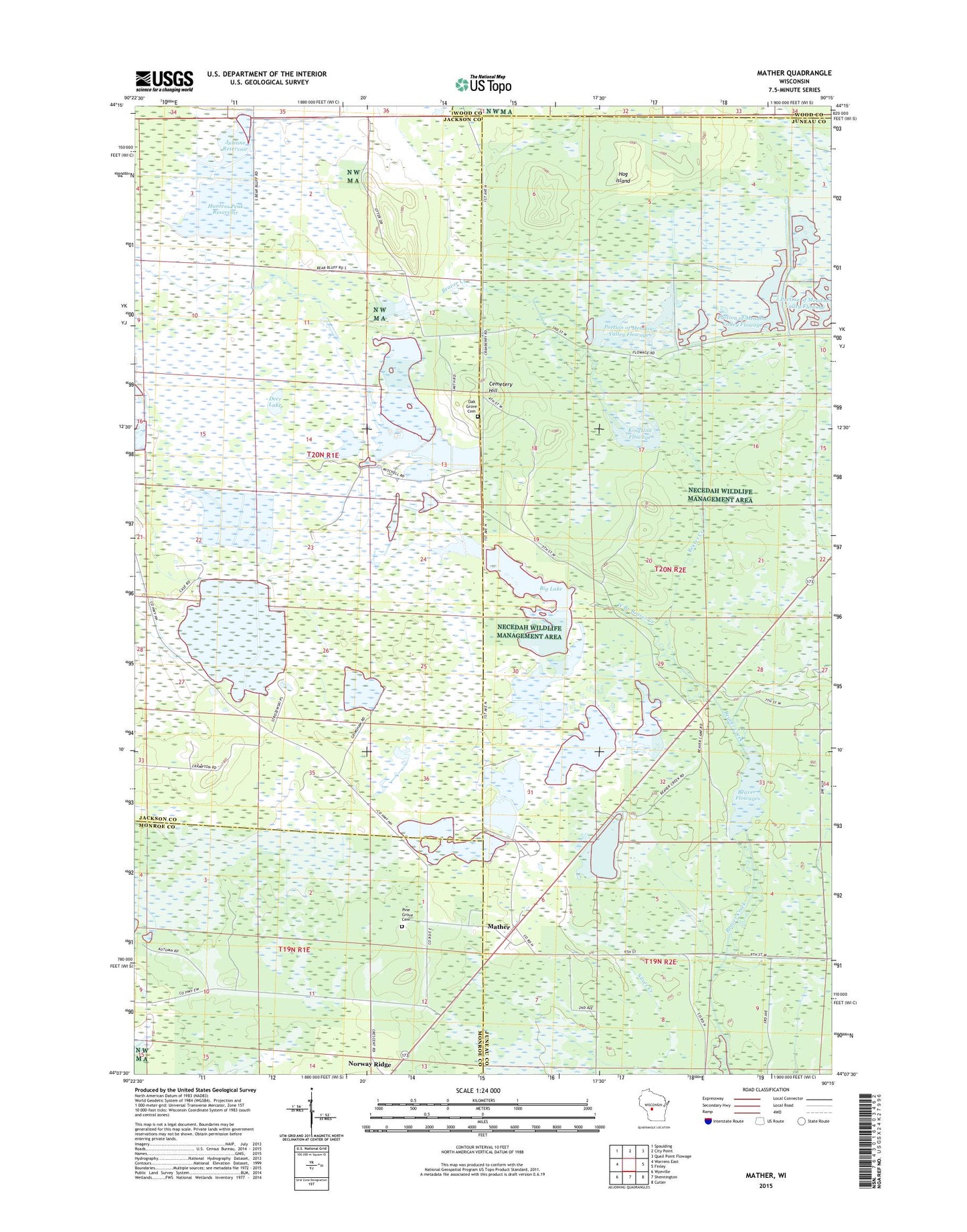
2018 topographic map quadrangle Mather in the state of Wisconsin. Scale: 1:24000. Based on the newly updated USGS 7.5' US Topo map series, this map is in the following counties: Juneau, Jackson, Monroe, Wood. The map contains contour data, water features, and other items you are used to seeing on USGS maps, but also has updated roads and other features. This is the next generation of topographic maps. Printed on high-quality waterproof paper with UV fade-resistant inks.
Quads adjacent to this one:
West: Warrens East
Northwest: Spaulding
North: City Point
Northeast: Quail Point Flowage
East: Finley
Southeast: Cutler
South: Shennington
Southwest: Wyeville
Contains the following named places: 16 Reservoir, 56 Reservoir, Beaver Creek 3 2WP479 Dam, Beaver Creek 4 2WP201 Dam, Beaver Creek 8 Dam, Beaver Creek 9 2WP479 Dam, Beaver Flowage, Beaver Flowage 68, Big Lake, Cemetery Hill, Deer Lake, Hog Island, Hunters Peak Reservoir, Juleane Reservoir, Kingston Flowage, Kingston Flowage 46, Mather, Mather Post Office, Meadow Valley Flowage 2WP395 Dam, Meadow Valley Spillway 3 G12.759 Dam, Meadow Valley Spillway 4 2WP395 Dam, Oak Grove Cemetery, Pine Grove Cemetery, Portion of Meadow Valley Flowage 14, Portion of Meadow Valley Flowage 24, Town of Bear Bluff, Town of Kingston, West Branch Beaver Creek