MyTopo
Mattoon Wisconsin US Topo Map
Couldn't load pickup availability
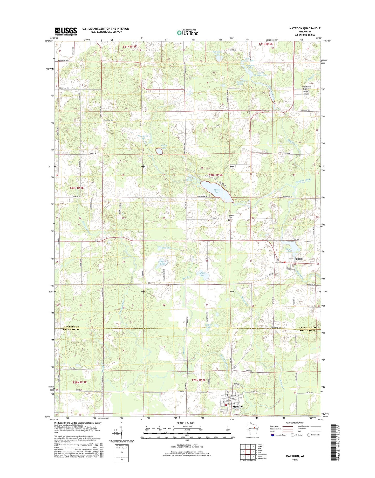
2018 topographic map quadrangle Mattoon in the state of Wisconsin. Scale: 1:24000. Based on the newly updated USGS 7.5' US Topo map series, this map is in the following counties: Langlade, Shawano. The map contains contour data, water features, and other items you are used to seeing on USGS maps, but also has updated roads and other features. This is the next generation of topographic maps. Printed on high-quality waterproof paper with UV fade-resistant inks.
Quads adjacent to this one:
West: Aniwa
Northwest: Antigo
North: Bryant
Northeast: Polar
East: Zoar
Southeast: Burney Lake
South: Regina
Southwest: Birnamwood
Contains the following named places: Apple Grove School, Crestwood Elementary School, Demlow Lake, Demlow Lake State Fishery Area, Deneault Springs State Fishery Area, Dollar Lake, Hilger Lake, Hillside School, Kennedy Lake, Kitty Hawk Estates Airport, Lower Demlow Lake, Maple Grove School, Mattoon, Mattoon Creek, Mattoon Elementary School, Mattoon Fire Department, Mattoon Post Office, Maxwell Spring, Mayking Creek, Mayking School, Meyer Lake, Mondl Creek, Moose Lake, Moose Springs, Mud Creek, Mud Lake, Norwood Cemetery, Norwood Volunteer Fire Department, Perch Lake, Phlox, Phlox Lake, Phlox Pond 13, Phlox WP269 Dam, Rag Wing Airport, Sanborn Chapel, Shelley Airport, Strassburg School, Sugarbush School, Thompson Lake, Town of Norwood, Trout Lake, Upper Demlow Lake, Village of Mattoon, ZIP Code: 54450