MyTopo
Melrose Wisconsin US Topo Map
Couldn't load pickup availability
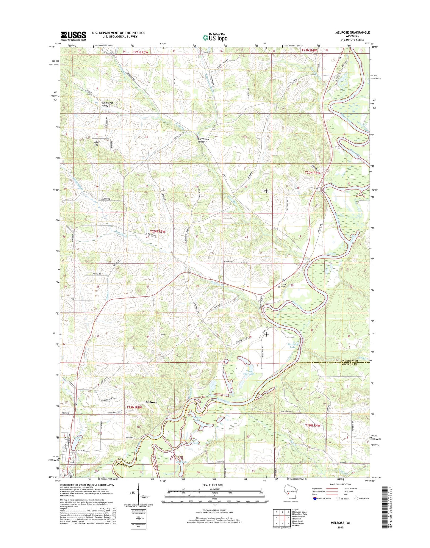
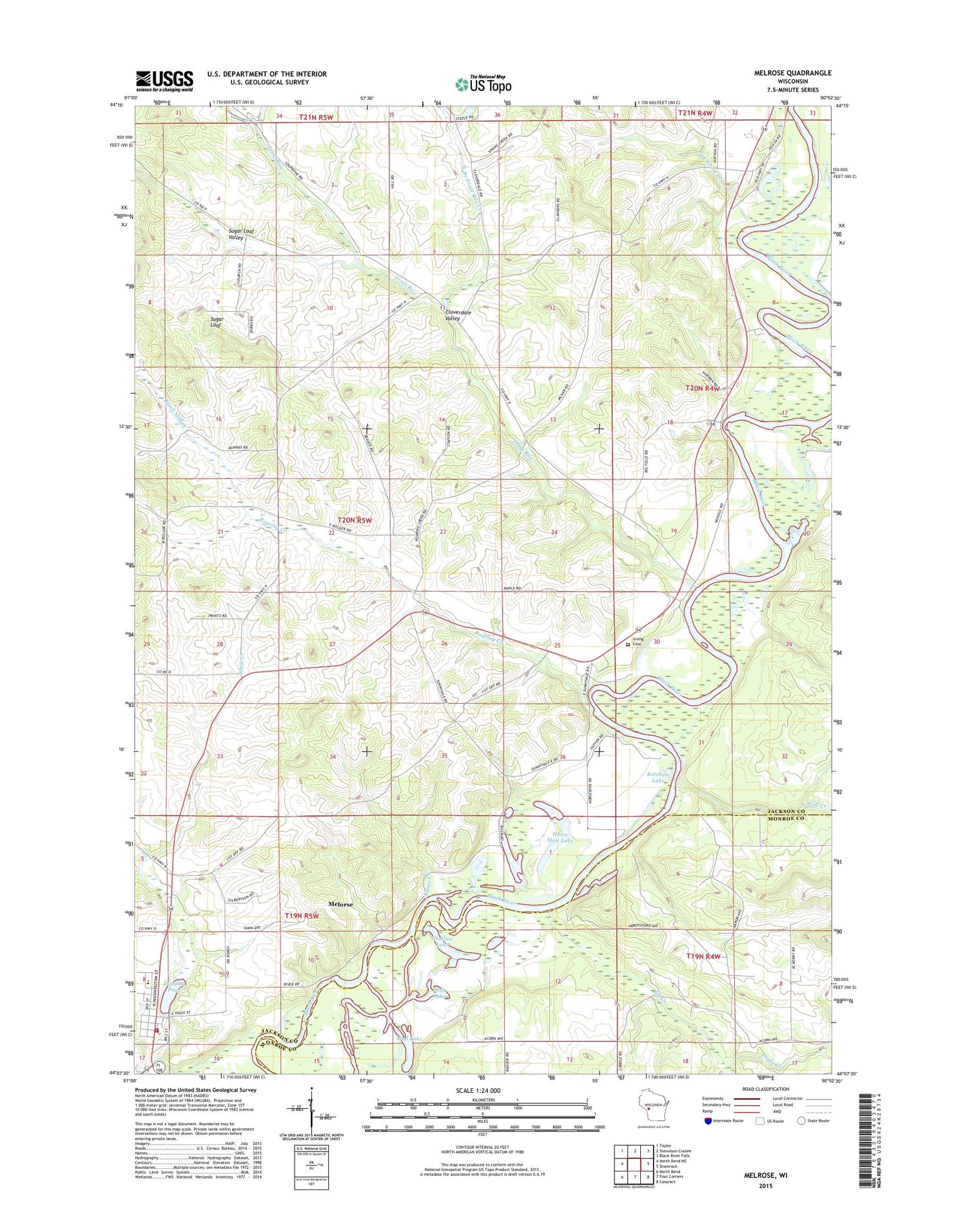
2018 topographic map quadrangle Melrose in the state of Wisconsin. Scale: 1:24000. Based on the newly updated USGS 7.5' US Topo map series, this map is in the following counties: Jackson, Monroe. The map contains contour data, water features, and other items you are used to seeing on USGS maps, but also has updated roads and other features. This is the next generation of topographic maps. Printed on high-quality waterproof paper with UV fade-resistant inks.
Quads adjacent to this one:
West: North Bend NE
Northwest: Taylor
North: Stenulson Coulee
Northeast: Black River Falls
East: Shamrock
Southeast: Cataract
South: Four Corners
Southwest: North Bend
Contains the following named places: Big Creek, Black Slough, Cloverdale Valley, Deep Lake, Douglas Creek, Douglas Pond, East Branch Trout Run Creek, Fisher Creek, Gullickson's Glen State Natural Area, Horse Shoe Lake, Horswill School, Irving, Irving Cemetery, Irving School, Ketchum Lake, Kunes Creek, Little Norway Church, Melrose, Melrose Dam, Melrose Elementary School, Melrose Police Department, Melrose Post Office, Melrose Volunteer Fire Department, Mud Lake, O'Brien School, Pine Grove Creek, Pine Grove School, Pleasant Valley School, Roaring Creek, Roaring Creek School, Robinson Creek, Saint Malachys Church, Shallow Lake, Stark Valley School, Sugar Loaf, Sugar Loaf Valley, Sunny Vale School, Town of Irving, Trout Run, Trout Run Church, Village of Melrose, White Creek, Wolf Creek