MyTopo
Monson Lake Wisconsin US Topo Map
Couldn't load pickup availability
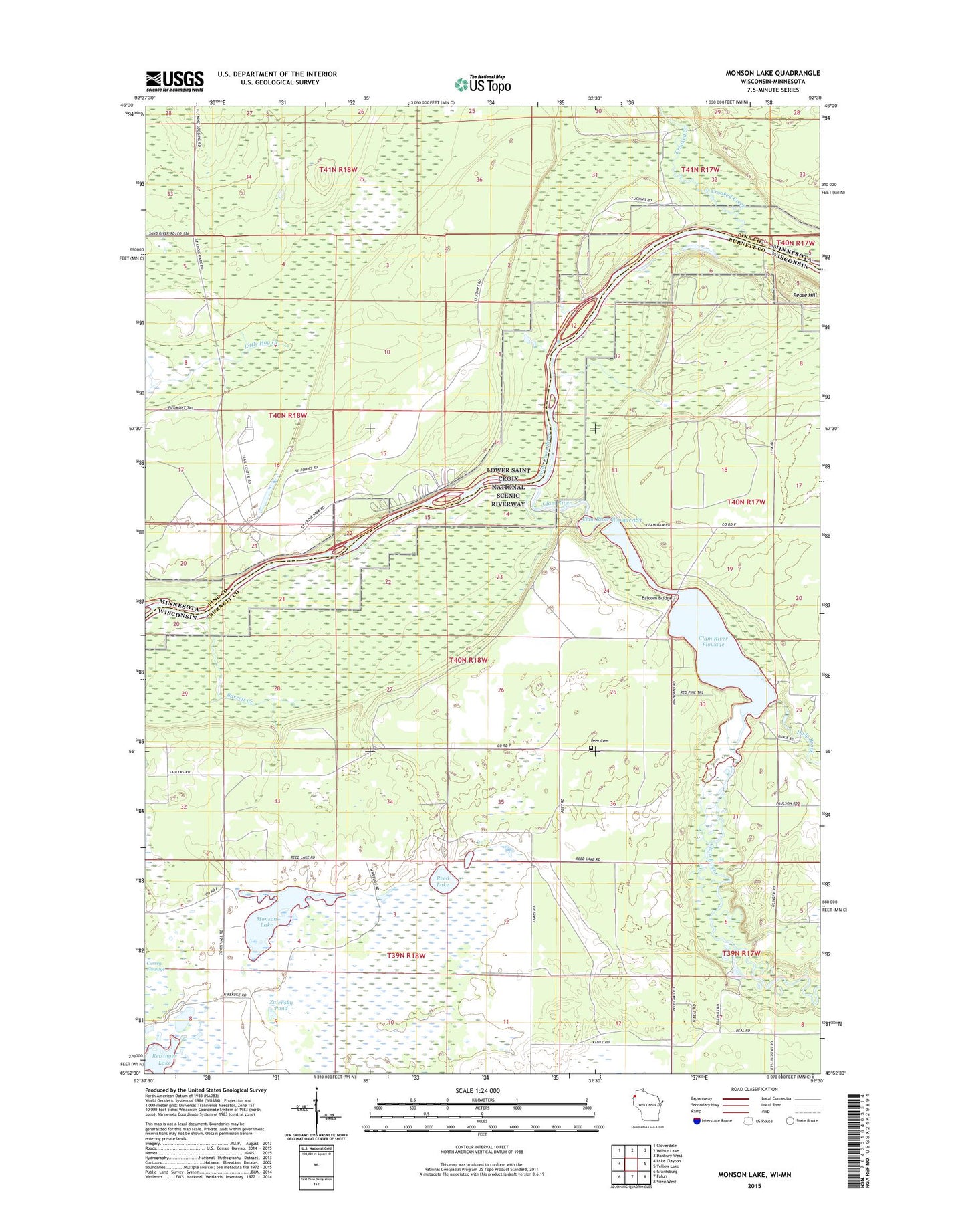
2019 topographic map quadrangle Monson Lake in the states of Wisconsin, Minnesota. Scale: 1:24000. Based on the newly updated USGS 7.5' US Topo map series, this map is in the following counties: Burnett, Pine. The map contains contour data, water features, and other items you are used to seeing on USGS maps, but also has updated roads and other features. This is the next generation of topographic maps. Printed on high-quality waterproof paper with UV fade-resistant inks.
Quads adjacent to this one:
West: Lake Clayton
Northwest: Cloverdale
North: Wilbur Lake
Northeast: Danbury West
East: Yellow Lake
Southeast: Siren West
South: Falun
Southwest: Grantsburg
Contains the following named places: Balcom Bridge, Barrett Creek, Clam River, Clam River 2WP516 Dam, Clam River Flowage, Clam River Flowage 383, Clayton Lake, Clayton Lake Dam, Crooked Creek, Currey Flowage, Dody Brook, Fleming Camp, Governor Knowles State Forest, Kohler-Peet Barrens and Cedar Swamp State Natural Area, Little Hay Creek, Minnesota-Wisconsin Boundary State Trail, Monson Lake, Old Logging Trail Campground, Paint Rock Spring Campground, Pease Hill, Peet Cemetery, Reed Corners, Reed Lake, Reed Lake Meadow State Natural Area, Reisinger Lake, Riverview Campground, Saint Croix State Park, Saint Johns Landing Camp, West Marshland Townhall, Zalensky Pond