
MyTopo
New Lisbon South Wisconsin US Topo Map
Couldn't load pickup availability
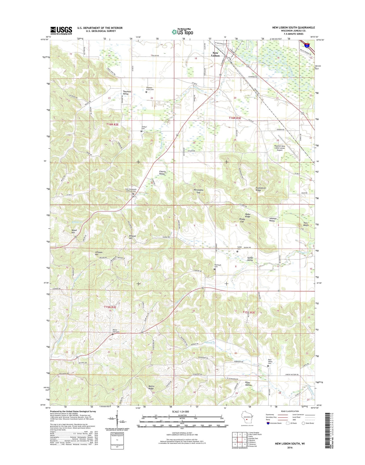
2018 topographic map quadrangle New Lisbon South in the state of Wisconsin. Scale: 1:24000. Based on the newly updated USGS 7.5' US Topo map series, this map is in the following counties: Juneau. The map contains contour data, water features, and other items you are used to seeing on USGS maps, but also has updated roads and other features. This is the next generation of topographic maps. Printed on high-quality waterproof paper with UV fade-resistant inks.
Quads adjacent to this one:
West: Kendall East
Northwest: Camp Douglas
North: New Lisbon North
Northeast: Kelly
East: Mauston
Southeast: Potato Hill
South: Wonewoc
Southwest: Hillsboro
Contains the following named places: 0.2 Reservoir, Aquarian Garden Holistic Wellness Center, Baker School, Braund Hill, Church Valley, Duckworth Ridge, East Lemonweir Lutheran Cemetery, East Lemonweir Lutheran Church, Johnson Hill, Johnson Valley, Juneau County Landfill, Lenandowski Floyd G3407 Dam, Lindina, Mauston-New Lisbon Union Airport, Mount Zion Cemetery, New Lisbon Wastewater Treatment Plant, Norwegian Gap, Pleasant Acres Cemetery, Pleasant Acres Nursing Home, Plymouth Cemetery, Plymouth Church, Riley Hollow, Rock Valley Cemetery, Ryder Ridge, Sarazin G3407 Dam, Suldal Cemetery, Suldal Valley, Teachout Valley, Town of Lindina, Town of Lisbon, Twin Bluffs, Webster Creek, Windy Gap, Wood Hill, WRJC-FM (Mauston), Zindorf Cemetery


