MyTopo
Newald Wisconsin US Topo Map
Couldn't load pickup availability
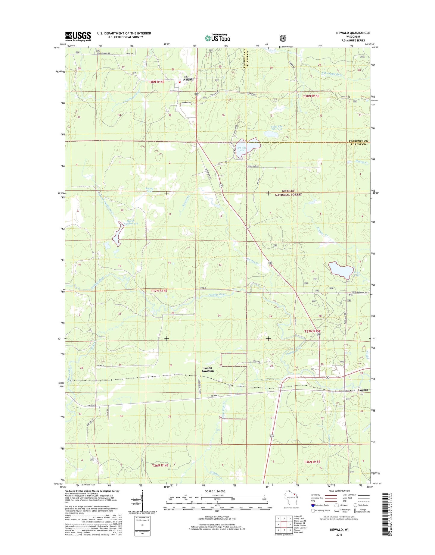
2018 topographic map quadrangle Newald in the state of Wisconsin. Scale: 1:24000. Based on the newly updated USGS 7.5' US Topo map series, this map is in the following counties: Forest, Florence. The map contains contour data, water features, and other items you are used to seeing on USGS maps, but also has updated roads and other features. This is the next generation of topographic maps. Printed on high-quality waterproof paper with UV fade-resistant inks.
Quads adjacent to this one:
West: Crandon NE
Northwest: Alvin SE
North: Long Lake
Northeast: Long Lake SE
East: Lake Gordon
Southeast: Blackwell
South: Laona
Southwest: Lake Lucerne
Contains the following named places: Big Joe Campground, Bills Creek, Camp Eight Creek, Cavour, Consolidated Lookout Tower, Gruman Creek, Kersten Creek, Laona Junction, Little Van Zile Lake, Marsh Number 10 Creek, Marsh Number Ten, Newald, Newald Census Designated Place, Newald Volunteer Fire Department, Otter Creek, Ross Lake, Sixtytwo Creek, Spring Pond, Town of Caswell, Town of Ross, Town Park Recreation Site, Van Zile Lake